
GEORGE WILKINSON heads out Great Ayton way to Gribdale Gate and some welcome height away from soggy farm fields.
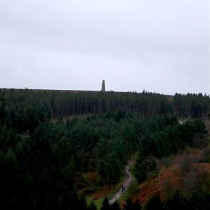
GRIBDALE Gate is a car park a mile or so out from Great Ayton and was, as so often, busy. The long line of cars poured out walkers for the obvious attraction of Captain Cook’s monument less than a mile to the south and the moor to the north, which was our way.
Gribdale Gate is at 700 feet of altitude and is most suitable in mid wet winter, because there’s limited joy in splodging around in farmers’ lowland fields.
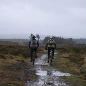
Within five minutes we’d climbed a few contours and reached Great Ayton Moor and good, sound tracks, most popular with mountain bikers, and just the stuff for brisk walking at about 1,000 feet all the way.
For a mile we tracked north, along the Cleveland Way, the plains far below to our left, the moors to our right, and entered National Trust land.
Nothing was out but people and dogs, the south-westerly generated a highway roar in the pines, flattened the grasses and the stiff stalks of the heather quivered.
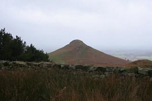
And then we reached a corner, and off it, half a mile to the west, stood Roseberry Topping, pointed and alluring, but it wasn’t really the day for its gift of views, with sky, sea, and Teesside smoke similar shades of grey, so we turned for another notable viewpoint, the Hanging Stone.
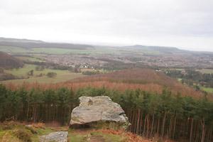
Despite the name, this seems a sound, stable and solid block of sandstone. Stand on the stone, which is flat topped and easily accessed, and you look down on to the sizable town of Guisborough, which mostly fills shallowness in the land and seems eager to spread to pack the rest. There’s been some acreage of conifers felled around here. This opens the view from the Hanging Stone, but leaves a mess of stumps and broken branches and raw, bare fingers of standing trunks – most desolate, but this will soften.
The next mile took us straight across moor. Here you’ll pass some military remains that contain a sordid detritus of bottles, crisp packets, etc.
The final mile took us in a curve through more moor and then we were back and jackdaws circled in a sunset and the cars were leaving Gribdale Gate.
Directions
When in doubt look at the map. Check your position at each point. Keep straight on unless otherwise directed.
View a map of the Gribdale Gate country walk>>
1. From main car park, cross road (fingerpost Cleveland Way), steps uphill (Gribdale Gate info board). Main track along edge of moor.
2. At junction and corner (waymark posts), turn right with wall to your left, 300 yards, stile (waymark) near fieldgate into forest remains and track beyond the fieldgate, 20 yards then pass post (forest waymarks).
3. On right-hand bend ignore path on left with forest arrow, 25 yards, path on left (waymark post), down to Hanging Stone. Return to track and left.
4. Left to wide path by moor/forest edges (Cleveland Way sign nearby).
5. At junction, forest barrier, 25 yards, forest barrier and fieldgate/gate on right to moorland track (waymark).
6. Before gate/fieldgate to road end, take track on right (public footpath sign).
7. After climb, ignore a track forking right fork downhill. Track slowly descends, left to track at ‘T’ junction, 20 yards, track downhill and curves right to car park.
Fact file
Distance: Five miles.
General location: North York Moors.
Start: Gribdale Gate.
Right of way: Public.
Dogs: Legal.
Date walked: December 2011.
Road route: From Great Ayton take Station Road, the last half mile includes a steep climb with a hairpin bend.
Car parking: Free car park, info board.
Lavatories: Great Ayton.
Refreshments: Great Ayton.
Tourist and public transport information: Great Ayton TIC 01642 722835.
Map: Drawn from OS Explorer OL26 North York Moors western.
Terrain: Moor.
Difficulty: Quite easy.
Please observe the Country Code and park sensibly. While every effort is made to provide accurate information, walkers set out at their own risk.

