
GEORGE WILKINSON visits Square Corner on the North York Moors, where he enjoys a walk that starts on a high.
SQUARE CORNER is a square corner on the minor moorland road from Osmotherley to Hawnby and it is usefully a car park at 900 foot of altitude. A John Deere tractor slowed, pulling a load of 29 large straw bales.
The corner is also a junction with the important and ancient track-way named Hambleton Street and up this chugged two business-like Landrovers and down it zoomed a mountain biker, down from the top of Black Hambleton.
This big hill shadowed the landscape. We joined 25 cars worth of people somewhere out there on a fine autumn day.
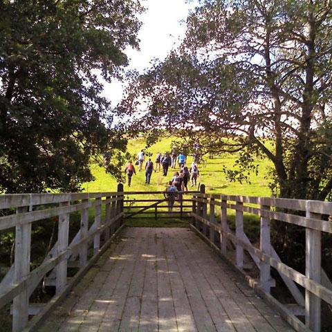
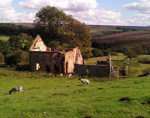
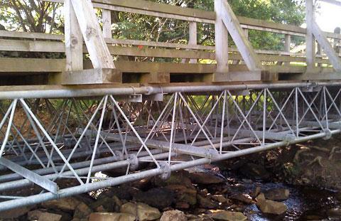
The first mile was an amble including the moorland road, Robinson’s Cross, the start of a stream, rowan berries, a sandstone ruin named Dale Head and a newish bridleway bridge.
We stopped here to remove a layer and were pondering the galvanized steel lattice of the bridge when off the moor poured the Cleveland group of the Long Distance Walkers Association on a celebratory fortieth anniversary forty kilometres. They were in good spirits, a rucksack was admired and sun hats ridiculed.
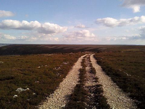
Soon we turned towards the top ground, a zigzag 4x4 track eased the climb, and from now on the walk was on good stone surface, and is a splendid one of this type. It hugs the high edge of Arden Great Moor and as you circle you see out to The Hambleton, Cleveland, Tabular and Hawnby Hills, which is great.
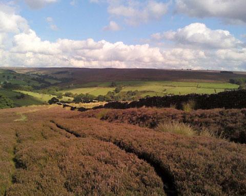
Whenever we glanced to the middle of the moor it was the same solid heather of a rather nice dusky hue. The sun did light Sun Bank and midges got us on a shirtsleeve afternoon.
A party of raptors swirled through valleys below, a scarab beetle wrestled with a lump of sheep dung and two grouse had a gurgling argument over who was top grouse.
Next it will be the top gun. We reached our last leg that was two-and-a-half miles along Hambleton Street and is now a length of the Cleveland Way.
In 1513, English soldiers marched along it to defeat the Scottish at Flodden; in the eighteenth and nineteenth centuries, vast numbers of Scottish cattle came the other way, and an uncomfortable traveller then said it “made a hazard of my neck”.
We made smooth progress and met no one but a lost and abject off-roading van driver.
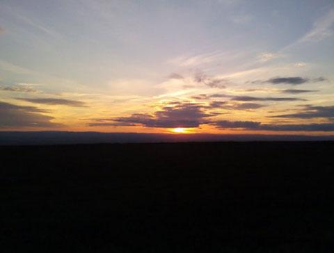
The light and the temperature dropped by the mile, moths emerged, the track eased over Black Hambleton at 1,300 feet and, to cap it all, the sun set rich and orange behind a wedge of cloud and then the Dales.
Back at the empty car park a tractor, probably the same one as hours ago, certainly with a similar load, slowed for Square Corner, lights flashing, and roared into the moorland night.
Directions
When in doubt look at the map. Check your position at each point. Keep straight on unless otherwise directed.
1. From car park, right to road, half a mile.
2. Track on right (bridleway sign), fieldgate, half a mile, fieldgate into field, grass track, gateway above ruin, 25 yards.
3. Left downhill at grass tracks T-junction, 100 yards, fieldgate into field (waymark) and right, (waymark post). Gated footbridge (waymark), path up onto moor, quite flat over moor for half a mile.
4. Before fieldgate (waymarked), grass path on the right uphill (ignore old sign), wall to your left, skirt to right of small old quarry, continue up near wall to your left.
5. Near top corner of wall, path becomes track which turns right and more steeply uphill, 300 yards, track turns sharp left, 600 yards.
6. At top, left at T-junction to edge of moor track.
7. Ignore left fork to lesser track, 100 yards, right at junction, 200 yards, right at junction.
8. Right at T-junction (Cleveland Way sign), track with wall to left, ½ mile.
9. Fieldgate/cattlegrid, 100 yards, fork left (fingerpost Cleveland Way), 2 miles. Gate, car park.
Fact file
Distance: Ten miles.
General location: North York Moors.
Start: Square Corner near Osmotherley.
Right of way: Public and Open Access.
Dogs: Illegal.
Date walked: September 2012.
Road route: From York, via Osmotherley.
Car parking: Free car park (info board).
Lavatories: Osmotherley.
Refreshments: Osmotherley.
Tourist & public transport information: Sutton Bank 01845 597426.
Map: OS OL26 North York Moors western.
Terrain: Mostly moor.
Difficulty: Moderate.
Please observe the Country Code and park sensibly. While every effort is made to provide accurate information, walkers set out at their own risk.


Comments: Our rules
We want our comments to be a lively and valuable part of our community - a place where readers can debate and engage with the most important local issues. The ability to comment on our stories is a privilege, not a right, however, and that privilege may be withdrawn if it is abused or misused.
Please report any comments that break our rules.
Read the rules hereComments are closed on this article