


George Wilkinson follows in the footsteps of saints as he takes in Lastingham on the North York Moors.
Lastingham is just down the road from Hutton-le-Hole, but what a contrast with the honeypot village. Instead of ice cream we have, to quote a modern abbot, the “cold stones” and “musty atmosphere” of St Mary’s ancient crypt.
St Cedd, from Lindisfarne, was abbot here some 1,500 years ago, and St Bede, the abbot of Lindisfarne, described Lastingham as being between “steep and remote hills”.
In the land of the living, springs gurgled, foxgloves by the dozen blazed erect and the Blacksmiths Arms is “open all day” from noon.
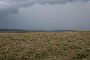
After 100 yards of road and one crushed hedgehog, we took a metalled track to Camomile Farm, and then another track, grassy, across the moor, and the sky glowed with weather and the rain came down, the swallows skimmed and there was half a chance of a storm.
Today’s length of open back road heads towards the one-in-three decent of Rosedale Chimney Bank so traffic was not heavy. A Landrover with a sheep trailer, a car or two, and a brave caravan.
Our second moorland crossing focused the mind.
You don’t need a brave heart or such, just when you get to the stream, Hole Beck, watch the steep banks. It’s deep cut. Down there is a good patch of bog myrtle or sweet gale, a shrub of damper moor used in gale beer. And when you’re climbing the other side, don’t doze because the grouse butts are sunken into the heather and are all but invisible till you’re on them.
This ascent, it’s only short, is fun though, butt by butt, 50 yards between them, numbered one to nine with fresh white paint. A choice of sandwich stops.
We didn’t hang around, despite it being such a secluded place, what with no sound of man bar the one aeroplane that circled a while.
No, we moved on, and with some rapidity because the weather was loud, dark, charged and mobile, the thunder cranking up, the lightning vertical. And we on a mile of track on Lastingham Ridge, as exposed as could be, our aluminium trekking poles conductors... St Cedd preserve us.
The storm veered; apparently a tornado took off a roof at Stape which is five miles east. Lastingham felt very sheltered, which it is.
Directions
When in doubt look at the map. Check your position at each point. Keep straight on unless otherwise directed.
View a map of the Lastingham country walk>>
1. From Blacksmith’s Arms, west on road, road/metalled drive on right with white railings, uphill to Camomile Farm.
2. Fieldgate to grassy area, 100 yards straight on then find grass track, actually just parallel indentations, that aim north-west. If you stand a quarter of the way between waymark post and stone wall corner you will be about right, the track skirts gorse and soon clarifies.
3. Right to road, half a mile.
4. Right to track east across moor and pass a 2ft diameter flat stone on a mound after 50 yards.
5. Where heather is shorter, track fades and ignore a left fork, keep east and identify sunken grouse butts up opposite bank, take care, steep slopes down to the stream.
Step over stream, uphill passing nine consecutive butts, heather thins higher up.
6. After top butt numbered 9 and 1, 50 yards, right to wide fresh track.
7. Millennium Cross (waymark post), fieldgate, road down into Lastingham.
Fact file
Distance: Four miles.
General Location: North York Moors.
Start: Lastingham.
Right of Way: Public and Open Access.
Dogs: Illegal.
Date walked: July 2011.
Road Route: Via Hutton-le-Hole.
Car Parking: Roadside in Lastingham.
Lavatories: None.
Refreshments: Blacksmith’s Arms and Lastingham Grange Hotel.
Tourist & Public Transport Information: Helmsley TIC 01439 770173.
Map: Drawn from OS Explorer OL 26 North York Moors western area.
Terrain: Moor.
Difficulty: Moderate if fine.
• Please observe the Country Code and park sensibly. While every effort is made to provide accurate information, walkers set out at their own risk.


Comments: Our rules
We want our comments to be a lively and valuable part of our community - a place where readers can debate and engage with the most important local issues. The ability to comment on our stories is a privilege, not a right, however, and that privilege may be withdrawn if it is abused or misused.
Please report any comments that break our rules.
Read the rules hereComments are closed on this article