
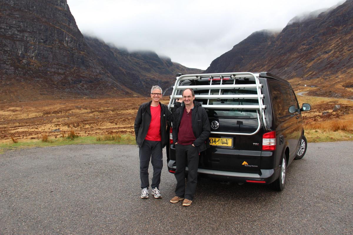
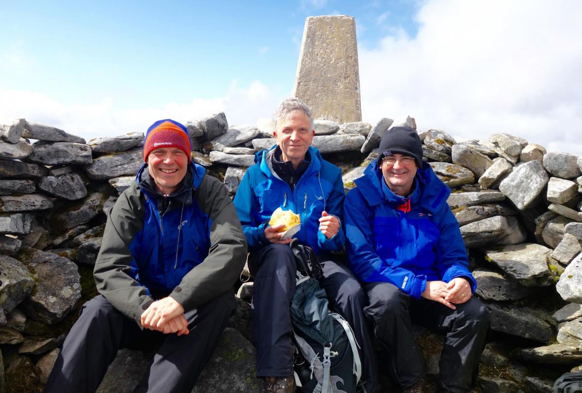
Retired Bootham Park Hospital consultant psychiatrist BOB ADAMS and two friends headed up to Scotland in a camper van to tackle the 'Scottish 500'
While everywhere south of Inverness basked in early May sunshine we decided to do the Scottish 500 - a 516-mile scenic road route around the north coast of Scotland designated in 2015 as a way of boosting tourism in northern Scotland.
This northern tip of Britain is one of our last empty wildernesses, a wild and beautiful place of rugged mountains and empty glens guarded by wild weather and winds in the winter and midges during the summer.
The 'Scottish 500' has perhaps been a mixed blessing to the area: good for restaurants, hotels and campsites but, as we were to discover, not so good for the suspension or for the effect of traffic clogging narrow roads.
As we were all men of a certain age we decided on separate sleeping arrangements. I was in the van (it was mine after all) while the other two slept in their own pop up tents. We packed plenty of emergency cheese, kept in Richard’s sealed box. There were to be occasional breaks in B&Bs.
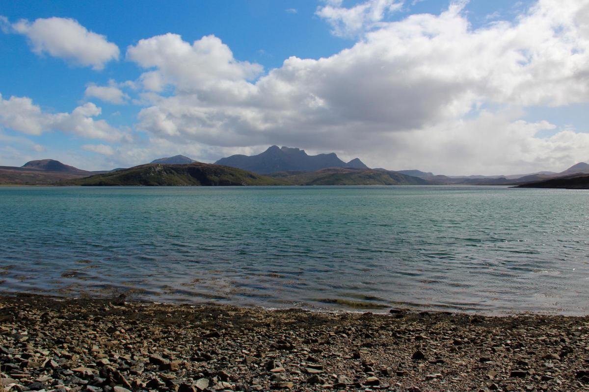
Leaving Inverness we headed west into increasingly wild country following the railway line to Lochcarron on the west coast. After stopping for a late breakfast at a café, we were ready to face the renowned Bealach na Ba (Gaelic for Drover’s Road), rising 2000 feet from sea-level in less than three miles. Our trusty VW T5 camper made it with ease. At the top we went for a hike. The road then descended to Applecross – no orchards, just the English way of pronouncing Aber Crossan, the mouth of the Crossan.
From the campsite we set off in search of a broch, an ancient round tower dwelling around 2000 years old. The north of Scotland is peppered with the remains of brochs that have a double outer wall with a fireplace in the centre.
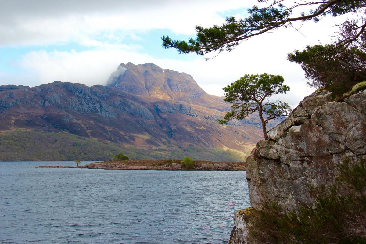
The next few days were spent driving in a zigzag fashion in the general direction of Scotland’s most northwestern tip, Cape Wrath. The road largely follows the coast but ventures inland around the high peaks of Beinn Alligin and Beinn Eighe.
It rained a bit as we passed the beautiful Loch Maree, but we did get a glimpse of vast bulk of Slioch rising from the opposite shore.
After lunch at the fishing village of Gairloch we drove past Loch Ewe, used as a base for Arctic and Atlantic convoys in WWII. As the weather had improved we stopped for a walk up the side of An Teallach. That was when we realised that Andrew had a problem crossing streams. Unfortunately we didn’t get photographic evidence of his slip off a stepping-stone...
Our next overnight stop was at the picturesque campsite at Ardmair, just north of Ullapool, a quaint fishing village and port for the Stornoway Ferry. That evening was the first time the others refused my emergency tin of cassoulet, which I had specially sourced at a supermarket in France the previous year. We had to settle for Richard’s cheese washed down with a few wee drams of a rather nice bottle of Edradour Malt.
The next morning we were awoken by loud snorts. I thought the fellow in the next van must have had a terrible chest, but it turned out to be a horse that had swum over from the nearby Isle Martin. We set off again inland, skirting the Coigach, a mountainous peninsula once teeming with people and forests before the clearances.
It is impossible not to come across the Highland Clearances, which started after the 1745 rebellion and continued into the mid 1850s. We passed ruined crofts, museums and monuments. Settlements were replaced in their turn by fishing villages, built to exploit the herring boom from the 1800s onwards. The ‘silver darlings’ have now been fished out.
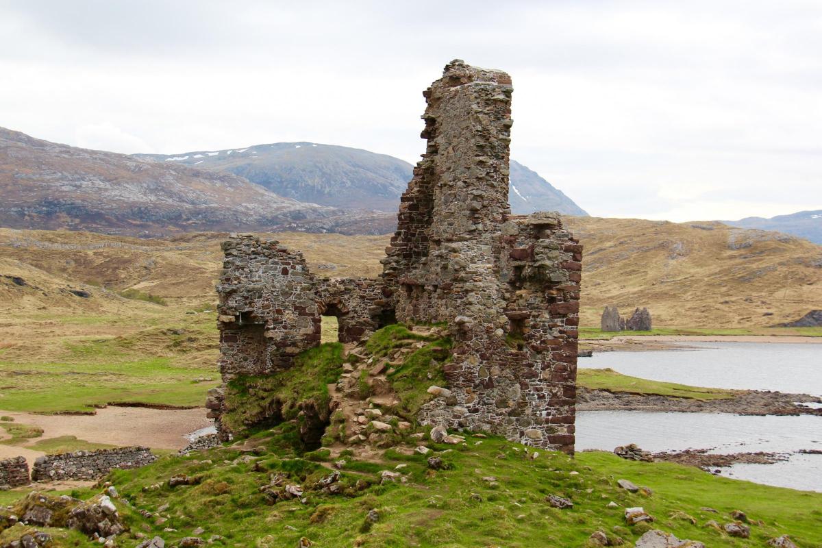
On the way we had a magnificent view of Stac Pollaidh. We then stopped off at Ardvrech Castle on the shores of Loch Assynt. The castle was denuded of stones to build the nearby Calda house in 1726, now itself a ruin.
Passing Lochinvar it would have been rude not to stop at the famous pie shop once recommended by Michael Winner, the Lochinvar Larder. Luckily Mr Winner (now deceased) had not eaten all the pies.
The longer route around the peninsula was incredible with hundreds of little lochs, woods, rolling hills and precipitous views of the sea below. We then crossed Kylesku Bridge – built in 1984 to open up the way to the ‘empty lands’ to the north.
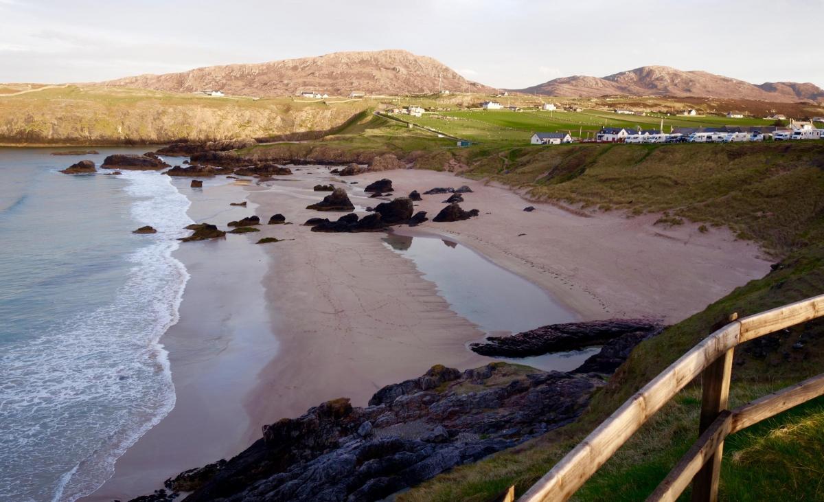
We stopped overnight at a B&B, the Old School House at Kinlochbervie, as we planned to walk one of Britain’s most isolated beaches, Sandwood Bay. It is reached by a four-mile walk across moorland. As we spotted its white sands and dunes down below, the sun came out. Down on the beach it was like being in the Caribbean. Apparently the ghost of a drowned sailor haunts the beach together with a mermaid. We saw neither.
The next day we took the ‘ferry’ (an open boat) followed by an old British Leyland bus to cover the twelve miles to get to Cape Wrath. On the way the driver entertained us with tales of bomb craters and near misses – the area is used as a training range by the military. He also informed us that sphagnum moss is useful as a wound dressing, and also comes in handy if you run out of loo paper.
After paying our respects to the lighthouse, we camped at Durness, where John Lennon used to go on childhood holidays. Our pitch was situated on top of a cliff overlooking Sango Sands far below.
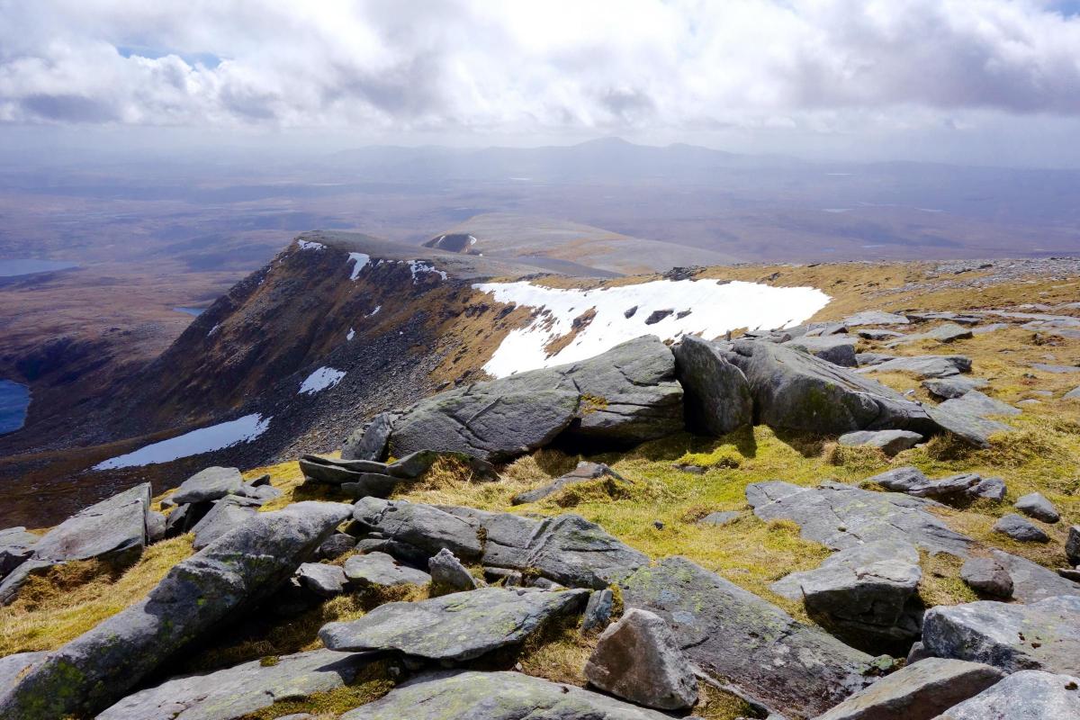
It was an early start the next morning to drive to the starting point of the climb to the summit of Ben Hope, the most northern ‘Munro’ (mountains above 3000 feet). On top it was clear but very windy. Afterwards the others had booked into the four star Tongue Hotel to recuperate. The friendly staff let me sleep in my van in the car park, and eat in their excellent restaurant.
After Tongue the countryside became much more bleak, but still beautiful. It is called the Flow Country, a massive area of peat bogs covering 1500 square miles. We visited the Strathnaver Museum, in the Old Parish Kirk of St Columba. It brought home how populous this area was in the past, going back to the Neolithic and Bronze ages, when it was much warmer. The Vikings took over coastal settlements and then there were the clearances.
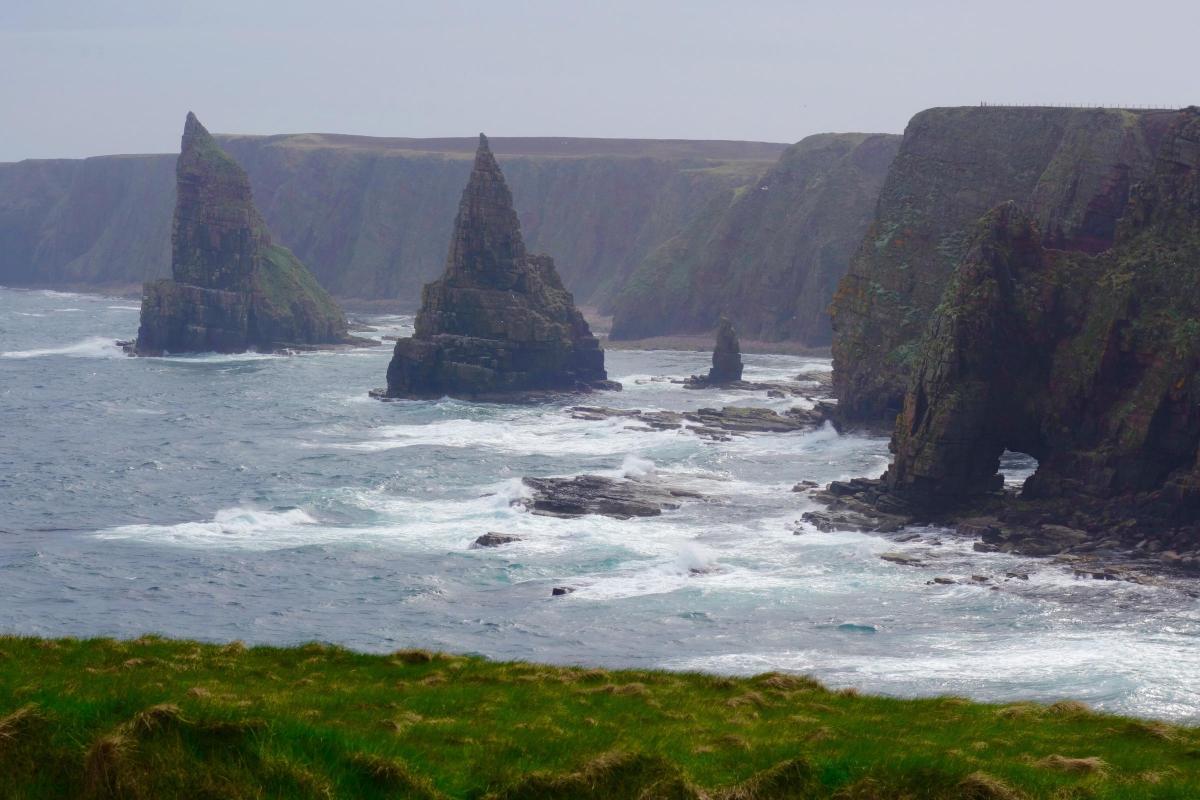
We stopped for lunch at the rather tired-looking town of Thurso then it was a short drive to the most northerly point of Britain. No, not John o’ Groats, but Dunnet Head. Of course we did visit John o’Groats and the nearby Stacks of Duncansby. They looked like witches hats.
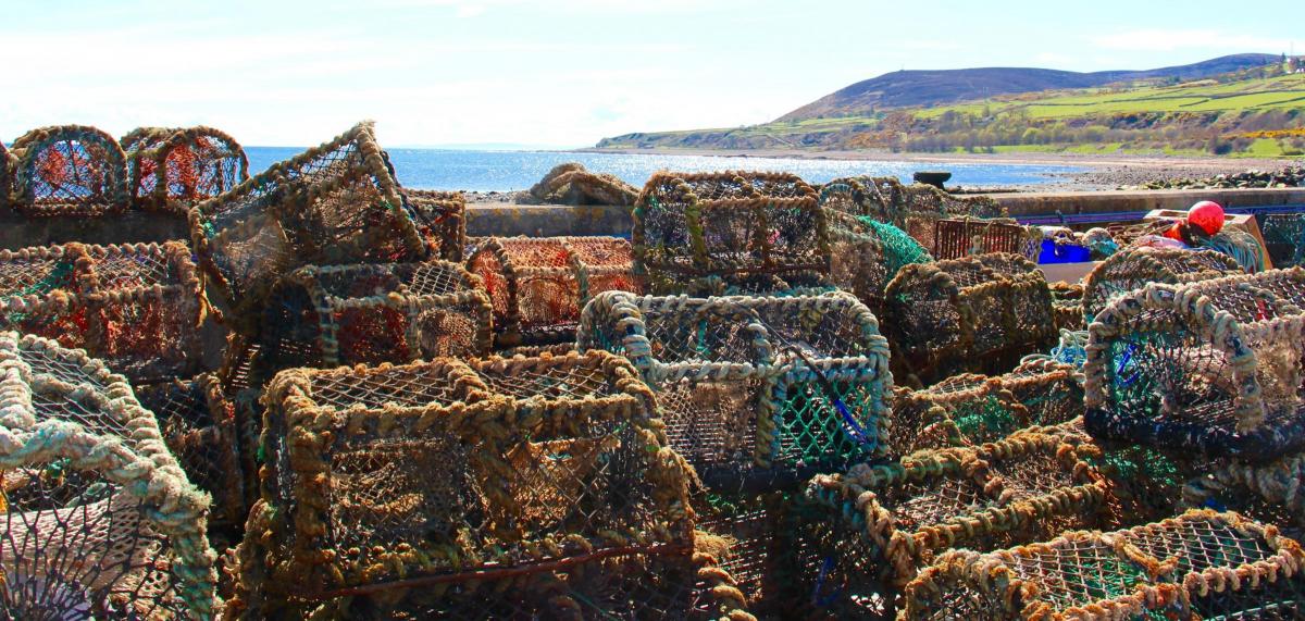
The east side of Caithness is populated by fishing villages and castles. There seemed to be a castle every few miles, growing out of the edge of the slatey red-grey cliffs. We visited Keiss Castle and harbour but left the more spectacular Castle Sinclair Girnigoe for the next day. We camped at a sheltered site at Wick and dined well at Mackay’s Hotel, situated on officially the shortest street in Britain, length 2.06m.
The next day an urgent visit to the Old Pultenhay Distillery was required to replenish our now empty stock of Edradour. We visited the spectacular Whaligoe Steps just down the coast. It was also a day of searching for brochs, an enterprise that had become a new obsession of Andrew’s. We took in the ‘Hill o’ Many Stanes’ (thought to be an ancient observatory) and the reconstructed Grey Cairns of Camster. You can crawl along passages under the latter to visit inner chambers but risk head injury in the process.
Our drive was now drawing to a close and naturally the weather started to improve. We continued south bypassing Dunrobin Castle to cross the Dornoch Firth arriving at the smart town of Tain. We then left the official route for an overnight stay at a B&B in the quiet fishing village of Portmahomack.
On our last day we headed for Inverness to complete our circuit. Then we said goodbye to the cuckoo and set off on our long drive south. Cheese stores were getting low but we still had the unopened tins of cassoulet...
What is the Scottish 500?
More properly known as the North Coast 500 (NC 500) the Scottish 500 is a route designated in 2015 as part of a plan to boost tourism in northern Scotland. The route starts at Inverness then follows the entire Scottish coastline to the north. The total distance is just over 500 miles, but with detours you can easily add anther 150.
Small camper vans, motorbikes and cars are the most popular means of transport although cyclists attempt the route too. The drive should take at least a week if you want to stop and look at the views, and do some walking.


Comments: Our rules
We want our comments to be a lively and valuable part of our community - a place where readers can debate and engage with the most important local issues. The ability to comment on our stories is a privilege, not a right, however, and that privilege may be withdrawn if it is abused or misused.
Please report any comments that break our rules.
Read the rules here