

YORK'S Roman history is well known - but now the city's position in the Empire has been visualised in a slightly more modern way.
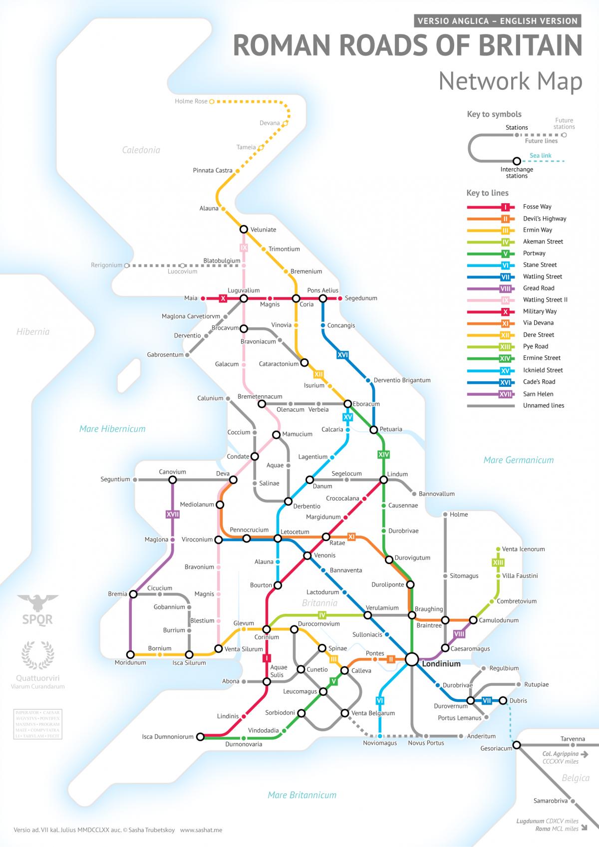
Blogger and researcher Sasha Trubetskoy has painstakingly created a map of Roman Britain - complete with roads and settlements - based on the iconic London Underground map.

York - or rather the Roman town of Eboracum - is there, along with the Derventio Brigantum (Malton), Calcaria (Tadcaster) and Isurium (Aldborough, near Boroughbridge).
The map also show the Roman roads which linked the towns - Ermine Street, Cade's Road and Dere Street, among others. Like the London Underground map, Sasha's map uses colour coded lines to denote the roads around Roman Britain, but as very little historical information remains he had to "get rather creative" with the roads' routes.
The same reason is behind the English names for Roman roads - their original Latin names have been lost as Roman Britain was not as well documented as places like Italy and Spain.
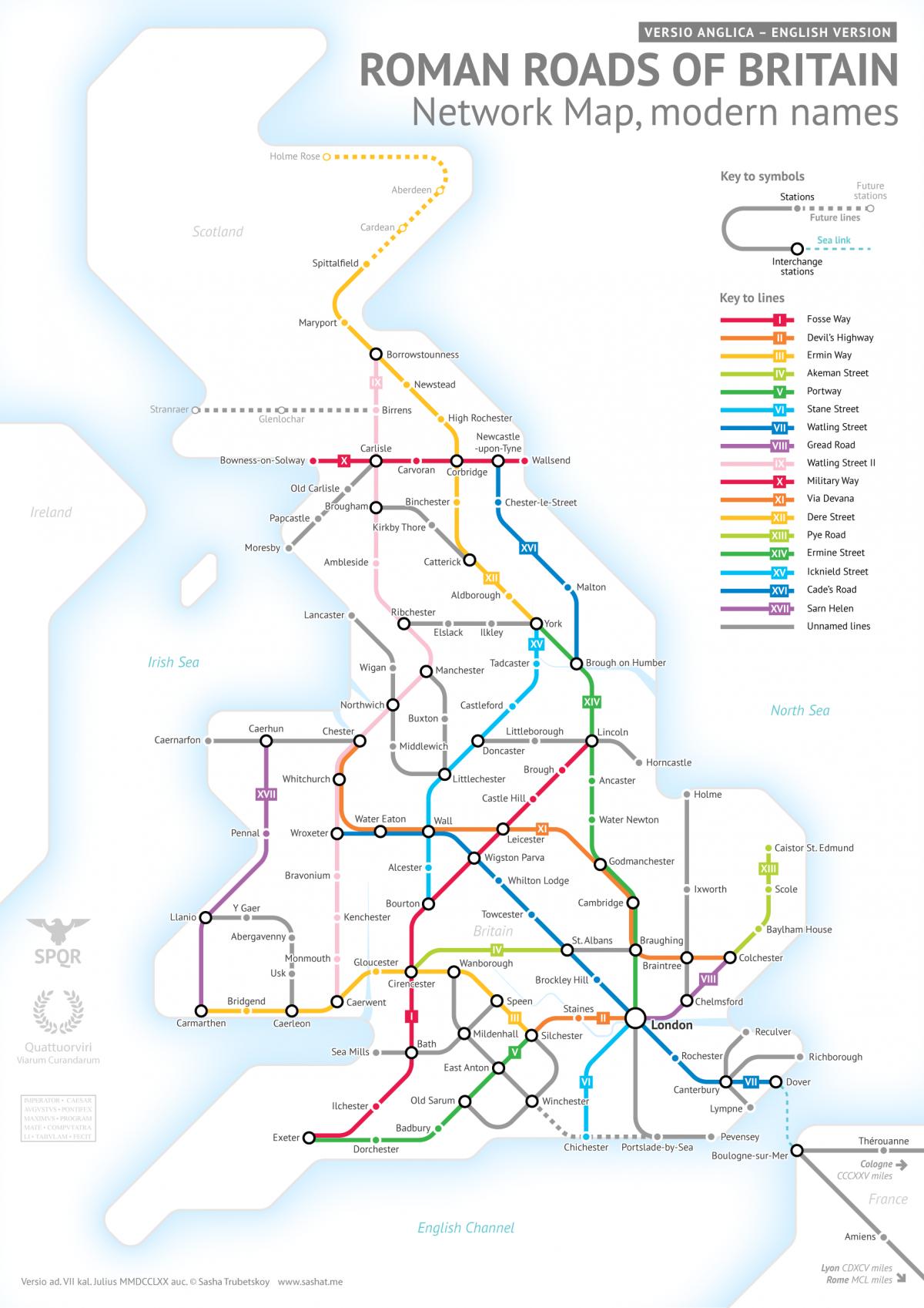
Sasha, a statistics student at the University of Chicago, has also produced a version of the map with the Roman town's English names, or the town closest to where Roman remains have been found.


Comments: Our rules
We want our comments to be a lively and valuable part of our community - a place where readers can debate and engage with the most important local issues. The ability to comment on our stories is a privilege, not a right, however, and that privilege may be withdrawn if it is abused or misused.
Please report any comments that break our rules.
Read the rules hereLast Updated:
Report this comment Cancel