
GEORGE WILKINSON grumbles about the cost of parking, but then forgets as he enjoys a grand walk at Bolton Abbey.
BOLTON ABBEY seemed, on first thoughts, not cheap at £7 for parking, but it’s free on weekdays in the winter, except for school holidays.
Anyway, we got our money’s worth and had a grand walk. And, economically, we had to pass up the nineteenth-century charms of the Cavendish Pavilion, to hurry straight off over the River Wharfe, having more miles to do than there was daylight for dawdling.
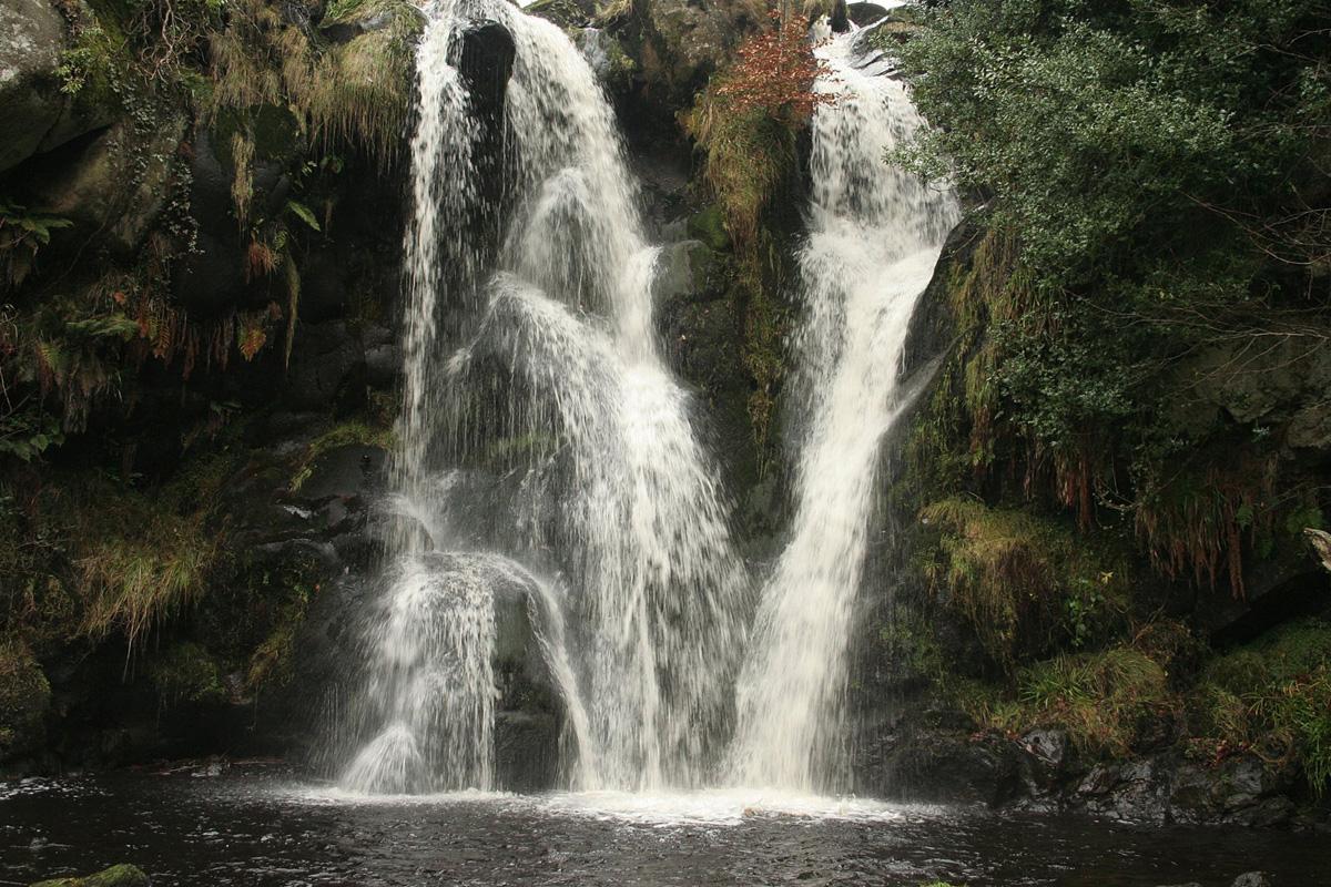
Walkers were thin on the ground, but a man said “better than Christmas shopping” as he ushered his two small children into the Valley of Desolation. In the ravine, twin 20ft waterfalls made, respectively, a hiss and a roar.
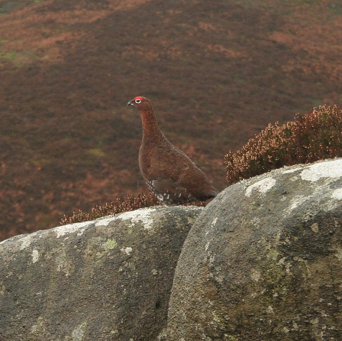
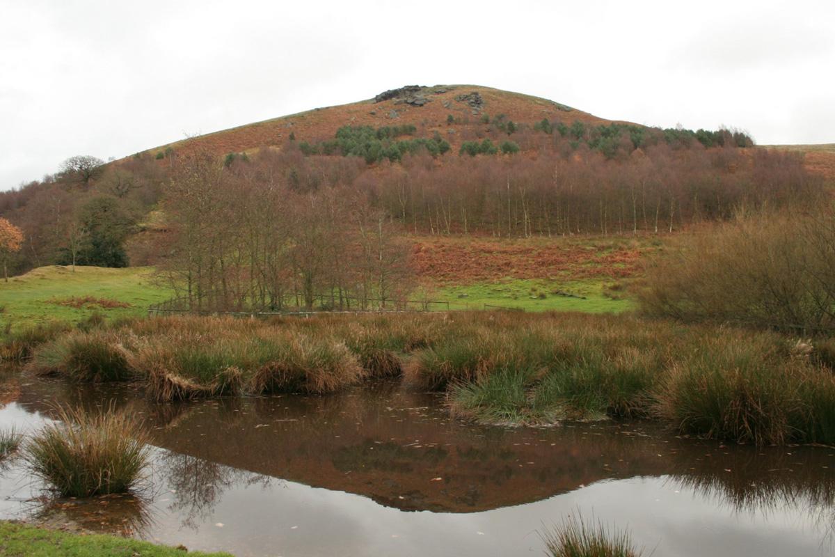
That was a distraction and we focused on the thousand-foot climb, up through the conifer belt and then on to the heather of Barden Fell, and the rain came down. Mile by mile there are more rocks and boulders strewn about, in piles, perched on by grouse and, towards the top, disrupting the route and assembled as crags.
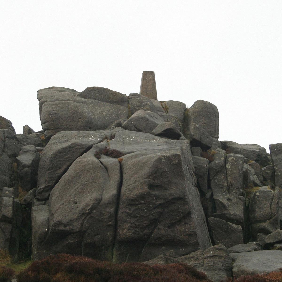
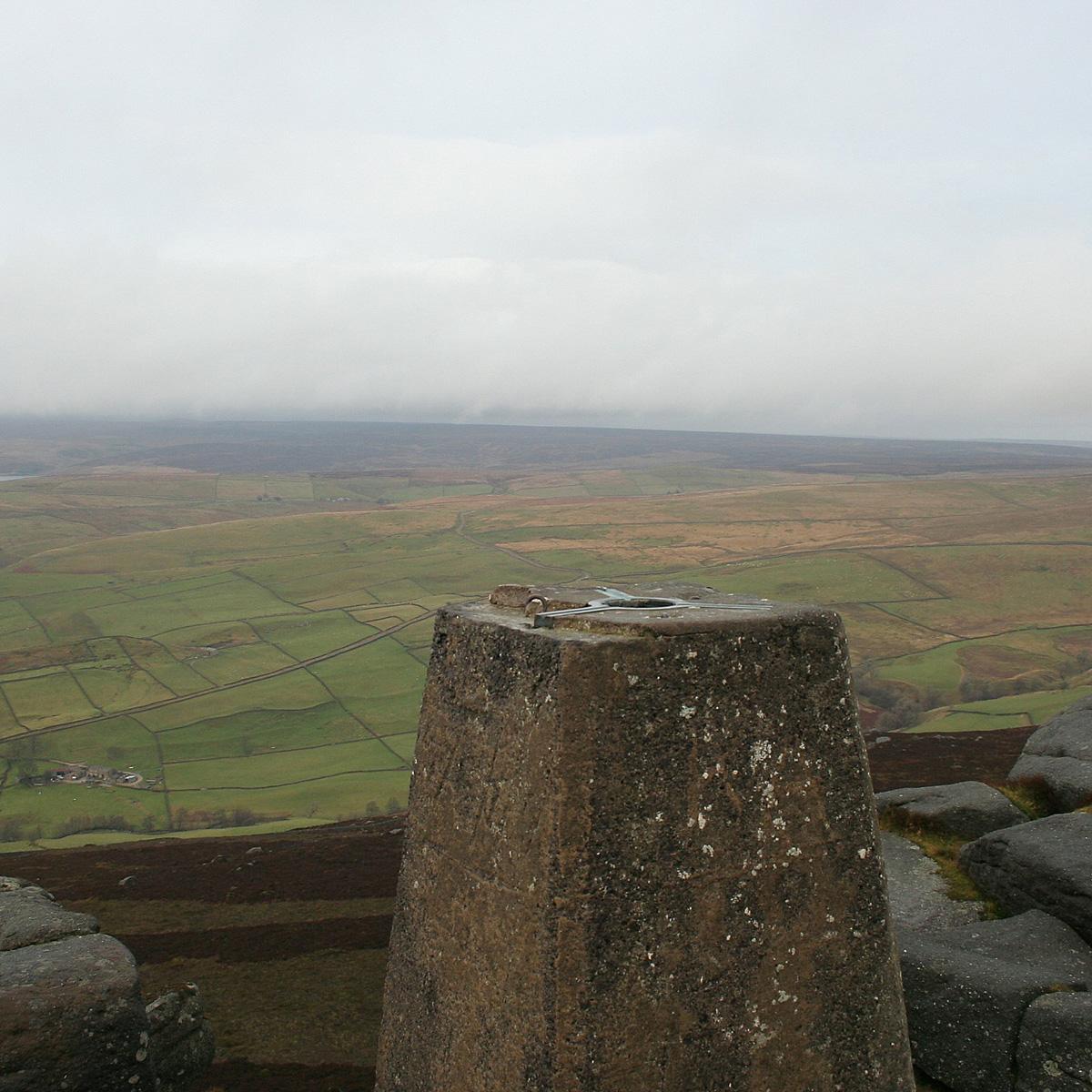
If I may take leave to suggest, the trig point at 1,500ft, on crags named Simon’s Seat could do with some TLC and a coat of white paint to make it stand out more from the blocks of grey gritstone everywhere. I found it with binoculars.
The reward is a superb view, one of the best around; the rock is vertical, the ground drops sharply and then pans out as green pasture for miles and holds four reservoirs.
Descending was a glide for a mile then a steep twist through the conifers again.
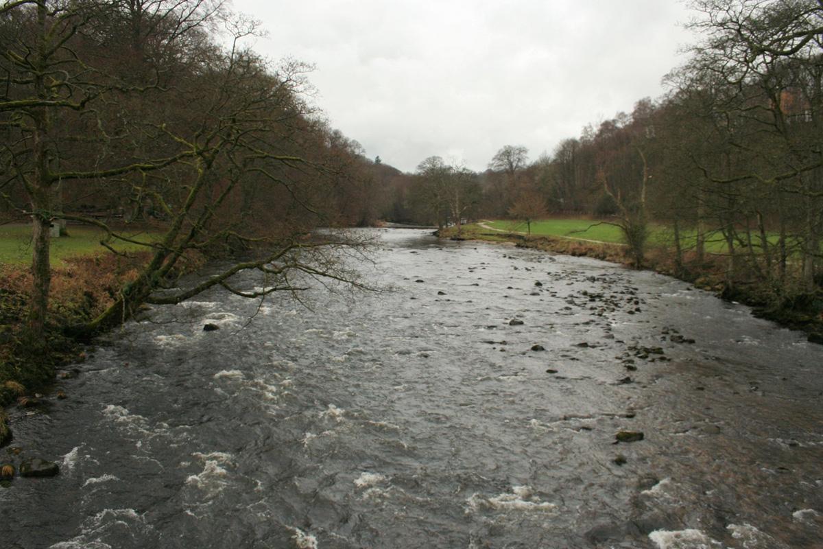
The rest of the day was smooth, if darkening, and right alongside the River Wharfe, on the Dales Way with a switch from one bank to the other at Barden Bridge. In the half-light ducks flew up-river, congregated and squawked a lot.
Gradually all became silent, the river smooth, the night warm and velvet, very black with small moths held in the torch beams. The Strid, where the wide river is compressed to a leap, if not a stride, looked most sinister. Anyone who falls into The Strid is sucked into the vortex and dies.
But to finish with more cheer – a few tiny lights flickered by a Romany caravan and a note read “Father Christmas has gone to feed his reindeers”. The café had shut at four.
Directions
When in doubt look at the map. Check your position at each point. Keep straight on unless otherwise directed. (wm=waymark, fp=fingerpost).
1 From Pavilion, bridge over river (fp Valley of Desolation), immediately left to surfaced path, gate, gate and right, left to road uphill.
2 Track on right to gate by Waterfall Cottage (info board), track in field. Snickelgate.
3 From pond, path on left downhill, footbridge, right to waterfall. Retrace steps to pond, continue uphill then down, footbridge.
4 Gate into conifer wood and right to track (fp Simon’s Seat).
5 Gate to moor and track straight on uphill. Ignore track on right after a mile.
6 At junction, right to rougher track uphill, through rocks, wide eroded path swings north uphill to Simon’s Seat and trig point on rocks. Scramble to trig point. TAKE CARE STEEP DROPS.
7 From paved path just before and between rocks at Simons Seat, path 50 yards to 20-yard length of wooden fence, from here take gravelled path south-west downhill - not surfaced all way, sometimes flagged (sign requesting users stay on the path).
8 Join wall to your right, then track, steep downhill through woods (fp Howgill). Over stile through ‘sheepfold’ and rejoin track.
9 Track swings right at bottom of woods (fp Howgill), gate. From info board, cross ‘road’ to path downhill. Cross road by bridge, track through farm (fp Dales Way/Barden Bridge), riverside path for one mile. Gate, footbridge, gate. Right to path by road.
10 Over road bridge, gate/squeezer on left, riverside path. Under bridge. Path climbs above river – SOME STEEP DROPS, left to rougher path down to the Strid. TAKE CARE: ROCKS BY THE STRID CAN BE SLIPPY (large info board). Riverside path through woods back to start.
Fact file
Distance: Nine miles.
General location: Yorkshire Dales.
Car parking: Car park at Bolton Abbey.
Right of way: Public paths, permissive paths and open access land, dogs illegal.
Date walked: December 2013.
Refreshments: All sorts at Bolton Abbey.
Tourist information: Skipton TIC 01756 792809.
Map: OS Explorer OL2 Yorkshire Dales southern and western areas or Explorer 297 Lower Wharfedale.
Terrain: Moor and riverside.
Difficulty: Take OS map, compass, torches and preferably GPS. Please observe the Country Code and park sensibly. While every effort is made to provide accurate information, walkers set out at their own risk.


Comments: Our rules
We want our comments to be a lively and valuable part of our community - a place where readers can debate and engage with the most important local issues. The ability to comment on our stories is a privilege, not a right, however, and that privilege may be withdrawn if it is abused or misused.
Please report any comments that break our rules.
Read the rules hereComments are closed on this article