
Grassington's car park was filling up by the minute. Anyone in an unreasonable hurry would have had to prod through the throngs of mum and dad walkers. The place has a long line of tempting stops, cafés and inns, but we were late.
Up and out of town we climbed. The slopes are the short green grass of pasture; the walls the colour of silver grey, further whitened by lichen.
After gaining some 500ft of altitude and at about a 1,000ft, we had a sandwich and a look around Wharfedale. It looked great, a good middle section.
Up here there were orange lichens, sluggish orange flies, bags of mushrooms and a spider on every thistle.
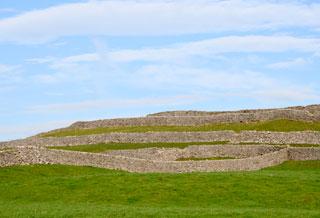
A little higher there’s a bield, a sheep shelter, this one made during the enclosures of the 1790s. It’s an exact symmetrical cross of walls pointing north, south, east and west, each 20 yards long and in ace condition.
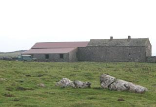
To our east the sky was clear blue, to the west it was misty red. At Bare House we chatted with the farmer about the bield, barn roofs, his Aberdeen Angus destined for Waitrose and the delightful day.
But the day was fading, so we quickly dropped to our return route on the Dales Way Set now for a fast two miles, we weren’t much slowed by the lime kiln with an info board (seen it) or by paths that are smooth grass except for roundabout rocks and, more pertinent, the rabbit burrows and the mole hills.
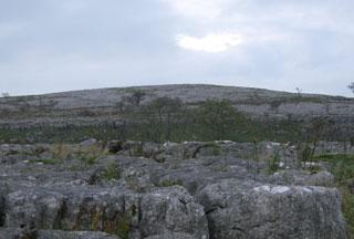
But we did linger in the twilight to watch a fierce bird fight. The stage was, from our feet, a pavement of deeply cracked blocks of limestone, then a scar topped with a dozen trees in silhouette.
Rabbits flickered through the pavement, something moved on a branch and out came the binoculars. Two big raptors perched above the scar and shuffled now and then without fuss, the same for two crows. Then a little falcon, a merlin presumably, came in and drove a crow from a tree and attacked again and again and took its place, victorious.
A minute later, the crow returned to the same tree and the fight was on again, a prolonged bout high in the sky, with arrow-like merlin attacks from under, above and behind.
But the crow had a practiced defence: just before impact, it would spin, cartwheel, feint and dip, slashing with its claws and beak. The falcon gave up after a dozen attempts and flew off towards a lesser scar across the valley; and all the time the two big raptors just watched.
We minded our feet in the gloom and didn’t register the medieval field system or the site of the medieval village, but did notice that there were not many lights on in Grassington.
That’s holiday cottages for you. But the walking shop was bright and we were almost last out of the car park.
Fact file
Distance: Six and a half miles.
General location: Yorkshire Dales.
Start: Grassington.
Right of way: Public.
Dogs: Legal.
Date walked: October 2009.
Road route: Various.
Car parking: National Parks pay and display.
Lavatories: Car park.
Refreshments: Grassington.
Tourist and public transport information: Grassington TIC 01756 751690.
Map: Drawn from OS Explorer OL2 Yorkshire Dales southern and western.
Terrain: Upland grasslands.
Difficulty: Moderate in good weather.
Please observe the Country Code and park sensibly. While every effort is made to provide accurate information, walkers set out at their own risk.
Directions
When in doubt look at the map. Check your position at each point.
Keep straight on unless otherwise directed.
1. Left to road from car park, right to Main Street, uphill, left to Chapel Street (waymark). Ignore Intake Lane.
2. Right to Bank Lane (fingerpost), becomes walled track, sharp right-hand bend.
3. Stile/fieldgate into narrow field, grass path then from bend keep by wall to your right (fingerpost). Squeezer (fingerpost), uphill, gated wallstile (no sign), 11 o’clock, wall gap (fingerpost), 11 o’clock, wallstile (no sign), 10 o’clock.
4. Wallstile (fingerpost/waymark post), 100 yards, ignore left fork and keep by wall to your right, gated squeezer, 11 o’clock, 300 yards and pass hilltop to your right, ladderstile, 10 o’clock, on grass track 5. Wallstile and 11 o’ clock OR 2 o’clock for 200 yards to bield sheep shelter (this is over open access land, so check any current dog rule). Return to route that was heading 11 o’clock, gap in wall remains, uphill, pass two rocks.
6. Ladderstile, 100 yards, left to track.
7. Wooden fieldgate in wall corner, track across field to barn, fieldgate and left downhill by wall to your left (no sign).
8. At and before fieldgate immediately below barn and house, right to grass track, level then diagonally downhill and steepening, wall gap by trees, fieldgate in corner, 100 yards, path diagonally, 11 o’ clock downhill, double-gated squeezer, 100 yards, fieldgate and fieldgate, path 1 o’clock.
9. At gated wallstile, double back left on level grass track (three-way fingerpost Dales Way), gated wall stile, gated wall stile, gate, gated wallstile (waymark), 11 o’clock.
10. Ignore a left fork that curves uphill, 200 yards, ignore a left fork, 50 yards, 11. Wallstile (fingerpost) into field, squeezer, left 100 yards, right-hand bend and uphill to gated squeezer with strong spring, 1 o’clock down to gated wallstile (fingerpost), 11 o’clock, 100 yards, wallstile on right (fingerpost), 11 o’clock, footbridge and gate to rejoin outward route.


Comments: Our rules
We want our comments to be a lively and valuable part of our community - a place where readers can debate and engage with the most important local issues. The ability to comment on our stories is a privilege, not a right, however, and that privilege may be withdrawn if it is abused or misused.
Please report any comments that break our rules.
Read the rules here