


THE Cleveland Way is 40 this year so the North York Moors National Park Authority are organising celebrations and their Rachel McIntosh has asked me to do my favourite stretch. It was a pleasurable task and an excuse to tread old ground.
But which part of the walk? There aren’t any bad miles of the 110. It’s a great route, a National Trail, around the edge of the moorland plateau, and what an edge. And though in 1969 this was one for toughies, now the paths are good and so are the signs.
So where to go? For me it came down to places, either Runswick Bay, the loveliest on the coast, or Roseberry Topping. It wasn’t ice-cream weather so it was to be Cleveland’s Matterhorn, signed two miles from the car park at Gribdale Gate. But not immediately. First we headed in the opposite direction and popped up to Captain Cook’s Monument, a stone obelisk to Cleveland’s most significant person ever, by a nautical mile, or as Bill Cowley wrote in 1969 in his book on the new way, “certainly no greater Yorkshireman”.
The info plaque on the 1827 monument mentions “pagan and savage tribes”. We saw our only proper hardy hiker in the lovely woods that took us round, at least that’s how she looked, the way she walked. The views were limited to the mist, but the bonus was the green air in the fresh leaved larch.
We left the Cleveland Way for a bit of rough and gated back road that drops into Lonsdale, a bowl of pastures where in the shelter the blackthorn, the may hedge, was blossoming white.
The track that led out was rutted by 4x4s, but the gates stop them at Great Ayton Moor and we had a lovely peaceful high mile or more in the heather. There’s a nicely shaped military relic up here in brick and concrete, and carpeted by lager cans. We had forgotten our champagne, which wouldn’t have impeded our progress, for there is no need for a sharp navigational brain on this one.
At Hutton Moor, we took a west to rejoin the Cleveland Way, crossed Newton Moor and reached the junction, where the only spur on the way takes off for the stand-alone peak of Roseberry Topping.
From this angle, the hill doesn’t show its pointed profile, but it does look notably steep for the top third of its one thousand feet, despite subsidence from the one time ironstone mining.
The climb is made comfortable by the zigzag path, and is a lot easier than it looks.
On the rock on the top were the people, a dozen at a time, and more, like ants on the slopes, funnelling up from all sides to pose for the lens and gasp at the ‘exhilarating’ views as Ian Sampson describes them in his definitive guide titled Cleveland Way. Well, the weather had not improved, a sea fret washed in and the only village visible out on the plain was Great Ayton. Such weather is not uncommon, it’s only eight miles to the sea at Saltburn as the crow flies, 10½ if you continue there on the Cleveland Way.
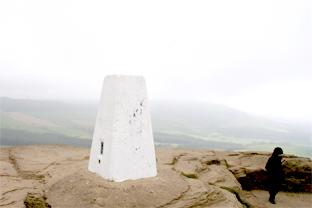
A pair of jackdaws had flown up, dicing with the wind for sandwich crusts, and daffodils flowered at altitude. That was it for wildlife, it’s a hostile spot, and tiny tots were clinging to the trig point.
Down one path is Aireyholme Farm where James Cook grew up, and just below is Aireyholme House, where I lived. He circumnavigated a largely unknown world, I go round in circles five mile in circumference. He never made it back from Hawaii. Our two miles back to the car park are moorland simplicity and guided by his monument. A note for your diary: on Sunday, May 24, you could see some serious walkers as this is the date for the National Park’s anniversary walk and various groups of ramblers will be doing it all in sections.
I think they will be going clockwise, so you should see them coming rather than be overtaken.
Directions
When in doubt look at the map. Check your position at each point.
Keep straight on unless otherwise directed.
1. From Gribdale Gate car park, gates to path/track up through woods (fingerpost, Cleveland Way, ‘Kildale 2½ miles’).
2. At monument path on left (no sign), 200 yards, wall gap, downhill through wood, on bend straight on through offset lengths of fence (fingerpost Cleveland Way). Footbridge over ditch and right to track uphill (waymark post points way you came).
3. Forest gate and left to road. On left-hand bend, straight on to rutted track uphill. Fieldgate.
4. Fieldgate and left to road end (Percy Cross info board), immediately fieldgate/gate to track. Ignore parallel path to your right later on.
5. Gates and left to track at edge of wood (waymarks).
6. Right-hand bend, 100 yards, gate on left to path through heather (blue waymark).
7. At junction gate in wall (waymark post), downhill by wood then uphill to top of Roseberry Topping (stone waymark). Return to point seven and right to track by wall.
Fact file
Distance: Six and a half miles.
General location: North York Moors.
Start: Gribdale Gate.
Right of way: Public.
Dogs: Legal.
Date walked: April 2009.
Road route: Take Station Road out of Great Ayton, then Dikes Lane.
Car parking: Free car park, info boards.
Lavatories: Great Ayton.
Refreshments: Great Ayton.
Tourist and public transport information: Great Ayton TIC 01642 722835.
Map: Drawn from OS Explorer OL26 North York Moors western area.
Terrain: Mixed.
Difficulty: Moderate.
Please observe the Country Code and park sensibly. While every effort is made to provide accurate information, walkers set out at their own risk.


Comments: Our rules
We want our comments to be a lively and valuable part of our community - a place where readers can debate and engage with the most important local issues. The ability to comment on our stories is a privilege, not a right, however, and that privilege may be withdrawn if it is abused or misused.
Please report any comments that break our rules.
Read the rules here