
TYPICAL of the South Pennine area, reservoirs dotted amongst some wild moorland. There are a number of reservoirs north of Hebden Bridge so a good choice of walks but I believe this is the most enjoyable way to combine these four.
There is also an option to miss the final one and stay in the pub!
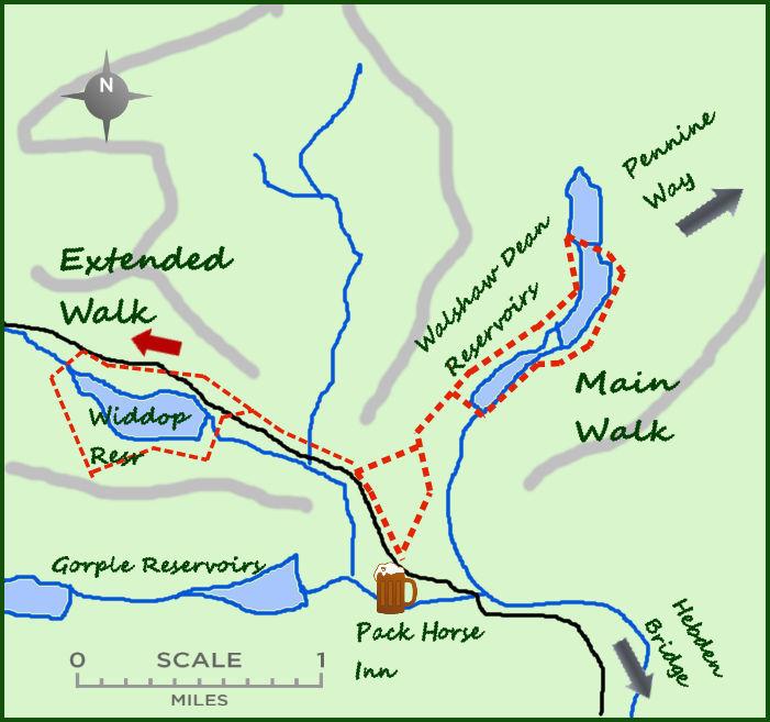
The basic walk is only five miles and includes three reservoirs. However give yourself time to extend the walk and include a circuit of Widdop Reservoir. The shorter walk includes the reservoirs of Walshaw Dean, built in the first months of 1900.
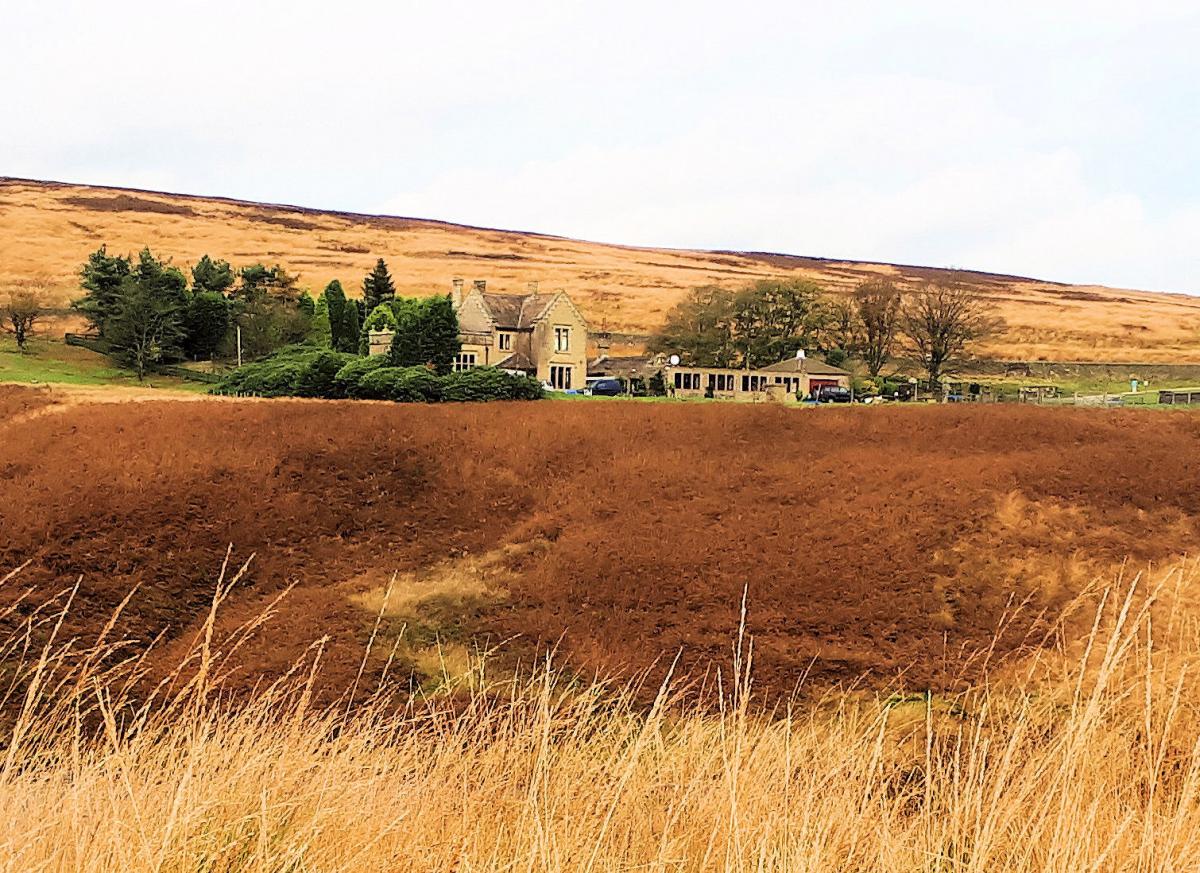
The water was used for the growing mill town of Halifax and entailed the building of a new town, Dawson City (later to become Heptonstall) named after a ‘gold’ city in the Klondyke Gold Rush. Both start at the Pack Horse Inn, two miles north west of Heptonstall.
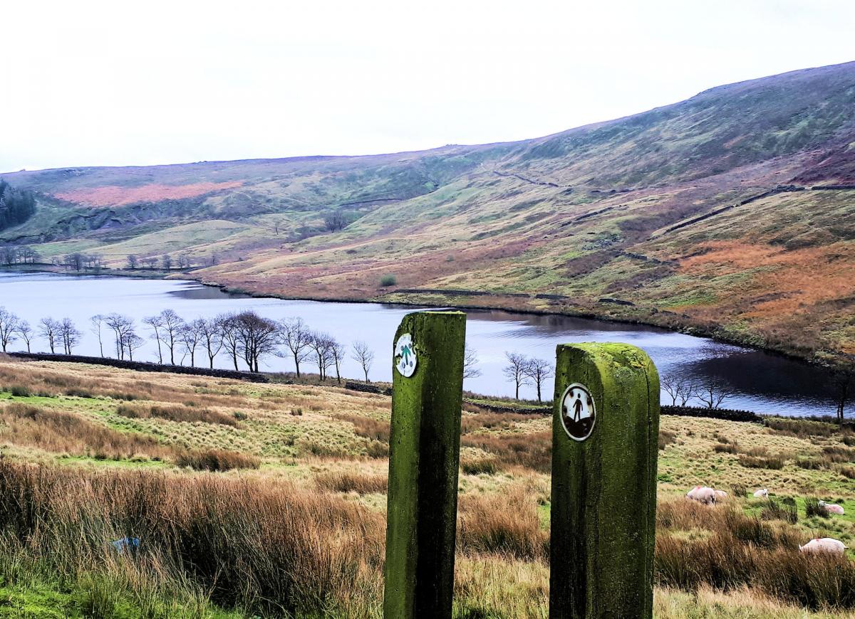
Cross the road from the pub and head north east on a footpath (crossing one stile) that drops towards the reservoirs in the distance. After less than half a mile the path meets a tarmac road heading north (built for the water board, it is not a through road). Follow the road north for half a mile to the first dam (Walshaw Lower Reservoir). I prefer heading north on the east side of the reservoirs (which are lined up to the north) and follow the Pennine Way route on the east side. Therefore cross the dam on arrival and follow the grassy track near the water.
After half a mile the second dam is arrived at with good views across to the lodge opposite. Carry on as Middle Reservoir bends east and then north. Half way along and just after a gate the Pennine Way leaves the water and heads in to the moors to the right. It is a one and a half mile walk to Top Withins from here on the Way. After another 200 metres the dam marking the third reservoir is met. It is possible to circle the Higher dam on a path but I prefer crossing the dam at this point and turning back south on a wide track.
Follow this track past the Lodge and towards the lower dam. Continue for a further 400 metres where the track divides, take the westerly track with woodland to your right. The track drops to the main road, turn left for the pub (half a mile away) or right to go for the extended walk.
Extend the walk with a round of Widdop Reservoir. Follow the road above the reservoir (the lower path is very wet) to some parking at the westerly end and drop down to a bridge and a signpost indicating the Reservoir circular walk.
Climb up the Burnley Way footpath south for just over half a mile to a meeting of paths. Turn left on to the Pennine Bridleway and follow it back to the dam and road at the east end of the reservoir. The views are superb. Turn right at the road and follow it back to the Packhorse Inn.
Fact Box:
Distance: Roughly 9 miles (includes Widdop, optional)
Height to Climb: 270m (885 feet)
Start: SD 952317. Park in the car park at the Pack Horse Inn or roadside nearby.
Difficulty: Medium. It is the remoteness that makes this hard but the tracks are good. The climb on the longer walk is quite strenuous.
Refreshments: The Pack Horse Inn is a traditional pub with food but closed in winter Monday to Wednesday.
Be Prepared:
The route description and sketch map only provide a guide to the walk. You must take out and be able to read a map (O/S Explorer 21) and in cloudy/misty conditions a compass (essential on this walk). You must also wear the correct clothing and footwear for the outdoors. Whilst every effort is made to provide accurate information, walkers head out at their own risk.
Please observe the Countryside Code and park sensibly.
Jonathan Smith runs Where2walk, a walking company based in the Yorkshire Dales:
Where2walk.co.uk also features 100’s of walks across Yorkshire and beyond, from easy strolls to harder climbs.


Comments: Our rules
We want our comments to be a lively and valuable part of our community - a place where readers can debate and engage with the most important local issues. The ability to comment on our stories is a privilege, not a right, however, and that privilege may be withdrawn if it is abused or misused.
Please report any comments that break our rules.
Read the rules here