

Retired York psychiatrist BOB ADAMS has completed the latest leg of his walk the length of the River Swale - this time the 12 miles from Catterick Bridge to Richmond
Swale Trail Day 7: Catterick Bridge to Richmond. Walked on Saturday June 25. Distance: 12 miles
The seventh day of my trek from the confluence of the river Swale to its source at the far end of Swaledale was a circular walk from Brompton-on Swale to Richmond and back.
As is often the case when you try and follow a river, progress is not always straightforward - and today’s walk was no exception.
My friend Steve, who has joined me on previous river walks, knew what to expect.
We set off downriver from Brompton following a path back to Catterick Bridge. There were occasional glimpses of the Swale, radiant in the morning light, through gaps in the trees.
We passed under the graffiti-adorned A1M motorway bridge and continued until we reached the metal soldiers guarding the way, the end of my last walk.
Some of the graffiti under the bridge was a bit rude but I can report there was support for the brave heroes of Ukraine.

Graffiti under the A1M bridge
After crossing the bridge that once carried the military railway to Catterick Camp we headed back west along the south bank of the river.
Soon after our way was blocked by brambles and stinging nettles, surprising as this route is part of the popular Coast to Coast long distance walk.
In retrospect we had probably taken a wrong turn.
The detour we took by road turned out to be a good thing as it gave us the opportunity to take in the impressive former Roman Catholic church and presbytery built on the Brough Hall estate in 1837.
This church, dedicated to St Paulinus, was designed by Durham architect Ignatius Bonomi and is now a private house. In the Seventh Century St Paulinus is said to have baptised Christian converts in the river Swale near Catterick, as well as at Brafferton.
We then headed back to the river, crossing some hillocks on a terrace above the river near St Giles Farm. The name is no coincidence. On this site there was once a medieval hospital and, centuries before that, bronze and iron age settlements.
Medieval hospitals, like St Leonards in York, did not just look after the sick and elderly, they also gave out alms and provided support for travellers.
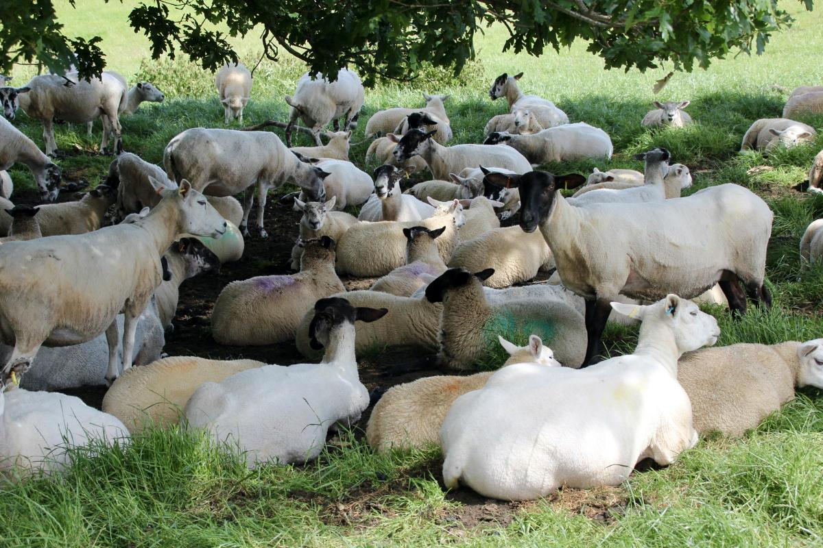
We passed a huddle of over sixty sheep gathered under a tree for shelter from the sun after a hard morning chewing grass.

A huddle of sheep near Colton
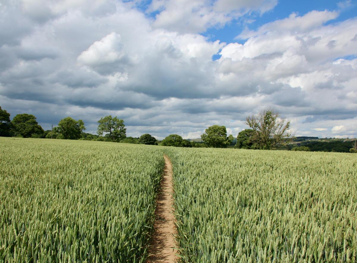
After fields of rippling wheat we came to the sleepy village of Colburn, not to be confused with its larger and busier partner, Colburn town, half a mile to the south.
Then we followed a beautiful path through some woods, known as Iron Banks, along the riverbank to join the disused railway line to Richmond.
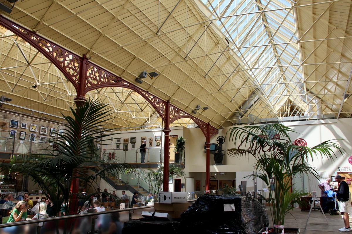
In no time at all we arrived at the old railway station of Richmond, a building worth a visit in its own right.
Since 2007 the station has been tastefully restored and managed as a community project by the Richmondshire Building Preservation Trust.
It is now a heritage centre housing an art gallery, various artisan food producers, a cinema, and a café and restaurant.
It was the perfect place to stop for lunch. The original station was the terminus of the Richmond branch line that opened in 1847 and closed in 1969.

Richmond railway station, now a heritage centre
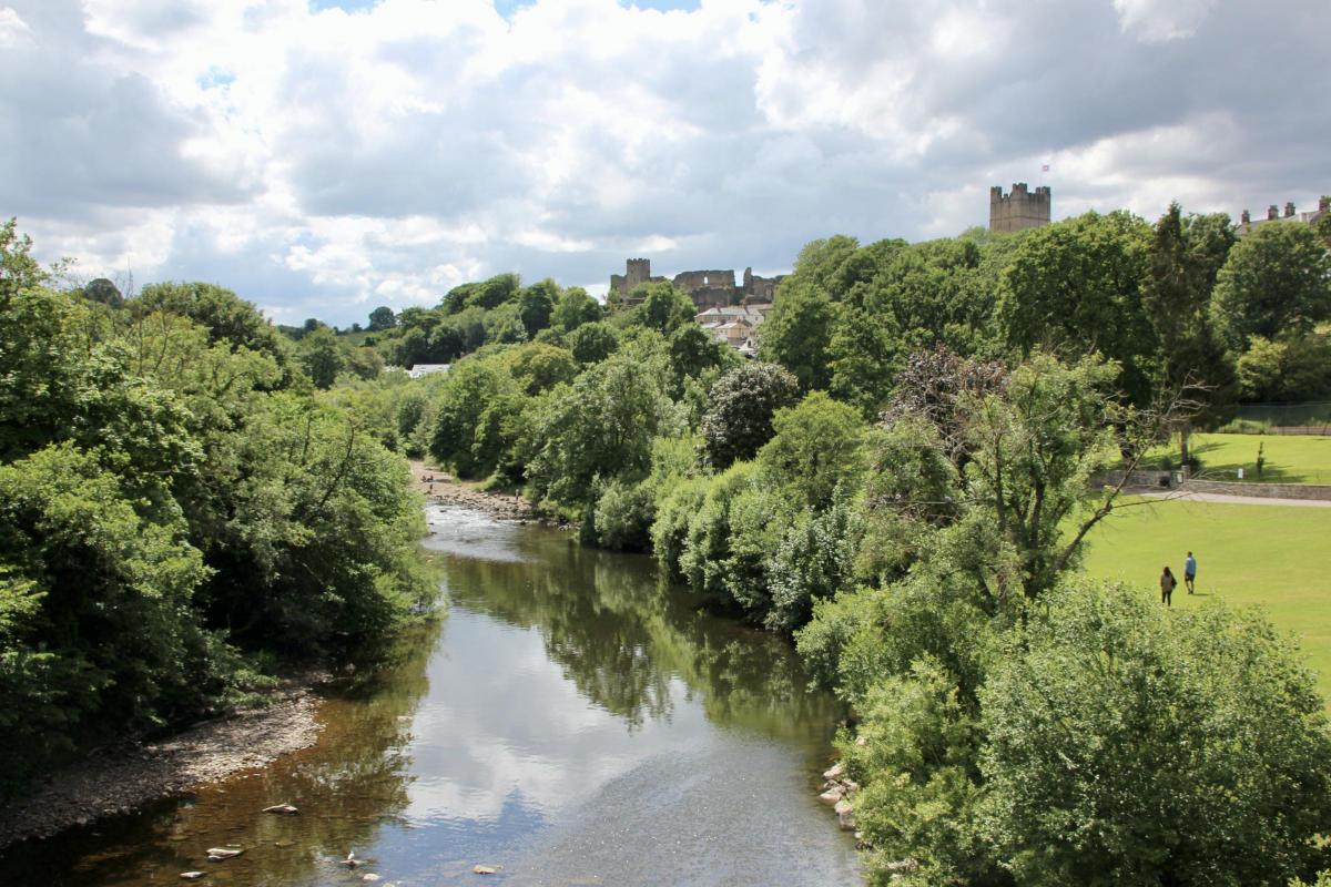
We continued over Mercury Bridge and our got first view of Richmond Castle.
The stone-arched bridge was built in 1846 by the railway company to provide access to the new station.
It was renamed Mercury Bridge in 1975 in honour of the 50th anniversary of the Royal Signals Regiment at Catterick.
No expense was spared in constructing the bridge and station, a result of the profits to be gained from lead mining further up Swaledale.
Exploration of the town and castle had to be left to another time and we turned back east along the north bank of the river towards Easby Abbey.

Richmond seen from Mercury Bridge
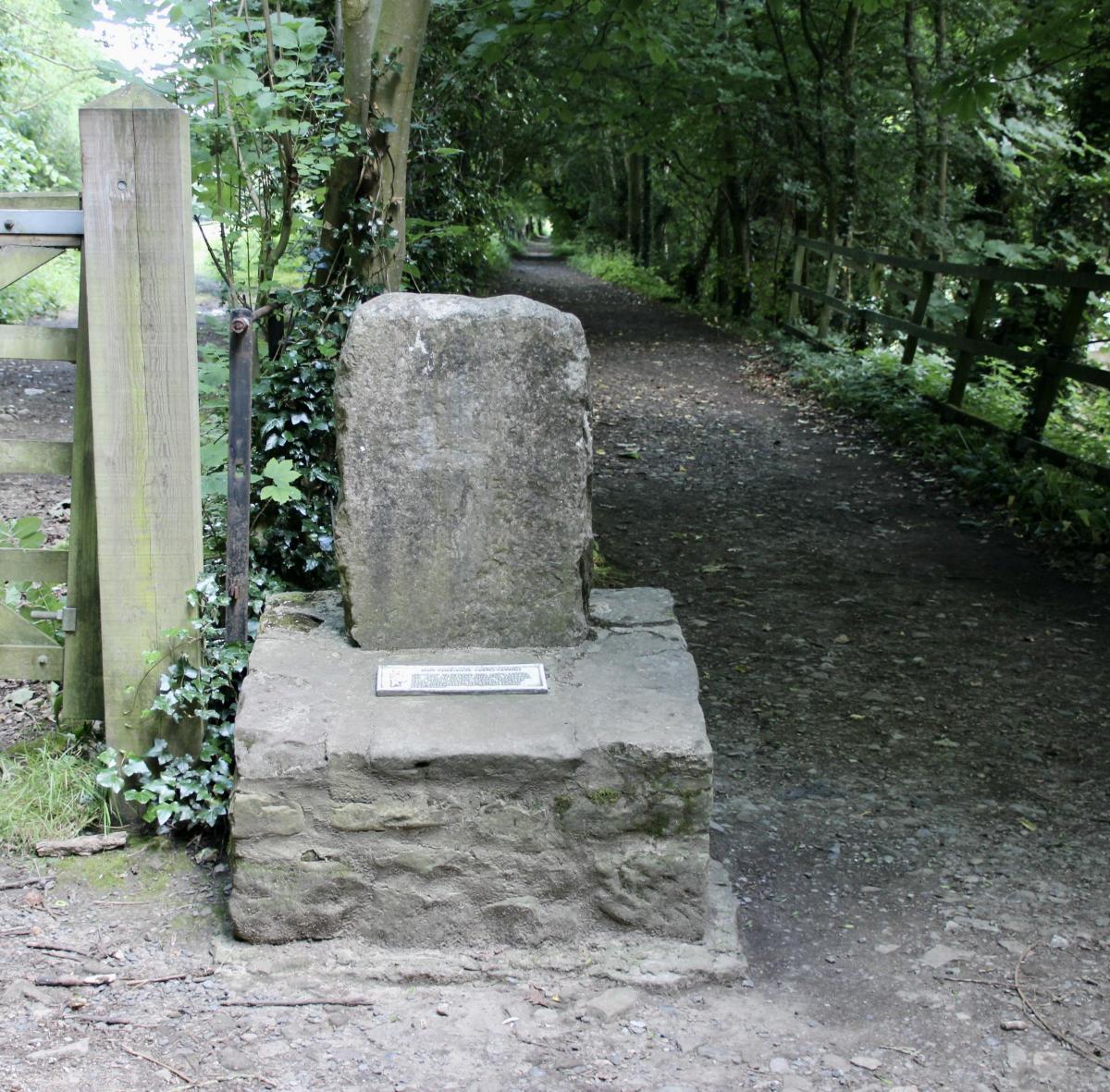
Our route took us through ancient woodland and past the Drummer Boy Stone.
As with all legends the tale of the drummer boy of Richmond needs to be taken with several pinches of salt.
Apparently in the late eighteenth century soldiers up by the castle discovered the entrance to a tunnel.
As the tunnel was too small for a man, a drummer boy ‘volunteered’ to explore the tunnel.
The stone marks the last place where the sound of his drum was heard.
He was never seen again.

The Drummer Boy Stone, near Easby Abbey
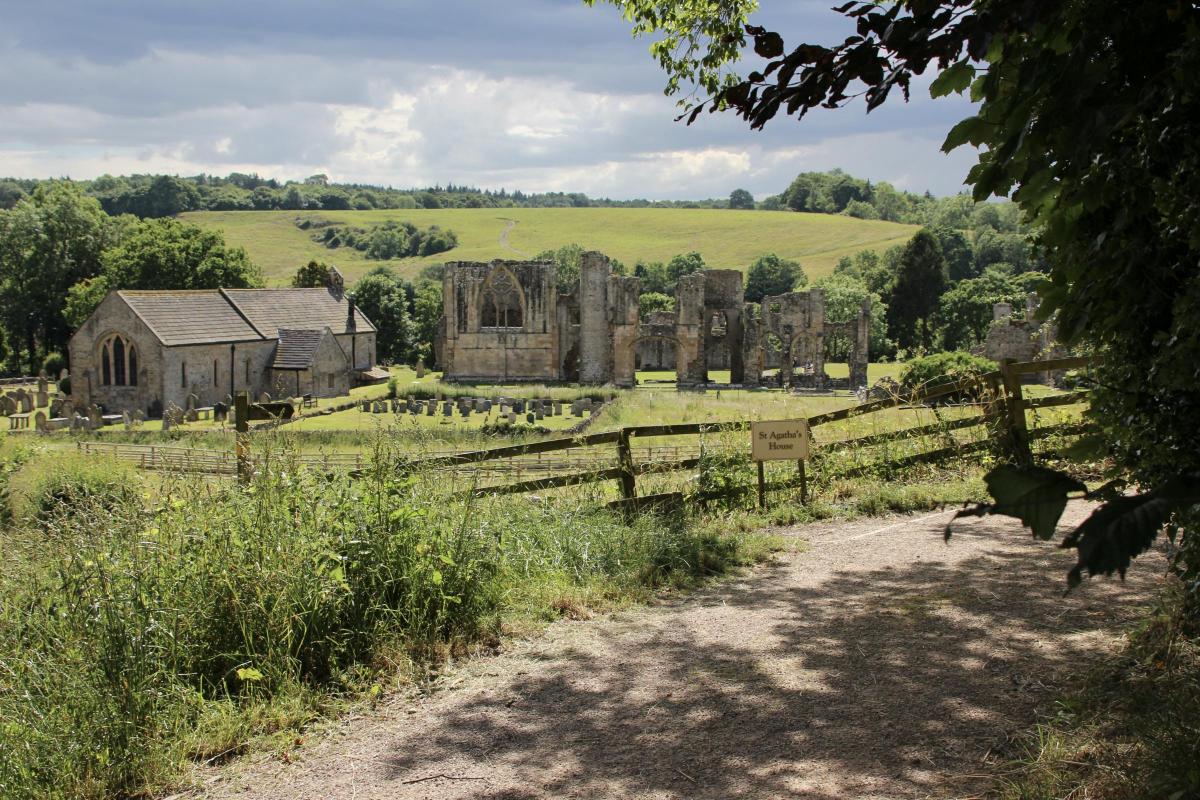
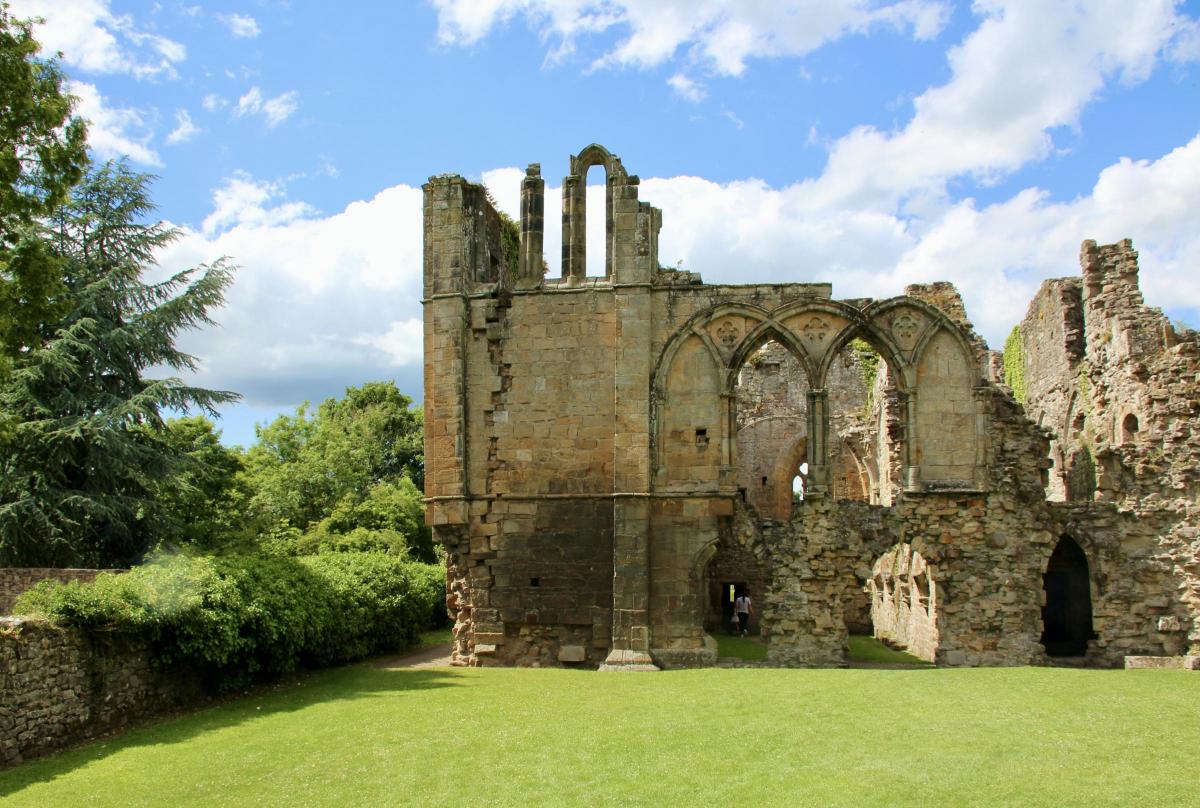
Next stop was the ruined abbey of Easby that was, as was the case with most monasteries, situated in a beautiful spot by the river.
The site is now run by English Heritage and entry was free.
Wandering around the ruins we found it hard to locate the position of the abbey church.
The impressive refectory and cloisters were obvious but not the church.
Reading some of the information panels we discovered why.
In 1536 at the time of the dissolution of the monasteries by Henry the VIII, Easby took the fatal decision to join the Pilgrimage of Grace, a popular rebellion against the King’s break with the Catholic Church.
After tricking the rebels to disband at Doncaster Bridge, the evil Henry took his revenge.
He ordered “… at St. Agatha (Easby) and such places as have made resistance … you shall without pity or circumstance cause the monks to be tied up without further delay or ceremony”.
It is not known what actually happened to the monks at Easby but to be ‘tied up’ meant to be hanged.
Presumably the abbey church was also on his revenge list.

The Easby Abbey ruins
But next to the abbey still stands the 11th Century St Agatha’s parish church of Easby.
It houses some remarkable medieval wall paintings. There is such a lot to see in the vicinity of Richmond.
Leaving Easby we continued along the river to Low Easby railway bridge, an iron structure that once carried the railway to Richmond station.
After that our way along the river was again blocked by impenetrable vegetation and Keep Out signs.
But once again this proved a bonus as, on returning to the Abbey and climbing the hill behind, we had a great view of the ruins with the added benefit of the ability to stand on the ‘echo stone’ and shout across to the valley beyond.
After that our path gradually descended back to the river and the village of Brompton.
There were clear views of the distant North York Moors and we were able to avoid walking along the busy B6271 by following a short section of the disused railway.
I am looking forward to walking the next stretch of the river as it enters Swaledale, one of the most attractive and remote of all the Yorkshire Dales.


Comments: Our rules
We want our comments to be a lively and valuable part of our community - a place where readers can debate and engage with the most important local issues. The ability to comment on our stories is a privilege, not a right, however, and that privilege may be withdrawn if it is abused or misused.
Please report any comments that break our rules.
Read the rules here