


Walking the River Swale
Days 2&3: Helperby to Skipton-on-Swale
Walked on April 16 and 24, 2021
When Lockdown 3 was introduced last January further Swale walks had to be curtailed. But with the easing of lockdown on the April 12 and the beginning of fine sunny weather it was time to get walking again.
The only problem was the lack of public transport. My solution was to develop a method of driving to where I wanted to get to, leaving a bicycle there, driving back to the start of the walk, doing the walk, then cycling back. It is a rather slow method, managing only 5 to 6 miles each time, but it was enjoyable.
Today’s account covers two walks, the first from Helperby/Brafferton to Topcliffe and the second from Topcliffe to Skipton-on-Swale.
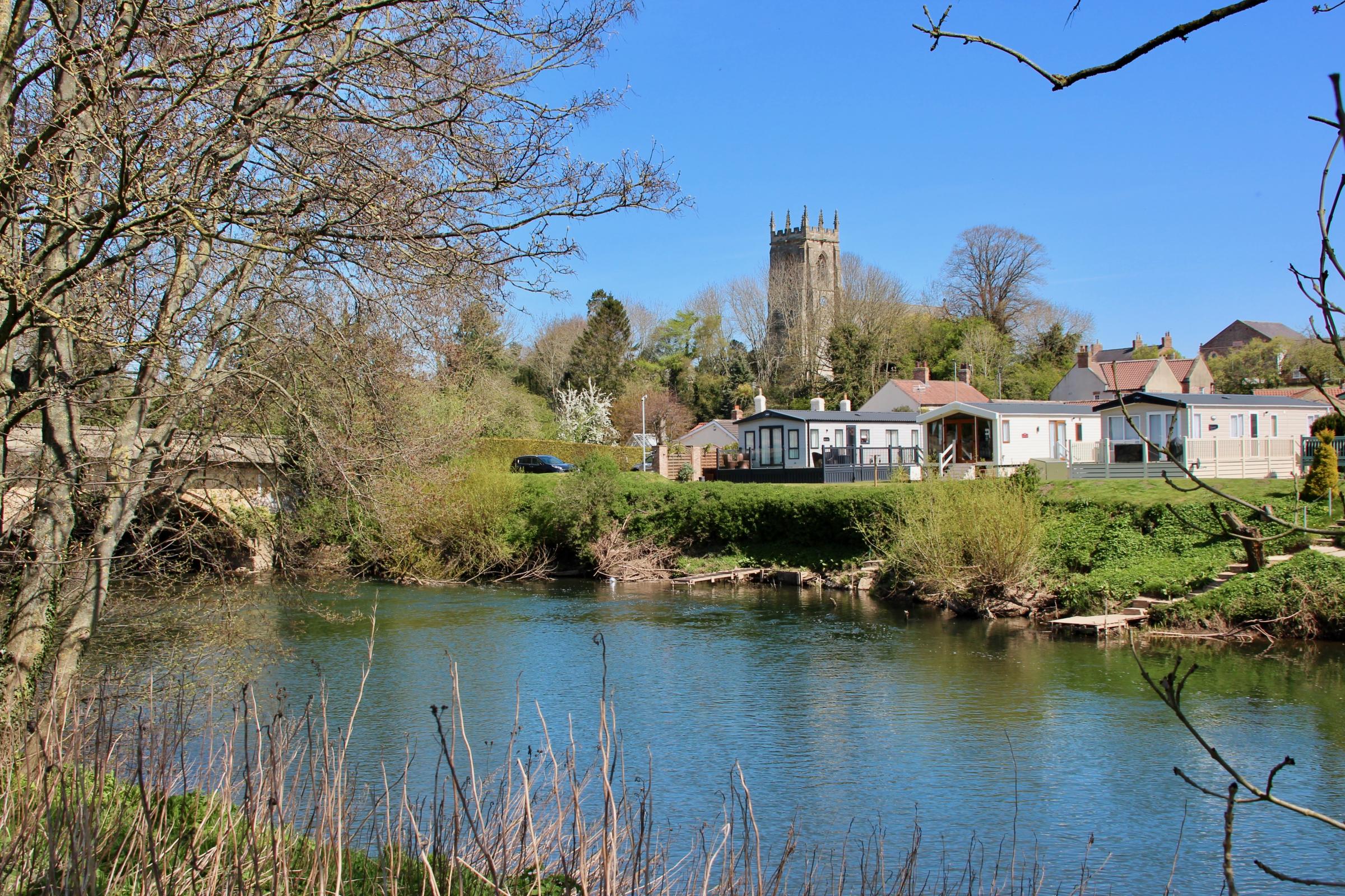
Day 2: Helperby/Brafferton to Topcliffe
This part of the Swale has been described as the Holy River of Saint Paulinus. This early Christian saint pre-dated Saint Cuthbert when he was sent north by the Pope in the 7th Century to convert the heathen Anglo-Saxons. After baptising King Edwin of Northumberland at York, Paulinus then set out into the countryside to look for converts, then baptising them in rivers. Catterick was one such place, but he also used the river at Brafferton, the start of today’s walk.
Unfortunately for the inhabitants the Vale of Mowbray was a major route for invaders, notably the Scots in the Middle Ages. William the Conqueror had previously laid waste to the area during his harrying of the north. The result was a number of deserted villages of which little remains.
The Swale winds its way in a leisurely manner down this slightly rolling countryside of rich farmland on its route south from Richmond. Never large enough to permit much in the way of navigation the river was not a major transport link. Nowadays travellers speed up and down the A1M, A19 and East Coast Mainline, passing through without stopping. They are missing some hidden gems.
At Brafferton my wife and I crossed the river by the footbridge and followed the west bank past the disused railway bridge and onwards along a permissive path to Thornton Bridge. This bridge is the first road crossing of the Swale after its confluence. The original 17th Century stone bridge was replaced by a cast-iron bridge in 1888. This bridge is grade II listed and has attractive iron trelliswork and shields of the City of York, but you won’t see them unless you leave the road.
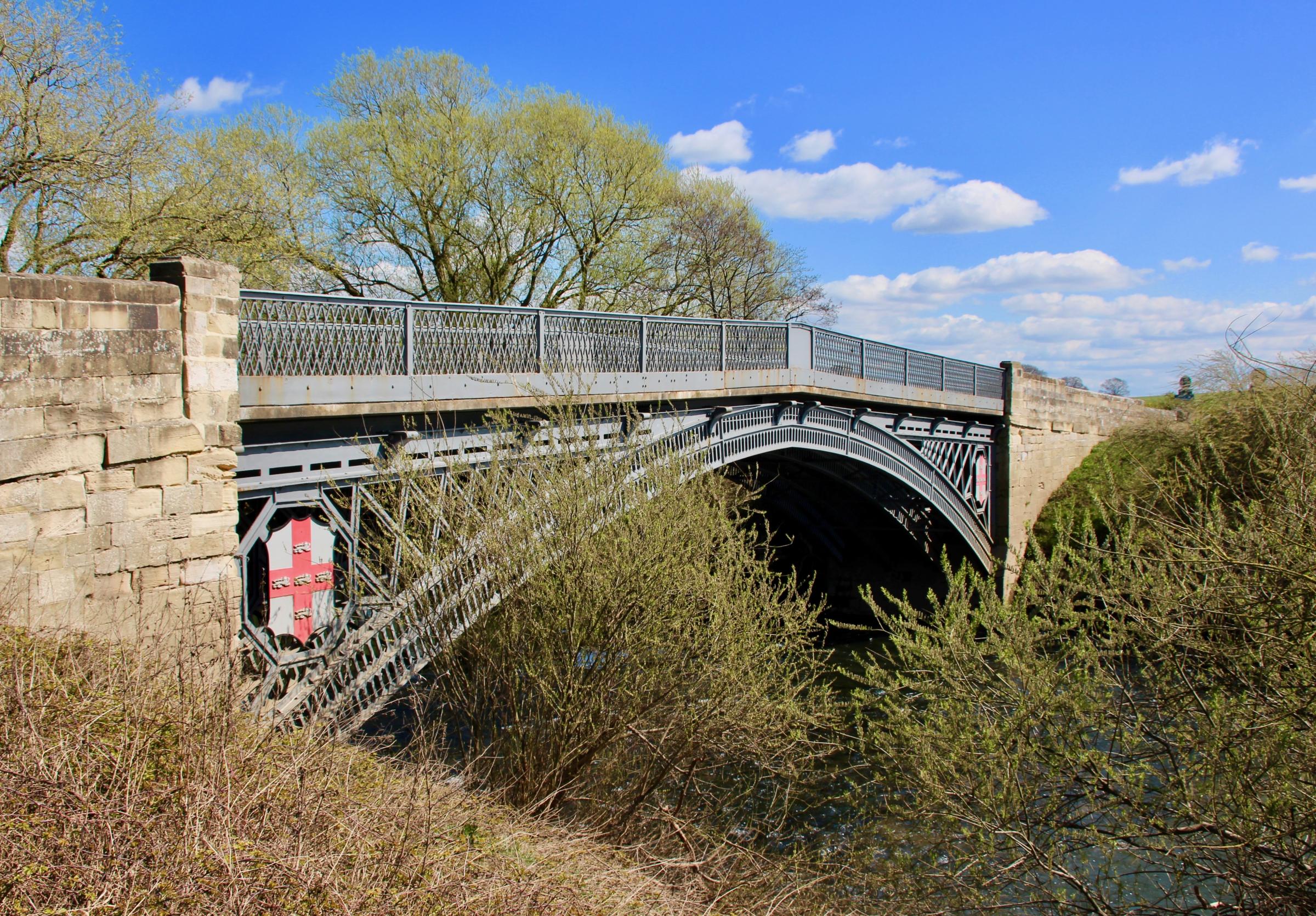
Thornton Bridge. Picture: Bob Adams
Thornton Bridge. Picture: Bob Adams
We took a short footpath followed by dusty dirt and tarmacked roads along the east side of the river the rest of the way to Topcliffe. The only river access was for private fishing and for sheep, although I am not sure the sheep fully appreciated this. We passed the tiny hamlets of Fawdington and Crakehill. There may have been a crossing point at Crakehill as it is close to the larger village of Cundall high up on the opposite bank with its water mill and manor house.
We passed some interesting mounds that were once the settlement of Eldmire. This was a moated village and included a chantry chapel dedicated to St Giles. The village was active from the 13th Century but suffered from flooding as well as Scottish raids. Apparently ridge and furrow field patterns are still evident but the site is not accessible to the public.
Nearing Topcliffe our route led us along a busy access road to the industrial estate, built on the site of a former wartime airfield. There were whiffs from a sewage farm and from manure, and an unidentified smell that Barbara thought was chicken stock. We soon found the culprit, a pet food processing plant. To our left we noticed some curious square embankments with a central enclosure containing a hut with a concrete roof. My guess is that these structures were bomb stores situated some distance away from the main runway.
There were in fact two airfields at Topcliffe, both used by bomber command during the Second World War. At one point the main Topcliffe airfield had over 2,500 personnel. The two pubs must have been packed. There was also another bomber base at Skipton-on-Swale, my destination on the second day.
We then crossed a brand new concrete bridge over Cod Beck and passed under the dual carriageway of the A168 to arrive at Topcliffe. As its name implies this pretty village is situated on the top of a cliff, actually a high bank above the river.
Just south of the village, a few earth ramparts are all that remain of Maiden Bower, the principle castle of the powerful Percy family who resided there from the Norman conquest until they moved north to Alnwick.
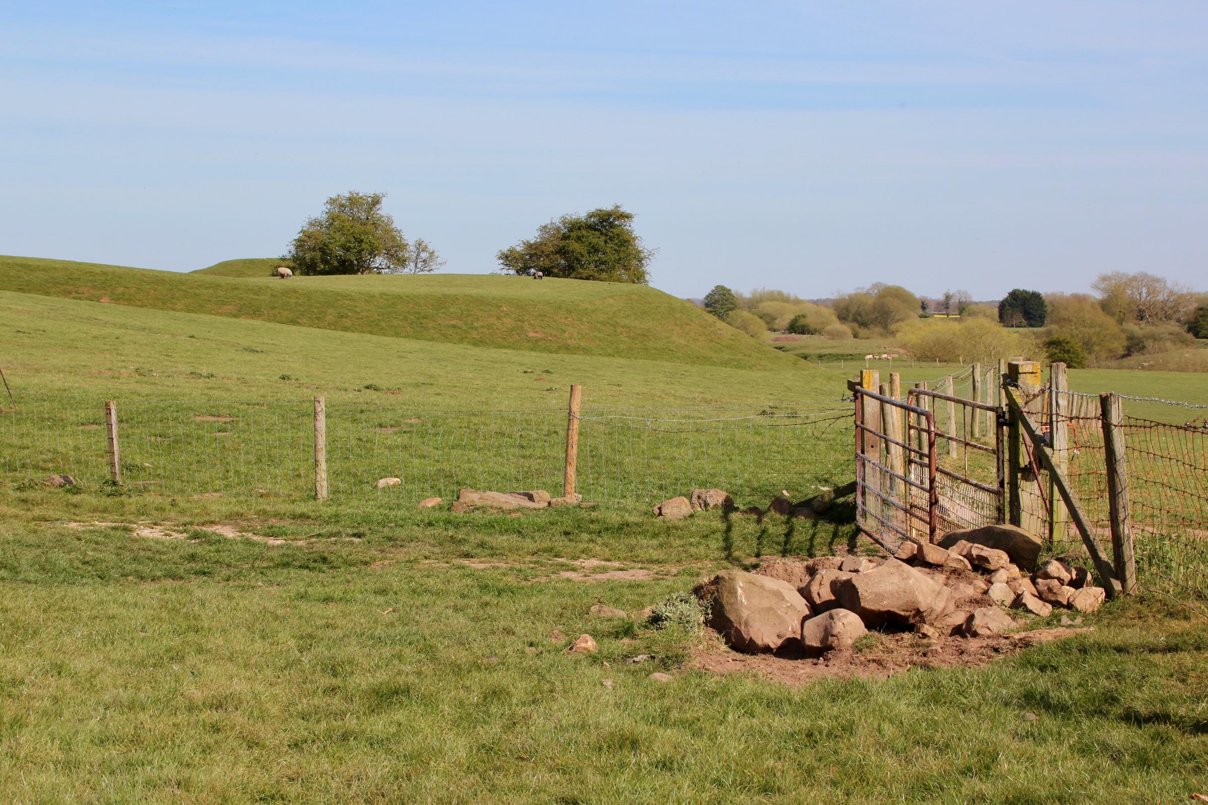
The ramparts of Maiden Bower. Picture: Bob Adams
The ramparts of Maiden Bower. Picture: Bob Adams
In 1489 a mob stormed the castle and murdered Henry Percy, the third Earl, in a protest over tax rises. In later years the Topcliffe family occupied a moated manor house just north of the castle mound, called Cock Lodge. There is a public footpath to the north of the site, but the ramparts are on private land.
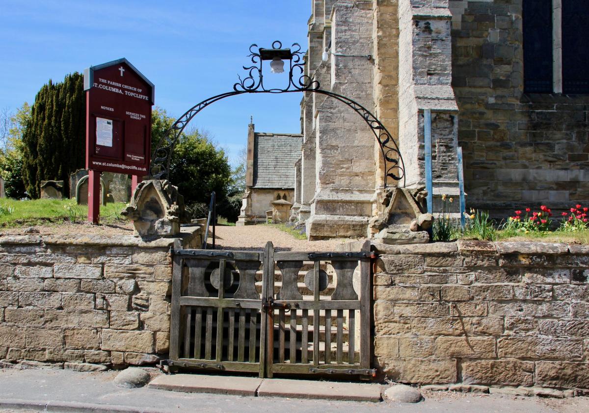
Topcliffe itself has two pubs, a few shops and a substantial church. It also has an attractive stone bridge over the river, next to a campsite. This bridge was first built in 1622, although it has been widened since (in 1786 and 1954).
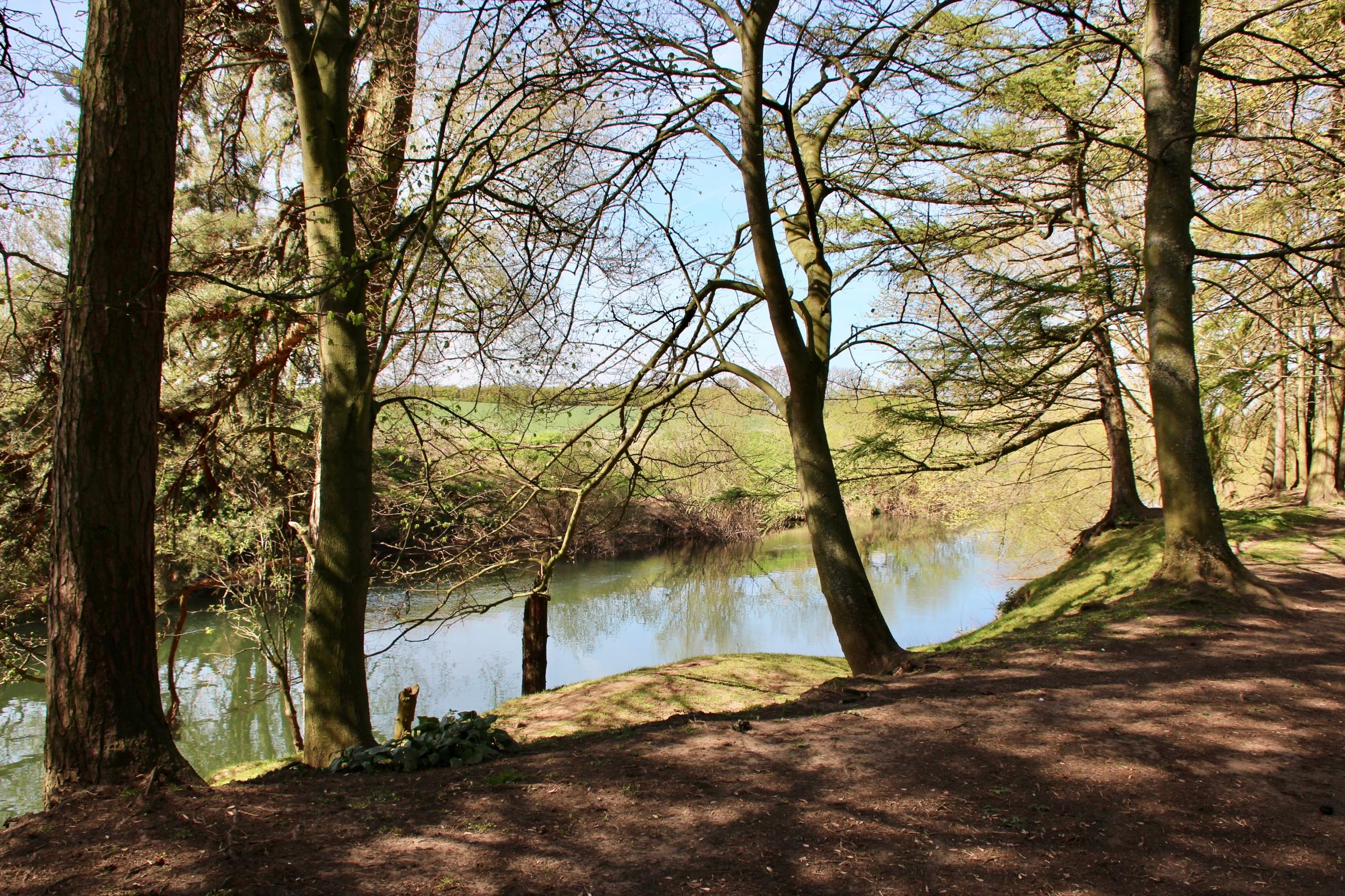
Day 3: Topcliffe to Skipton-on-Swale
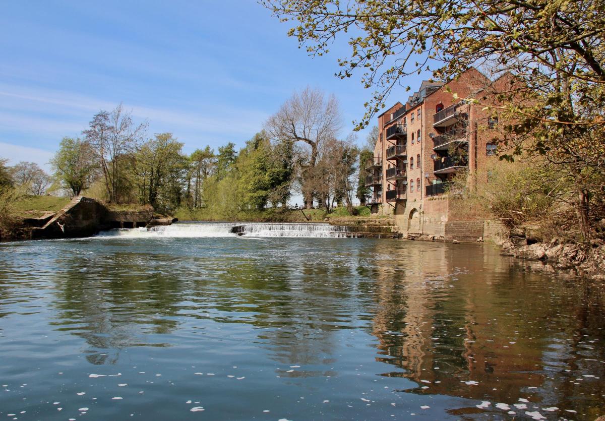
The next stage of my walk took me through the village then down the bank to follow a minor road to Catton. Soon after leaving the village I passed a huge building by a weir. This was once was a flour mill, now converted into apartments. Next up was a partial view of what is now known as Baldersby Park, once Newby Park and home for a brief period to George Hudson, the Railway King.
Topcliffe from the River Swale. Picture: Bob Adams
Topcliffe from the River Swale. Picture: Bob Adams
The Palladian-style house is now a girl’s boarding school. Screams and shouts from the playing fields drifted over the river in the still air, mingling with birdsong. After that the road took me slightly away from the river before turning back to the west when I had glimpses of the spire of Baldersby St. James church. Soon after I arrived at the hamlet of Catton, passing a tiny nineteenth century chapel called the Wayside Pupil. Then at last there was a riverside path and I sat down by the river for lunch. A perfect spot.
A 'perfect spot for a picnic' at Catton. Picture: Bob Adams
A 'perfect spot for a picnic' at Catton. Picture: Bob Adams
Suitably refreshed I moved on. Just ahead I could see what appeared to be a temple by the riverbank. Only as I got closer did it become clear that this was actually the abutment of a disused railway bridge, standing alone without its bridge or embankment. If it had not been for George Hudson’s plan to run all railways via York, the preferred option would have been to run the East Coast Main Line via Leeds, bypassing York altogether.
This railway bridge was on one of the opposition routes, a line that ran from Leeds to Stockton, via Starbeck, Ripon and Thirsk. It opened as far as Thirsk in 1848, closing to passengers in 1959. The majority of George Hudson’s lines survived the Beeching axe, although HS2 now threatens to take York off the railway map.
It wasn’t long before I reached my destination at Skipton-on-Swale, another crossing point over the river. The bridge here was designed by the famous York architect John Carr in 1781. It has unusual ‘cutwaters’ topped by semi-circular ‘pedestrian retreats’. In other words a place where you can avoid the heavy traffic that still thunders over on the A61. My bike was still there, hidden nearby in the churchyard of the petite but perfectly formed St. John’s Church. It was time to cycle back.


Comments: Our rules
We want our comments to be a lively and valuable part of our community - a place where readers can debate and engage with the most important local issues. The ability to comment on our stories is a privilege, not a right, however, and that privilege may be withdrawn if it is abused or misused.
Please report any comments that break our rules.
Read the rules here