


Just before lockdown was imposed again, BOB ADAMS set off on his latest Yorkshire river walk - this time along the Swale. He’s not sure when he’ll finish. But here’s the first leg...
As the end of 2020 approached, I decided it was time to start my next river walk. After much deliberation I decided to tackle the River Swale. This river starts high up in the Yorkshire Dales, beyond Keld, at the western end of Swaledale, in my view the most picturesque of the Dales.
The Swale is said to be the fastest flowing river in England and apparently can rise three metres in twenty minutes during times of flood. It flows in an easterly direction along Swaledale to Richmond, then turns southeast and passes through the Vale of Mowbray (the flat land between the Yorkshire Dales and the North York Moors) to join the River Ure at Myton.
Swale or Suala is Anglo Saxon for ‘swirling, rushing or tumultuous’. The river is around 72 miles long.
The problem walking this river is going to be how to get from its confluence with the Ure to Richmond, with few footpaths and without being able to use public transport. I am sure I will find a way. My plan - Covid and lockdown permitting - is to get to Swaledale proper by the spring, the best time to enjoy the wild flower meadows.
Day One: Myton to Helperby, circular route, about 10 miles
I was fortunate to do this walk on a fine and clear day just before the government imposed ‘Lockdown Three’. We are now not allowed to travel beyond our local area to exercise, so further walks will have to be postponed until better times.
I parked next to St. Mary’s Church in the village of Myton-on-Swale, about fifteen miles northwest of York. Myton, like Helperby, is an estate village dominated by its manor house. In recent centuries this was the manor of the Stapylton family who built Myton Hall in the late seventeenth century. The initials HMS are everywhere around thevillage. These stand for Henry Miles Stapylton who has a memorial inside the church. The Morrison family, of the supermarket chain, now own Myton Hall.
Keeping to the grass verges to avoid patches of black ice I headed north through beautiful parkland. It was especially beautiful in the low sun and frost. I passed Myton Hall to my left. The hall is Grade 1 Listed. Everything looked immaculate and well managed. To my right was a ha-ha and signs advising me not to enter the parkland. Not long after I passed another immaculate set of buildings including water tower. This was Myton Stud Farm, built as model farm by HMS in the 1850s.
Just over two miles further I arrived at the picturesque village of Helperby, and passed another manor house. On walking through Helperby, now joined to its northern neighbour, Brafferton, you cannot avoid the Coates family. They built the ‘Old Hall’, almshouse, reading room and village well, amongst other things.
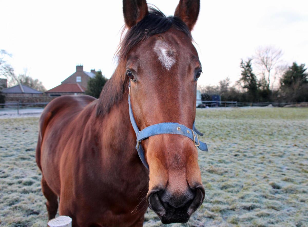
Helperby was less deserted than Myton, being on a through route and possessing a pub and shops. After admiring the splendour of some of its buildings I took a small detour along a footpath just to the left of the school, to see if there was anything left of Brafferton Railway Station. On the way, I passed a very frisky horse and a field full of rams.
At the old railway bridge I got talking to a couple walking their dog. They told me that a famous vet, Peter Wright from the Channel Five series, The Yorkshire Vet, had just treated one of the horses. As far as I can work out Peter Wright took over his veterinary practice from Alf Wight, otherwise known as James Herriot. No wonder the horse was frisky!
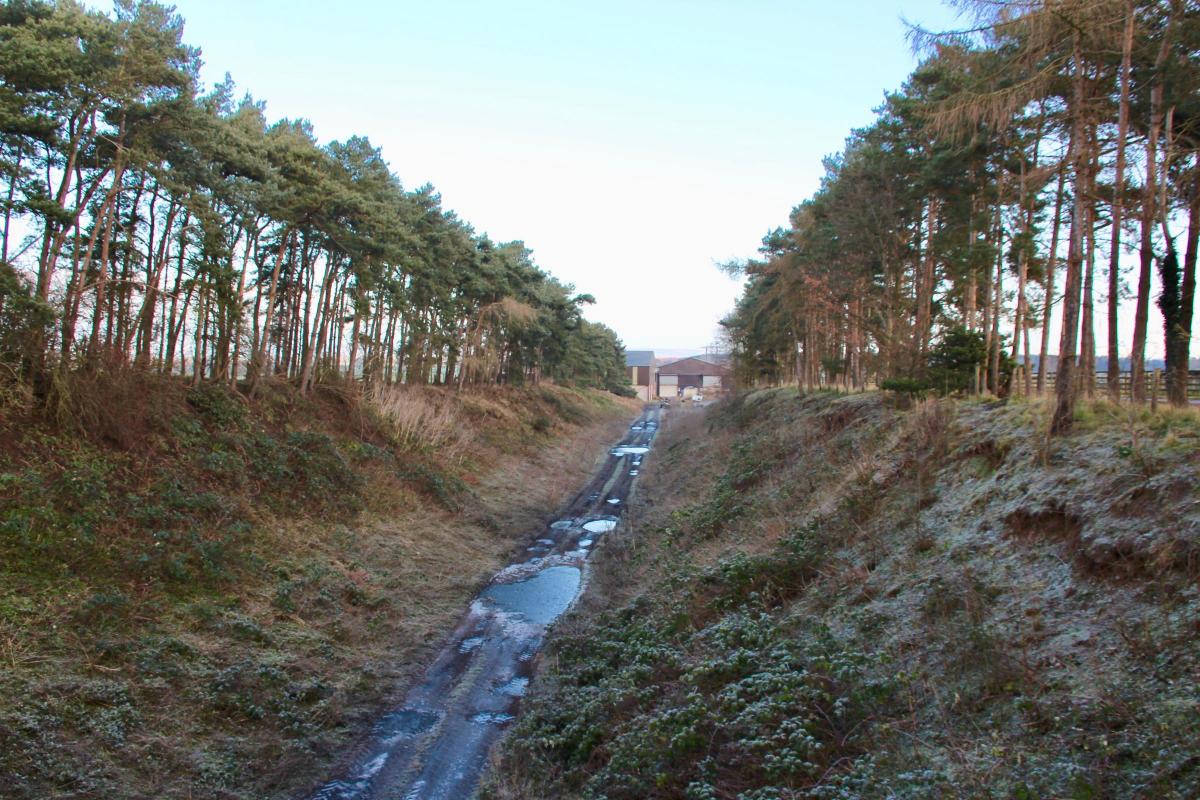
We also had a discussion about the sad failure of Dr Beeching to consider the future use of disused railways when he closed them in the 1960s. Helperby and Brafferton used to be served by the Knaresborough to Pilmoor Railway. Pilmoor junction, just up the old line from Brafferton, was quite an important junction in pre-Beeching days. It linked to the railway to Scarborough as well as the East Coast Main Line. The course of the disused line down to the Swale is now blocked off and there is no circular route for dog walking. The site of Brafferton Station is now occupied by a collection of industrial buildings.
I returned to the village along a busy road with no path, then headed down to the river via St. Peter’s Church.
From the church you can see why this village was built where it is, above the flood plain of the river. There was a pleasant view westward over the valley.
Just after the church I found an information panel about a Canadian Air Force Halifax bomber that was shot down in March 1945 by a German night fighter waiting to catch returnees to RAF Dishforth. The aircraft rolled onto its back and exploded as it hit the ground killing all seven crew.
The German fighter then flew on to Coxwold and fired at a train killing a passenger before returning to Denmark across the North Sea, emptying its machine guns over the streets of Scarborough on the way.
My day was less eventful. I crossed an iron footbridge over the Swale and turned north to check out the disused railway bridge. Well worth it as it was a three-arched beauty. And you could cross it for great views up and down the river. Please note the metal balustrade has been removed
I then headed southwest to continue my circular route back to Myton.
After passing Burton Grange I joined a busy road for about a mile before heading southeast along Ellenthorpe Lane. I passed the interestingly named Clott House Farm – perhaps a place to make cream. There were byres full of cows. Then there was then a slight descent down Coney Hill to arrive at the site of the Battle of Myton.
The Battle of Myton, otherwise known as the White Battle, took place on September 13, 1319, and was a major victory for the Scots. While King Edward II of England laid siege to Berwick-upon–Tweed, the wily Scots headed south from Carlisle to harry undefended Yorkshire.
The Archbishop of York, William de Melton, mustered an army of around 20,000 men and headed off up the Ure to meet them. The trouble was that Melton’s army consisted of townsfolk and up to 300 clerics and priests (hence the ‘White’ Battle) but few professional soldiers.
After crossing the Swale the English army were cut off when the Scots blocked the bridge. The result was a massacre. Various accounts give between 1,000 and 5,000 English dead. Many drowned trying to escape across the river.
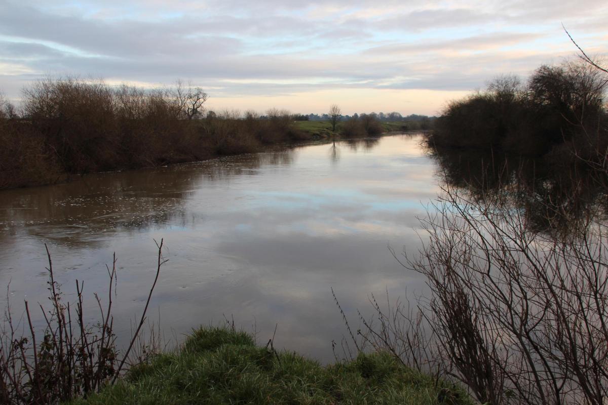
I skirted the west side of the battlefield and turned right on the flood barrier to walk the short distance to the confluence of the river. There I sat and watched swirls and eddies of brown water battling it out as the two great rivers merged. At one point it looked as if the gushing waters of the Swale had supremacy, until the sheer volume of more sluggish water from the Ure pushed back. It was a great place to rest, have something to eat and contemplate how many interesting things you can discover while walking just a short section of a river.
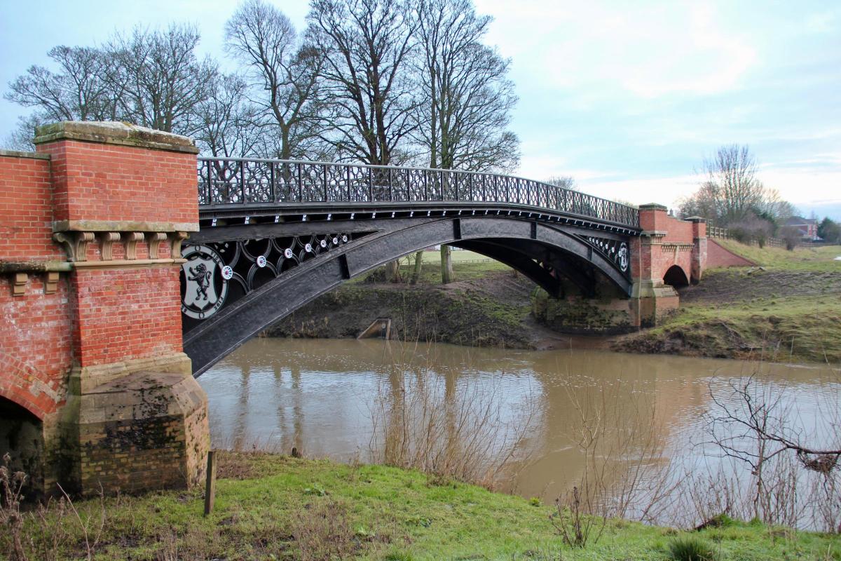
Suitably refreshed I headed back to Myton over the ‘new’ iron bridge. After the battle the original bridge was destroyed and for 500 years the villagers had to make do with a ferry to get to their pastures. Then in 1868 an iron bridge was commissioned by, yes you’ve guessed it, HMS. It cost £1,250, a fortune at the time.
Structural repairs had to be made in 2002 and the bridge is now as good as new. It looks magnificent. However the villagers still have to drive the long way round if they want to head west by car.
For my next walk I will be starting at Brafferton and plan to walk to Topcliffe. I hope I won’t have to wait too long before this is possible...


Comments: Our rules
We want our comments to be a lively and valuable part of our community - a place where readers can debate and engage with the most important local issues. The ability to comment on our stories is a privilege, not a right, however, and that privilege may be withdrawn if it is abused or misused.
Please report any comments that break our rules.
Read the rules hereLast Updated:
Report this comment Cancel