

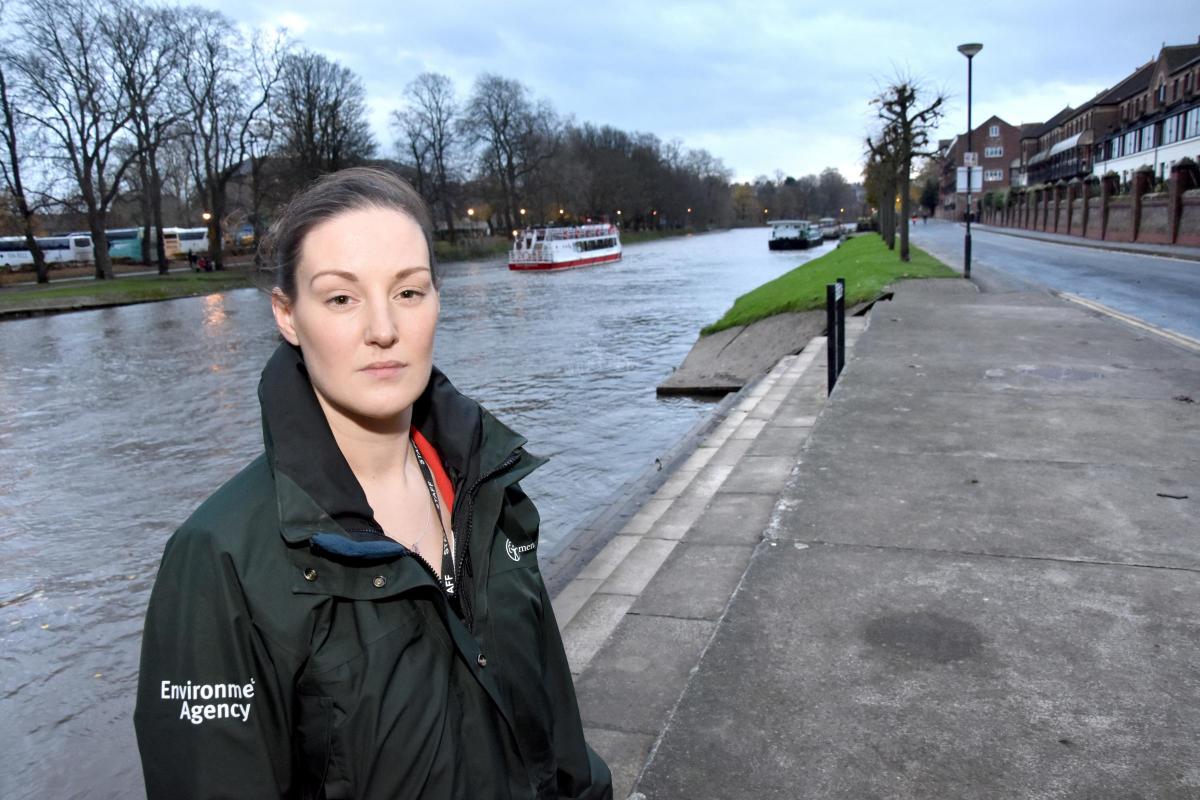
FIVE years on from the devastating Boxing Day floods of 2015, an Environment Agency boss has told what has been done to try to prevent it happening again - and what still needs to be done.
Ben Hughes, team leader with the agency’s York Flood Alleviation Scheme, said £83 million was being invested to better protect more than 2,000 homes and businesses across the city, with work starting on several schemes next year.
He said a flood alleviation scheme of this size and complexity would normally take many years to complete. “We have made considerable progress within the past five years,” he said.
He also warned that with the effects of climate change and more extreme weather conditions expected in the 21st century, it wasn’t possible to build defences big enough to protect every home or business.
“Even with new flood defences in place, people cannot ever be fully protected from flooding,” he said.” This is why it is essential that people know their flood risk and sign up for flood warnings in their area.”
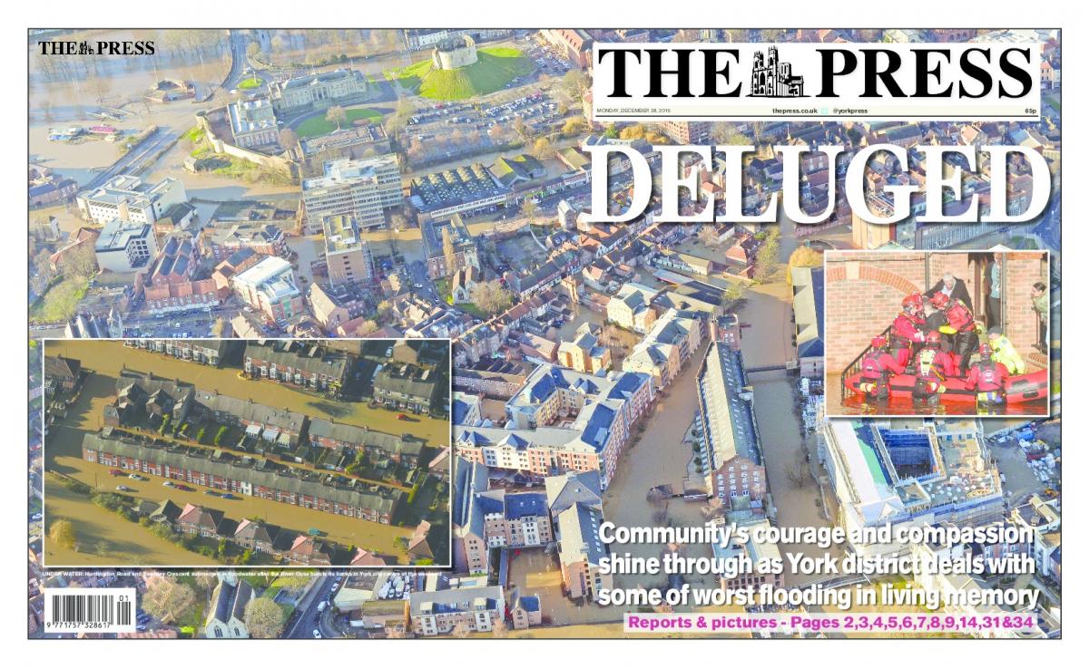
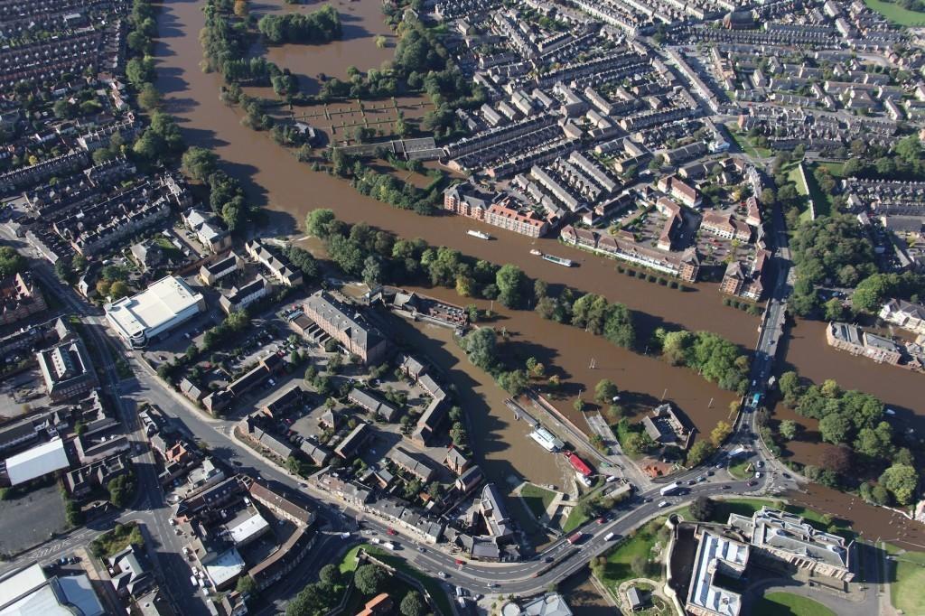
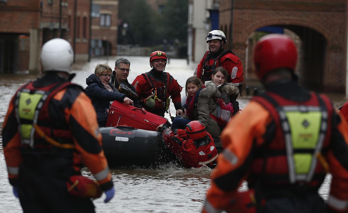
He said that in 2015, more than 620 homes and businesses were flooded, banking facilities were suspended, York telephone exchange was flooded causing some phone-lines to be cut off and numerous roads were blocked.
The agency secured £45.2 million of government funding to better protect 2,000 local homes and businesses in York, and an additional £38 million was also allocated to upgrade the Foss Barrier and surrounding infrastructure, where eight new pumps had been installed, increasing capacity from 30 to 50 cubic metres per second, the electricity supply had been upgraded and all electrical equipment had been moved to the first floor.
“Our aim is to achieve a consistent standard of flood protection across the city against floods by raising or installing new defences,” he said.
“Where this is not feasible we have looked into the options, such as Property Flood Resilience.
“The Environment Agency continues to put a huge amount of focus on learning lessons and improving how we respond to flood incidents.
“We have a state-of the-art flood incident room which helps us to react more effectively in a crisis and we work closely with City of York Council and other key stakeholders to ensure we can respond quickly to any flooding incident.”
He outlined some of the work which had been conducted or was being planned across the York area:
Scarborough Bridge to Lendal Bridge
We are improving the existing flood defences here to reduce the risk of flooding to 42 homes and 15 businesses within the Marygate community of York.
What we’ve done so far:
• Obtained planning permission from City of York Council to improve the flood embankment in Museum Gardens
• Worked closely with York Museum Trust, City of York Council and Historic England to come up with a design that not only acts as a viable flood defence, but also fits in with this much used and well-loved public space
• Agreed a design that minimises the impact on the Hospitium and protects the true service tree, which is very rare and was a key concern for local people.
What we will do when work starts in August 2021,when the weather is more likely to be dry to minimise the impact.
We plan to:
• Increase the height of the existing flood wall along Earlsborough Terrace with glass panels
• Increase the height of the floodgate and flood wall on Marygate
• Increase the height of the embankment in Museum Gardens and extend it. We will terrace the area of the next to the Hospitium
• Install property flood resilience measures to the properties at Lendal Hill.
Lower Bootham
We are improving the existing flood defences here to reduce the risk of flooding to 134 properties in the Lower Bootham area.
The area already has embankment defences in the grounds of St Olave’s and St Peter’s schools and a flood wall in the gardens of Almery Terrace but these are at risk of over-topping in the future and so the plan is to raise their standard of protection.
The flood alleviation work is being carried out in three phases and includes:
• Raising the existing embankment along St Peter’s and St Olave’s School playing fields
• Extending the length of the existing embankment through St Peter’s playing field
• Raising the height of the existing flood wall at the back of Almery Terrace using glass panels to reduce the visual impact of the wall and maintain views and natural light for the properties
What we’ve done so far:
• Completed extensive ground investigation work to help design of our flood scheme
• Completed the majority of the work to increase the height of the flood embankment in St Peter’s School fields, and constructed a new transition wall between the embankment and the development at the end of Almery Terrace
• Started installing new flood gates and glass panels to increase the height of the flood defences along Almery Terrace. The glass panels will reduce the visual impact of this wall and maintain views of the river and natural light for the properties
What we will do:
• Install a flood gate on top of the Almery steps and link this to the Network Rail embankment to complete the line of flood defence. We will start work on this in spring next year.
• Provide funding grants for Property Flood Resilience for eligible homes at risk of flooding in Government House Road.
Bishopthorpe
We are building a new flood scheme here which will reduce the risk of flooding to 114 properties in Bishopthorpe.
What we’ve done so far:
• Completed extensive ground investigation work to inform the design of our flood scheme
• Obtained planning permission from City of York Council to construct our proposed flood scheme
• Started the preparatory work which needs to be completed before we can start construction, including carrying out surveys to assess the condition of buildings and removal of vegetation.
What we will do:
Construct a 180 metre-long flood wall along Chantry Lane with a six metre deep steel barrier underground; a flood gate across the bottom of Chantry Lane; and a new manhole chamber with a penstock mechanism. Construction will start early next year and take around nine months.
Clementhorpe
We are building a flood scheme here to better protect 135 properties from flooding.
It will involve installing a floodgate at the junction of Clementhorpe and Terry Avenue, as well as flood defence walls on Waterfront House and Lower Ebor Street. To ensure that the floodgate is effective a four metre deep concrete barrier needs to be installed under Terry Avenue to stop water seepage.
The planning application was originally submitted last February but has been delayed due to concerns over the construction traffic and diversion route for cyclists and pedestrians.
In response, the Environment Agency, working with City of York Council Highways department, has updated the traffic management plan and carried out a road safety audit.
What we’ve done so far:
• Completed extensive ground investigation work to contribute to the design of our flood scheme
• Obtained planning permission from City of York Council to build a continuous line of flood defence from Skeldergate Bridge to Rowntree Park
• Completed preparatory work ready to start on site early 2021, including surveys to assess the condition of buildings and removing the lower branches of trees.
What we will do:
• In early 2021, we will start building the flood defence which will include road raising, new flood walls, flood gates, a small embankment, and the increase in height of existing walls.
We will also install an underground barrier along Terry Avenue from Postern Close to Dukes Wharf to prevent flood water from seeping under the defences. This will take approximately 18 months.
Tang Hall and Osbaldwick
We are proposing a flood alleviation scheme at Tang Hall Beck & Osbaldwick Beck which will reduce the risk of flooding to 263 properties in the Tang Hall and Osbaldwick area.
We are working closely with York Urban Becks and St Nick’s Nature Reserve to maximize the environmental benefits of the scheme and the aim is to increase the flood flow capacity through St Nick’s Nature Reserve.
A planning application will be submitted to City of York Council next year.
River Foss Storage Area
We are constructing a flood storage area north-east of Strensall to reduce the risk of flooding to around 490 properties downstream between Strensall and The Groves area of York.
It will also reduce flood risk to key transport routes and result in benefits to the environment including tree planting, creation of valuable wetland habitat, create space for local wildlife improvements to river bank habitat and help improve water quality downstream.
The purpose of the storage area is to help reduce peak flows in the river, therefore reducing flooding downstream. During heavy rain, the structure fills with water, temporarily holding back flood water and reducing the flood risk to properties along the Foss Corridor, towards York city centre. Once the flood has passed the water in the storage area will subside. For the vast majority of time the structure will not need to be used in this way which means that farming practices will be able to continue in the area.
What we’ve done so far:
• Obtained planning permission from City of York Council last month to progress with the scheme
• Completed extensive ground investigations to inform the design of our scheme
• Hosted four public drop-in events to keep communities living along the River Foss informed of how the scheme is progressing.
What we will do:
• Fulfil planning conditions before starting work on site next summer
• Offer personal flood resilience protection to eligible properties in Huntington Road which do not benefit sufficiently from either the Storage Area or the Foss Barrier


Comments: Our rules
We want our comments to be a lively and valuable part of our community - a place where readers can debate and engage with the most important local issues. The ability to comment on our stories is a privilege, not a right, however, and that privilege may be withdrawn if it is abused or misused.
Please report any comments that break our rules.
Read the rules hereLast Updated:
Report this comment Cancel