


Walk to the Source of the River Derwent: The Final Day
Distance walked: 13.3 Miles
Date of walk: Saturday, October 9, 2020
IT has taken six days walking and two days cycling to get to this point, the final day of my exploration of Yorkshire’s River Derwent.
The source of this river is high up on Fylingdales Moor in a remote setting. I worked out that the best way to tackle it was to take two cars and walk over from the Flask Inn, just southwest of Robin Hood’s Bay, to the Hole of Horcum, on the Pickering-to-Whitby Road.
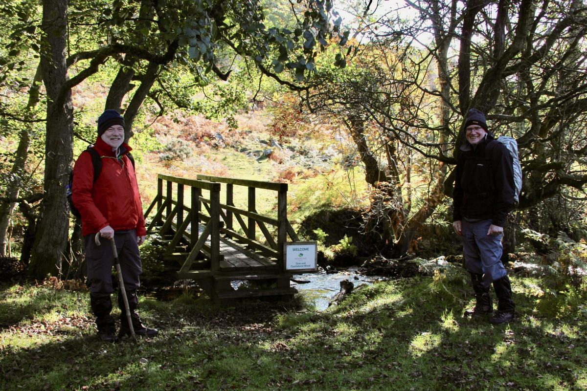
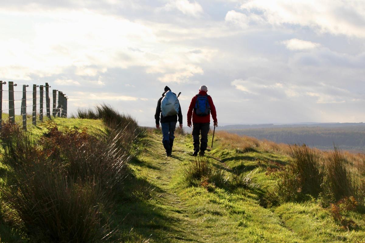
It was a changeable autumn day when I set off with my two companions, Nigel and Linden, walking down the busy A171 to the start of the footpath at Juggerhouse Beck.
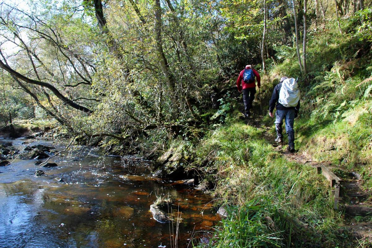
We headed down the beck through woods managed by the Woodland Trust (Scar and Castlebeck Woods). The path took us through a magnificent gorge with sunlight dappling through the leaves and mirroring the water. A mile or so further on there was a brief ascent up Park Hill to Lownorth Moor. Prior to the walk Nigel had repaired his leaky boots with superglue. We speculated whether they would hold out, as showers were forecast.
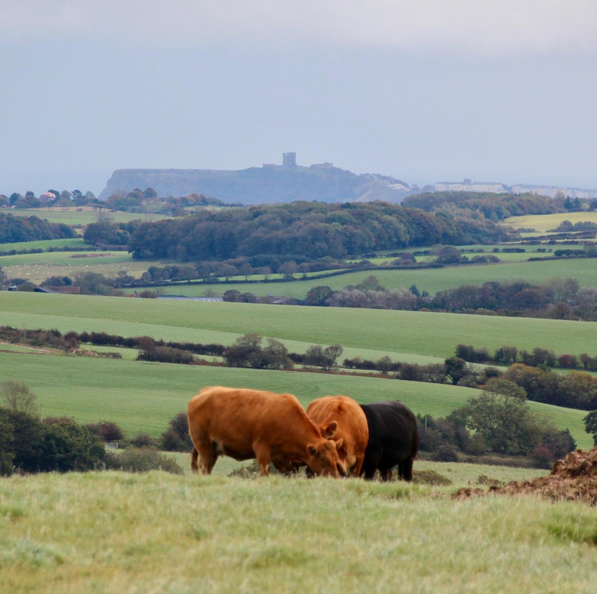
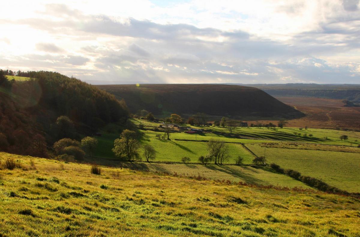
Stopping at the top we looked back to the southeast to admire the view. In the distance you could just make out the keep of Scarborough Castle with Filey Brigg beyond. An escarpment topped by Broxa forest framed the view to the south with blue sea to the east. The River Derwent flows along the base of this escarpment before cutting through its gorge to Langdale End. The whole area is literally peppered with prehistory. Ancient barrows stretch for miles along strategic crests, many now hidden by conifer forest. There is also plenty of medieval history on the moor with lines of packhorse trails waymarked by crosses. It is hard to imagine that over 4,000 years ago humans once occupied this now rather unknown and isolated part of the country. During the Bronze Age the moors supported many communities, until the soil became exhausted and the people moved on.
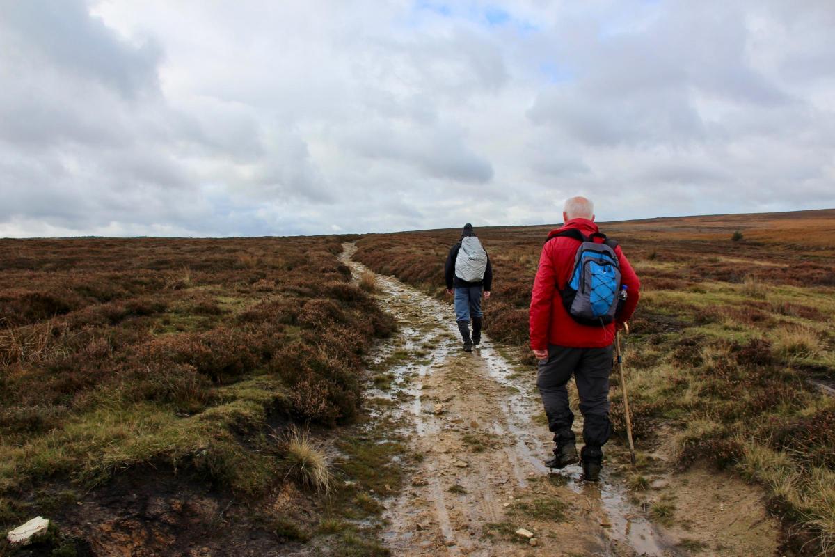
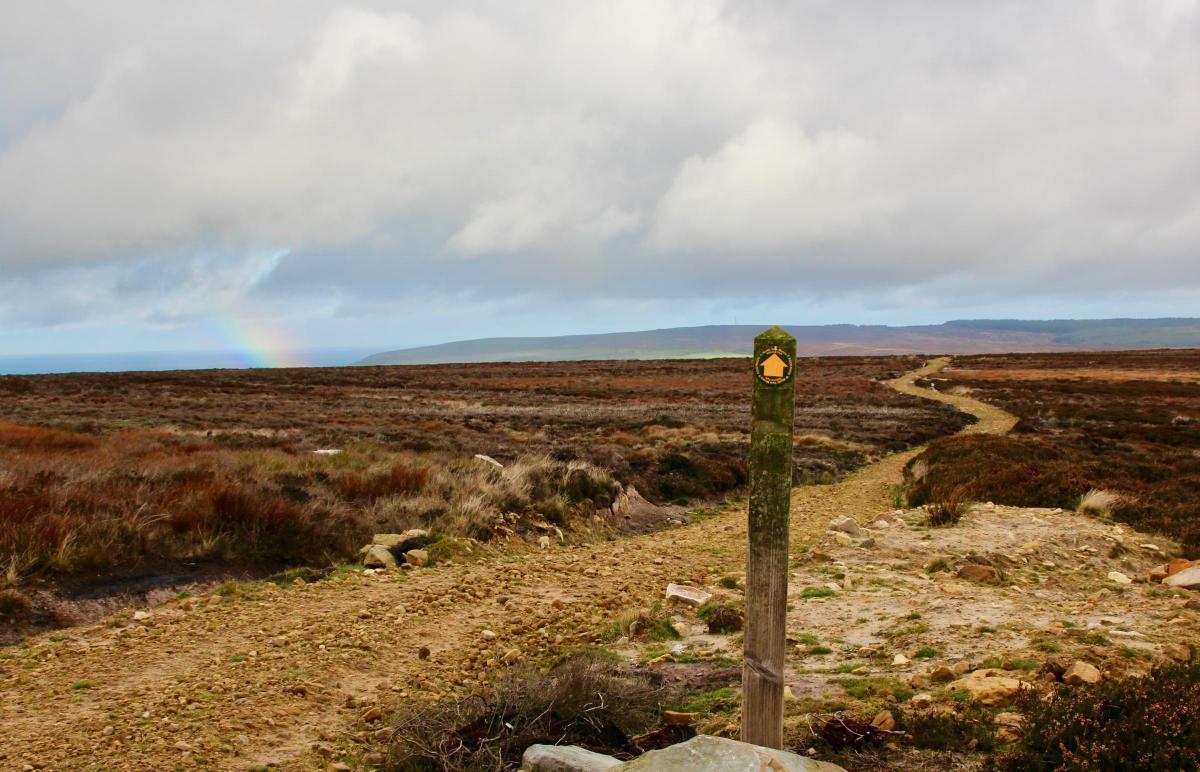
The next part of our walk turned out to be a long slog uphill for four miles to Lilla’s Cross. We left the farmland behind to follow a narrow straight track between the heather that seemed to go on forever. Sticky white clay underfoot made the going hard. At one point it was easier to leave the path and walk over patches of burnt heather smelling of carbon. All the way we were chilled by a persistent north wind and were, for good measure, soaked every now and again by a shower. On one memorable occasion, looking back, we saw a rainbow over the sea. Then we knuckled down to cover the distance, ascending gradually upwards to 300 metres.
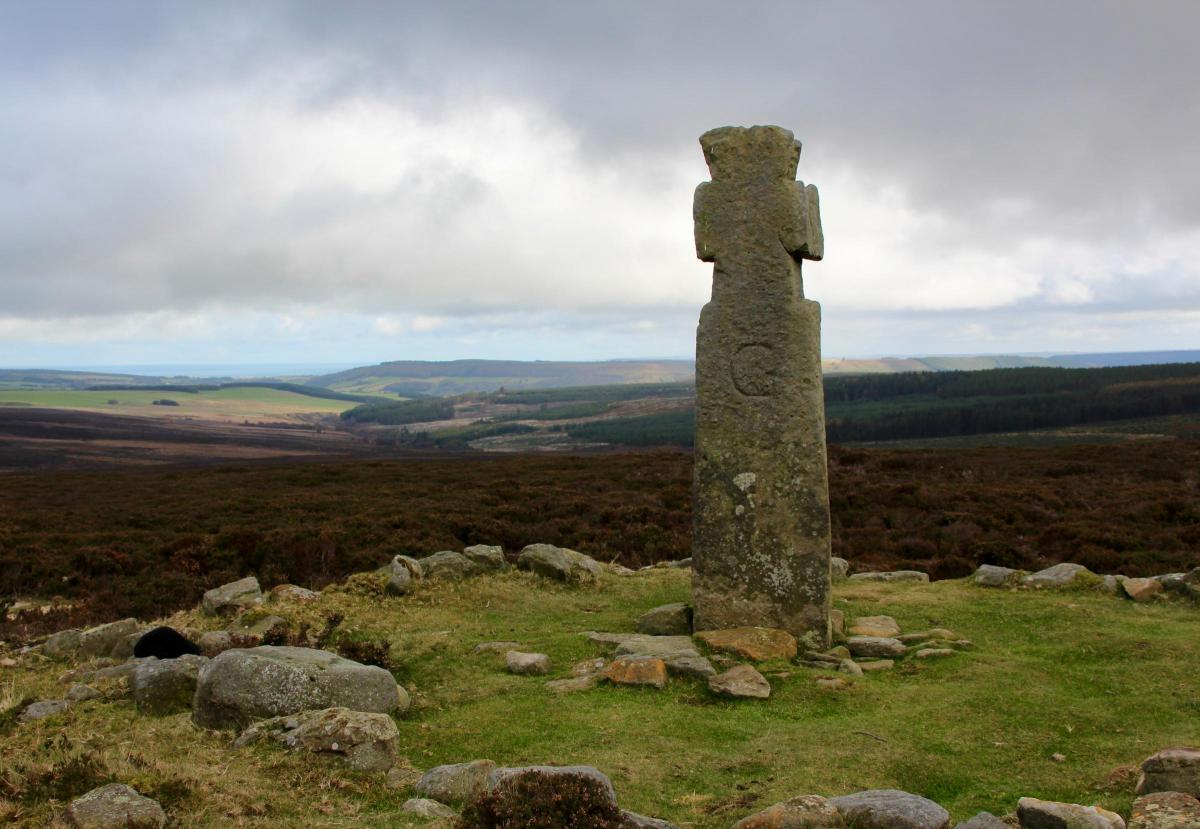
After many false summits we eventually got our first sight of Lilla’s Cross standing enticingly on the next rise. This ancient monument has a mysterious history. The cross is named after Lilla, who saved King Edwin’s life by getting between him and an assassin brandishing a poisoned sword. This all happened in the year 625. King Edwin then converted to Christianity with the support of his wife Queen Ethelburga. But Historic England suggests that the style of the Lilla’s cross is from the tenth century. The cross itself is situated on top of a bronze age barrow which, in a dig, was found to contain Anglo-Saxon and Viking grave goods. In 1952 the cross was unceremoniously removed when the whole area was used for artillery and mortar practice. It is now back in its rightful place marking the crossing of two ancient tracks as well as the boundary of the original estate of Whitby Abbey.
We found the cross to be a spectacular end to our climb and spent some time admiring the vista of the four tracks descending from it like a major road junction, which indeed it used to be. Then it was time to descend to the source of the River Derwent, just a mile away to the south.
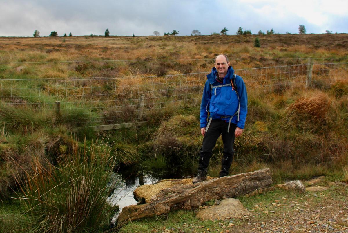
As always, river sources turn out to be notably unspectacular. Derwent Head was easy to miss. It was a tiny stream seeping out of a bog which then disappearing down a pipe under the track we were following. It was not even signposted. I told myself for the fifth time, it’s not the destination but the journey that is important.
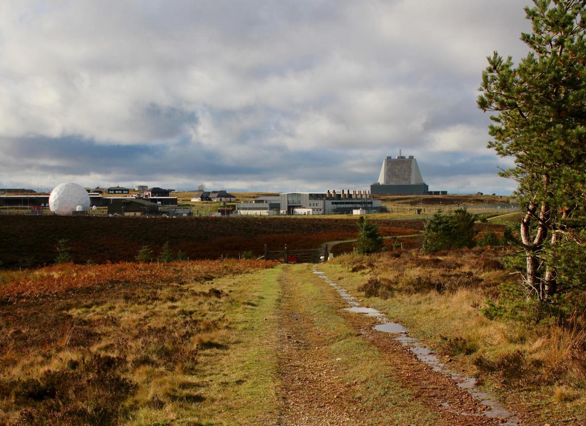
It was time to head back to our second car parked at the Hole of Horcum. Our path took us along the edge of Langdale Forest then sharply west to the boundary fence of the RAF early warning station at Fylingdales Moor. We were amazed we could get so close. There were signs, I should point out, stating that if we went any closer we would be subject to military law. We decided not to test this.
The place appeared deserted apart from the hum of machinery, although we guessed we would be on their radar. The station apparently houses some 350 personnel all hard at work tracking missiles. It became operational in 1962. The famous golf balls were removed in recent years, although one still remains, only visible from where we stood. I hope they didn’t mind when I got out my camera.
Then it was onwards due south to Malo Cross. As we approached the cross the looming bulk of Whinny Nab (296m) appeared to rise above us blocking out the sun. Far more recent than Lilla’s cross, Malo Cross was erected by Sir Richard Egerton in 1619 to mark the boundary of his estate. It is a rare example as in that century many crosses of this type were destroyed during the reformation.
The final part of our walk was impressive. The sun had come out and the wind had gone. To our north tiny vehicles crawled along the pencil straight A169 journeying to and fro from Whitby.
The highlands of the North York Moors stretched endlessly to the west. The Old Salt Road from Saltersgate Inn to Robin Hoods Bay used to start just below us, but had to be diverted when the early warning station was built. This ancient track way was also called the Fish Road and was a notorious smugglers route. Sadly the Saltersgate Inn was closed in 2007 and then demolished two years ago. This inn reputedly kept a peat fire going for 200 years. The bones of a customs officer were said to be concealed beneath. I wonder if the demolition workers took a look?
As the sun went down we rounded Saltersgate Brow and crossed the last muddy field to a track, known as Old Wife’s Way, which led to the car park. Going the opposite way this ancient path takes you down to more prehistoric sites and into the heart of Dalby Forest and the Bridestones. Another day perhaps?
I have now completed my fifth Yorkshire river walk over six years. I don’t think I’m going to stop. Incidentally, just in case you wanted to know, Nigel’s superglued boots did hold out.


Comments: Our rules
We want our comments to be a lively and valuable part of our community - a place where readers can debate and engage with the most important local issues. The ability to comment on our stories is a privilege, not a right, however, and that privilege may be withdrawn if it is abused or misused.
Please report any comments that break our rules.
Read the rules hereLast Updated:
Report this comment Cancel