

We've written about Layerthorpe on these pages before: the lost pubs (the John Bull and the Frog Hall); the vanished power station; the gasworks; the long-gone streets of residential terraces that were demolished between the 1950s and 1970s.
Today, we have three photographs from Explore York's wonderful Imagine York archive which show those vanished streets before they were demolished - and three more from our own archive which show the final phase of demolition in the early 1970s.
Those demolitions paved the way for the mainly commercial area that is Layerthorpe today - though if and when the gasworks site is developed for housing, the character of the area could soon change again.
But then, Layerthorpe has seen constant change throughout the last 100 years of history.
The village of Layerthorpe was first mentioned in a charter of 1184-9, where it was referred to as Leirthorp. But from 1089 onwards, much of the area around what is today Foss Islands Road became part of a marshy lake known as the King’s Fish Pool. This was created by damming the River Foss - and throughout the medieval period the area of marsh and open water created formed part of the eastern defences of York (it is why there is no city wall here).
By the early 14th century, according to the city council's 'character study' of the area, Layerthorpe bridge had been built to carry a road from York across the ponds and marshes to the small settlement of Layerthorpe and on to Heworth. The bridge was attached to a gatehouse, on the York side, known as Layerthorpe Postern.
By the 18th century the King’s Pool had begun to silt up and small islands began to appear, giving rise to the name Foss Islands. Soon afterwards, the River Foss was canalised and the King’s Pool dried up completely.
In the mid 19th century small-scale industries such as potteries and brick kilns had grown up, and by the end of the century what had been the largely agricultural area of
Layerthorpe became fully industrial. Several Victorian terraced streets such as Monks Terrace and Vicars Row had also appeared by the 1850s.
The York Gas Light Company was set up on the west side of the Foss in the 1820s. By the end of the 1800s Foss Islands Road had been created,
the gas works had been expanded, a power station and refuse destructor had been built and to the east the St. Lawrence’s Brick and Tile works and associated industries were in operation. The Foss Islands railway branch connected most of these industries to the rail network, and the Derwent Valley Light Railway opened in 1913, providing
an East/West route from Layerthorpe to Selby - although land immediately south of Heworth Green was still being used as allotments in the the early-mid 1900s.
From the mid-late 1900s the gas works site went through several periods of expansion and re-organisation until it closed in the 1970s. Most of the terraced streets, home to generations of York people, were demolished between the 1950s and 1970s, along with the pubs and shops which had served them.
Three of our photos today, from Explore's Imagine York archive, show some of these terraces in the 1930s - all of them with the outline of gas containers looming in the background.
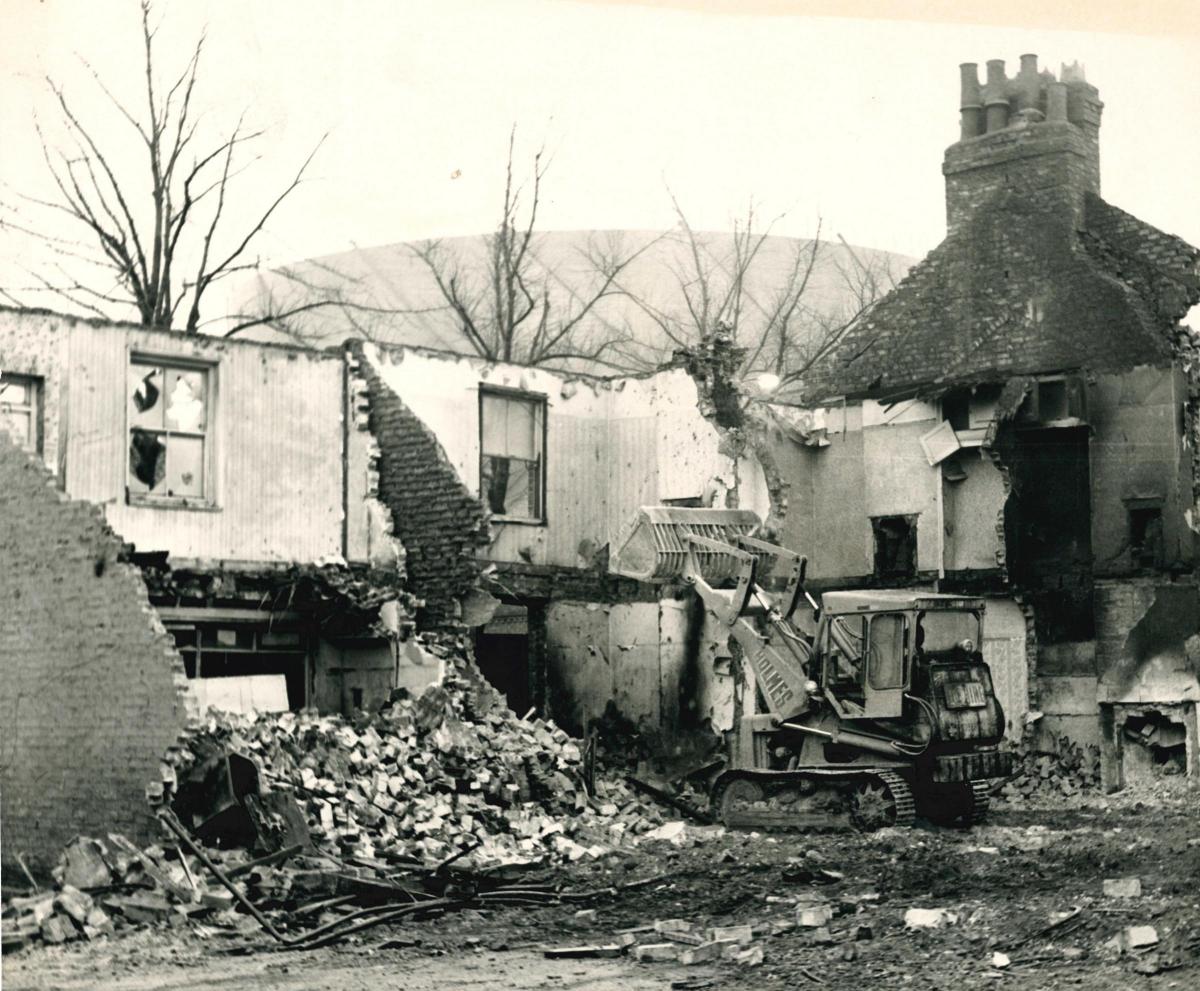
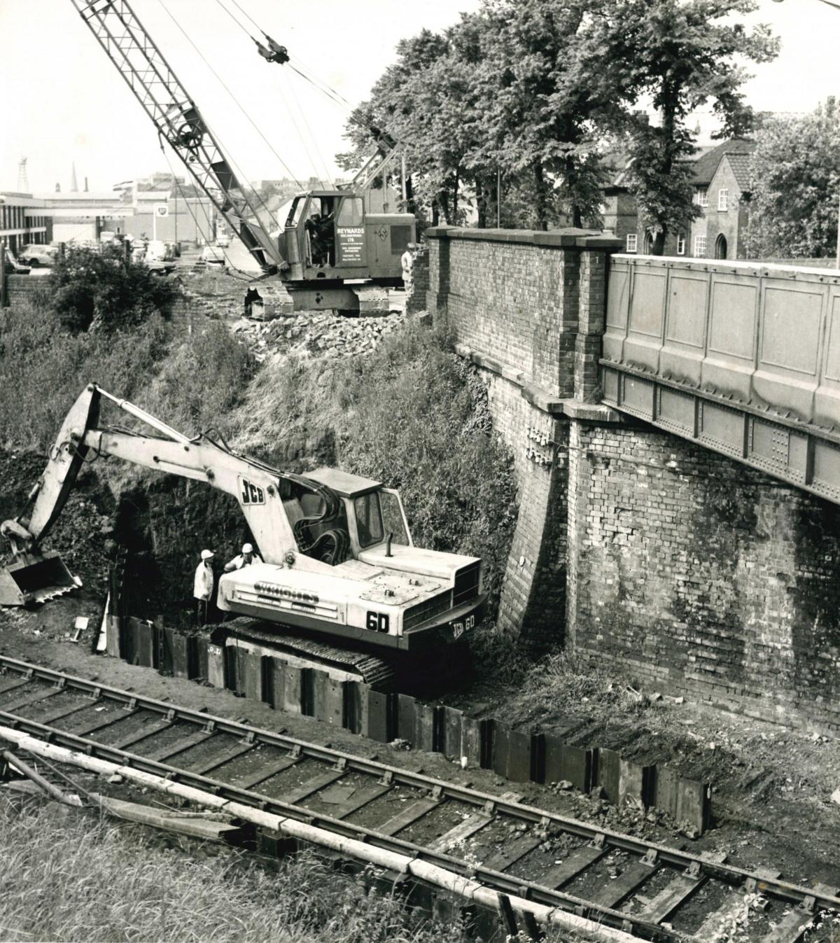
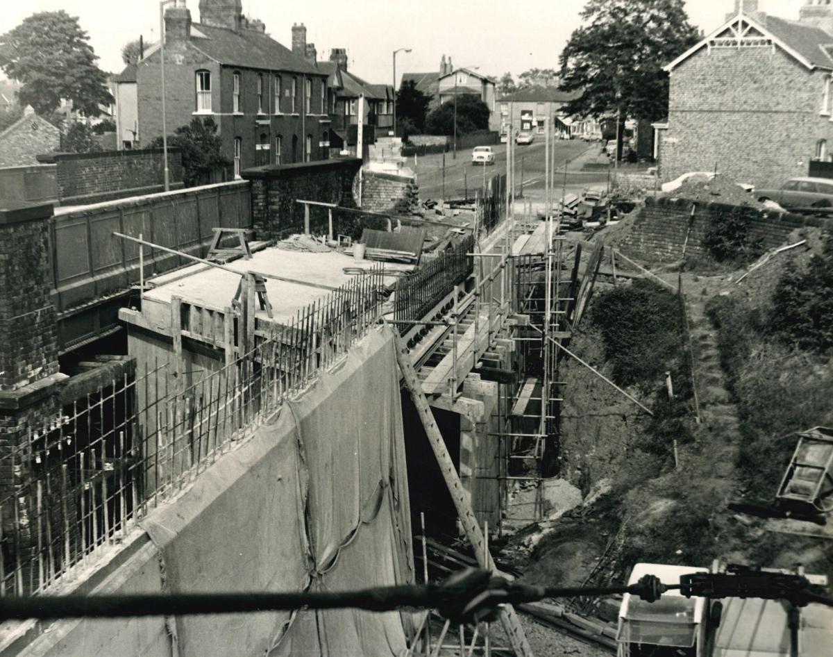
Three more, from a recently-discovered folder in our own archive, show demolition and reconstruction work in 1972, in what is described as the 'third and final stage' of improvements to Layerthorpe which included widening Layerthorpe bridge.
Our photos show:
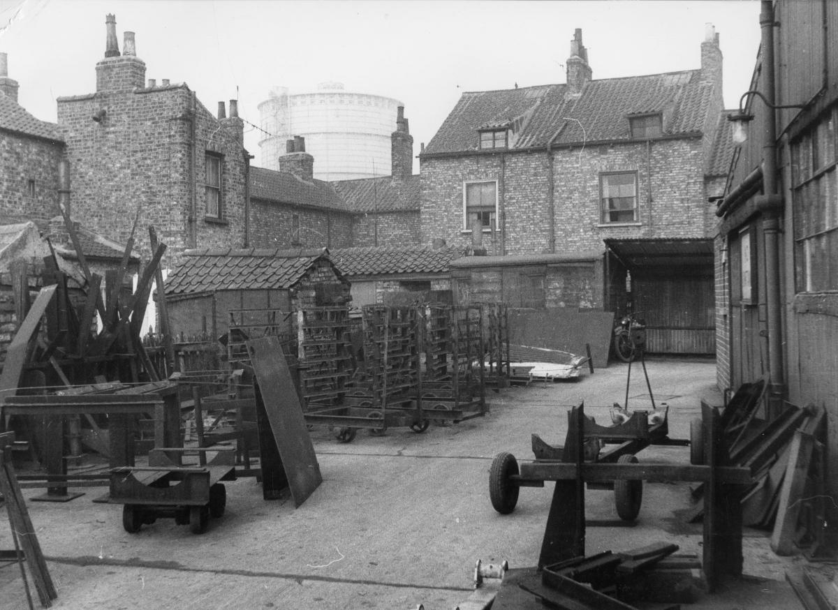
1. The yard at the back of 42 - 50 Layerthorpe and 1 - 3 Bilton Street, thought to be in the 1930s
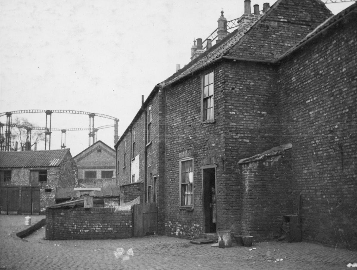
2. The back of Nos 10-15 Wilson's Yard in Layerthorpe in about 1933
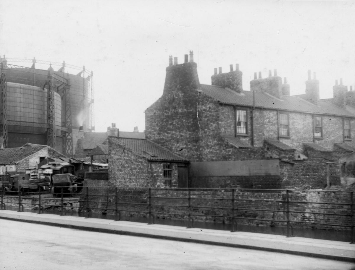
3. Layerthorpe seen from Foss Bank in about 1933. The left hand side of the photograph is dominated by a gas container and the right by terraced housing


Comments: Our rules
We want our comments to be a lively and valuable part of our community - a place where readers can debate and engage with the most important local issues. The ability to comment on our stories is a privilege, not a right, however, and that privilege may be withdrawn if it is abused or misused.
Please report any comments that break our rules.
Read the rules hereLast Updated:
Report this comment Cancel