

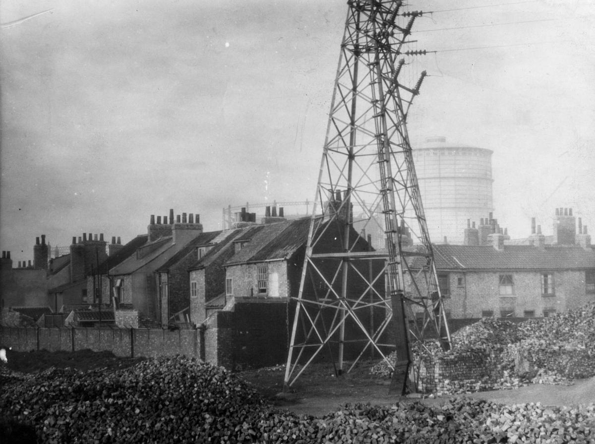
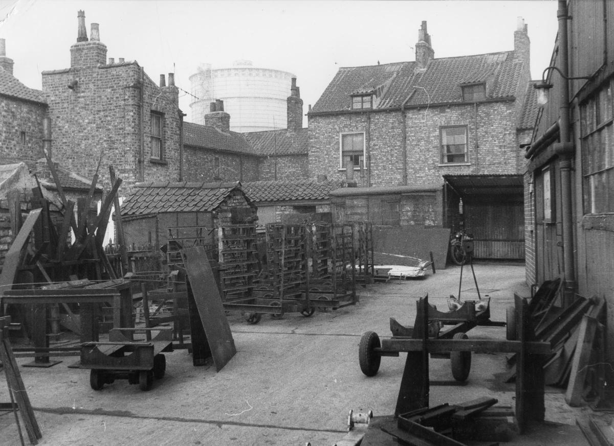
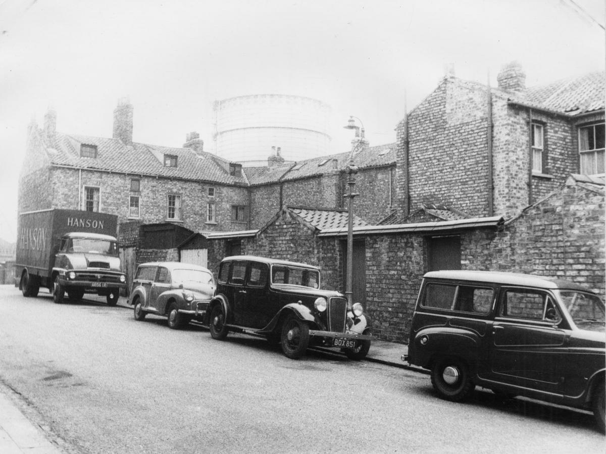

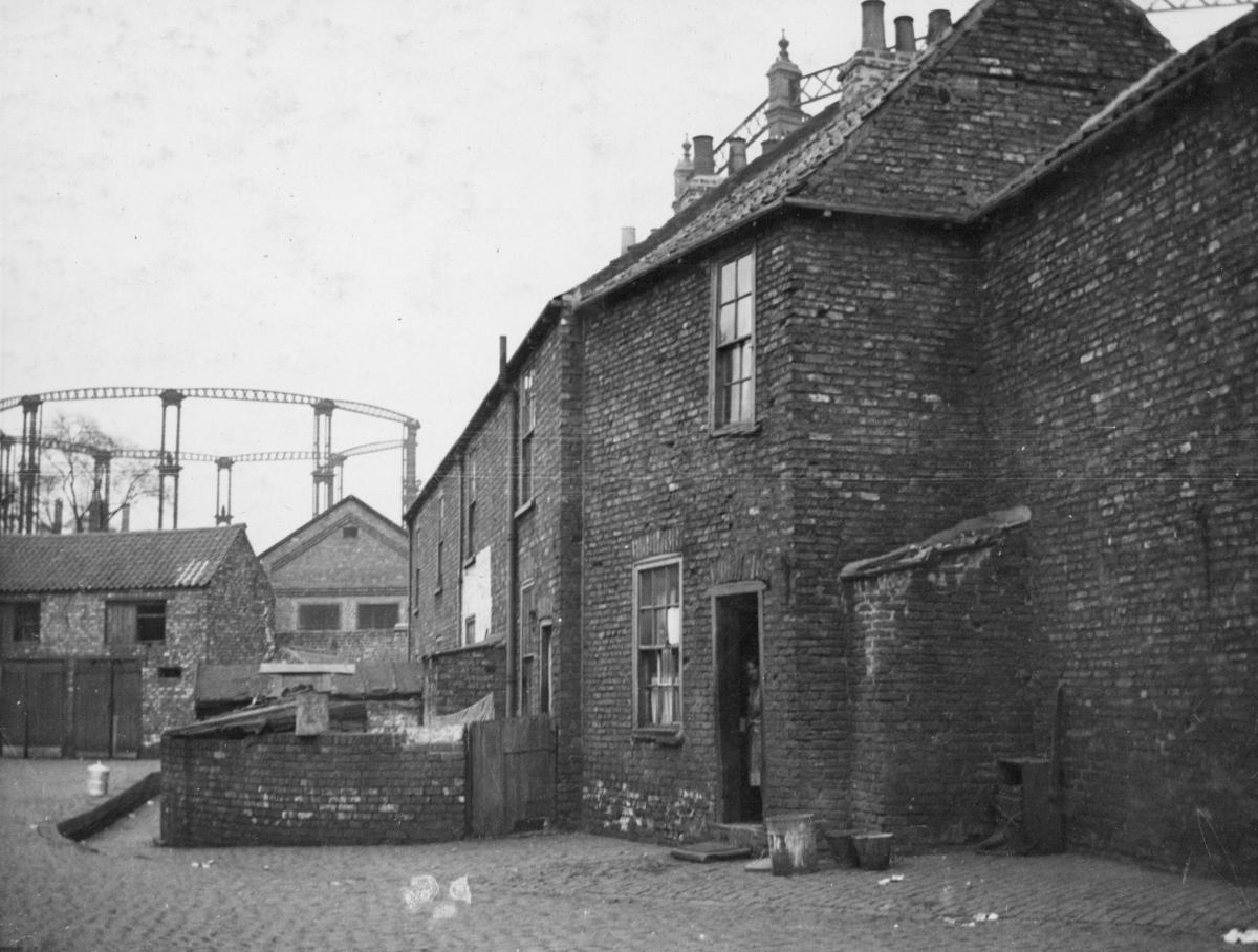
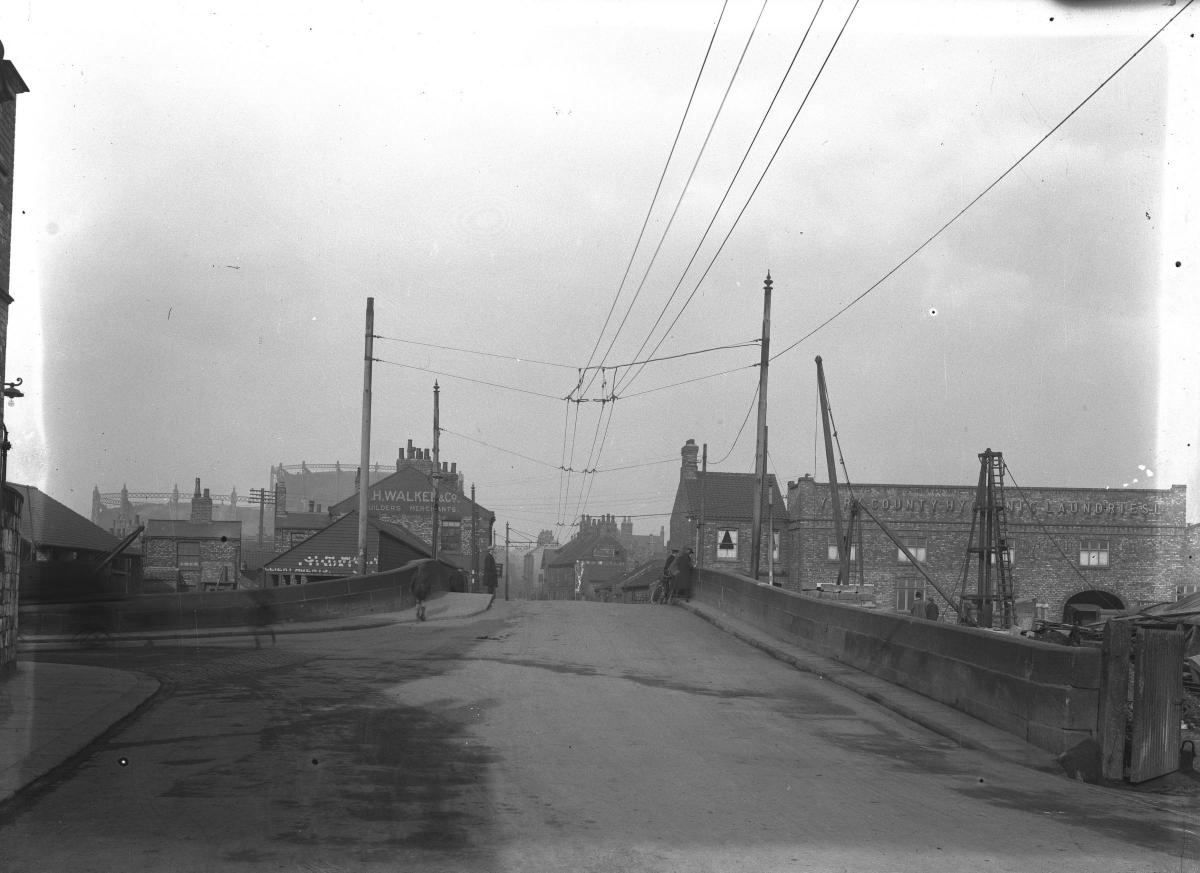
THERE is a wonderfully industrial feel about most of these photographs of Layerthorpe taken between the 1920s and 1960s. Somewhere in the background of all but one you can see at least one of the gasometers associated with the old gas works.
From 1089 AD onwards, when the River Foss was dammed, much of the eastern edge of York was an area of marsh and open water known as the King's Pool that formed part of the city's defences: it's why the city walls do not stretch the length of Foss Islands Road.
By the 18th century, according to City of York Council's character area study, the King's Pool had begun to silt up and small islands began to appear - hence the name Foss Islands Road. The Foss was then canalised, the King's Pool dried up, and the area was drained.
There were already some potteries and kilns in the area by the late 1700s, but it was during the 1800s that the area became fully industrialised - with associated tightly-packed terraced housing for industrial workers.
On the west side of the Foss, close to Heworth Green, the York Gas Light Company was set up in the 1820s. Several streets of Victorian terraces had grown up in the heart of Layerthorpe by the 1850s, and by the late 19th century, Foss Islands Road had been created, the gas works had been expanded, and a power station and refuse destructor constructed. To the east, St. Lawrence’s Brick and Tile works and associated industries were in operation. The Foss Islands railway branch, built in the 1870s, connected most of these industries to the rail network.
The Derwent Valley Light Railway opened in 1913, providing an East/West route from Layerthorpe to Selby. And from the mid-late 20th century the gas works site went through several periods of expansion and re-organisation - before closing in the 1970s. By then there had already been a major clearance programme. Most of the terraced streets at the heart of Layerthorpe, including public houses and shops, were demolished in the 1950s to 1960s to create the commercial area in existence today. In the last 20 years or so, supermarkets, a council depot and office blocks have been built.
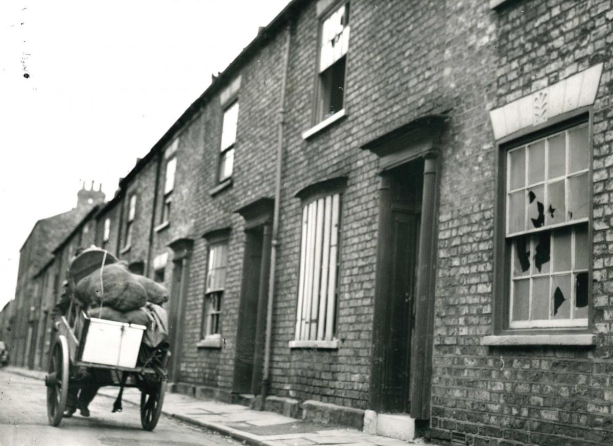
All but one of our photos today come from Explore York's wonderful Imagine York photo archive. Many of the streets and buildings pictured no longer exist, having been demolished in the 1950s and 1960s. Redeness Street, in the one photo which doesn't come from Explore (it is from The Press's own archive) was already looking sad and derelict in 1962, many of the houses empty and the glass in windows broken.
Stephen Lewis
- Thousands more photos like those on these pages are held on Explore York’s Imagine York archive. You can browse the archive yourself at imagineyork.co.uk


Comments: Our rules
We want our comments to be a lively and valuable part of our community - a place where readers can debate and engage with the most important local issues. The ability to comment on our stories is a privilege, not a right, however, and that privilege may be withdrawn if it is abused or misused.
Please report any comments that break our rules.
Read the rules hereLast Updated:
Report this comment Cancel