


WE begin a historic journey along the River Foss this week, courtesy of a series of photographs from Explore York's brilliant Imagine York archive of digital images.
This week, we concentrate on the lower reaches of the Foss, around Foss Basin and the confluence with the Ouse.
There are a couple of close-up photographs of Blue Bridge, both taken in 1929 and showing the pair of cannon captured during the Crimean War which 'stood guard' at either side of the bridge before being melted down for scrap in the Second World War.
There's a wonderful photograph showing the approach to the mouth of the Foss, with sailing barges on the Ouse to the left; and a great aerial photograph taken in the 1890s showing the long tongue of land sandwiched between the Foss and Ouse, in the days before a Foss Barrier was ever dreamed of.
There's a close-up, taken presumably from Blue Bridge, looking up that same tongue of land; and a picture of barges moored in the Foss Basin. Our final photograph was taken further up the Foss, where it flows through Layerthorpe.
We'll have some more historic photographs for you next week showing the upper reaches of the Foss. But for now, here is a bit more detail about each of today's images...
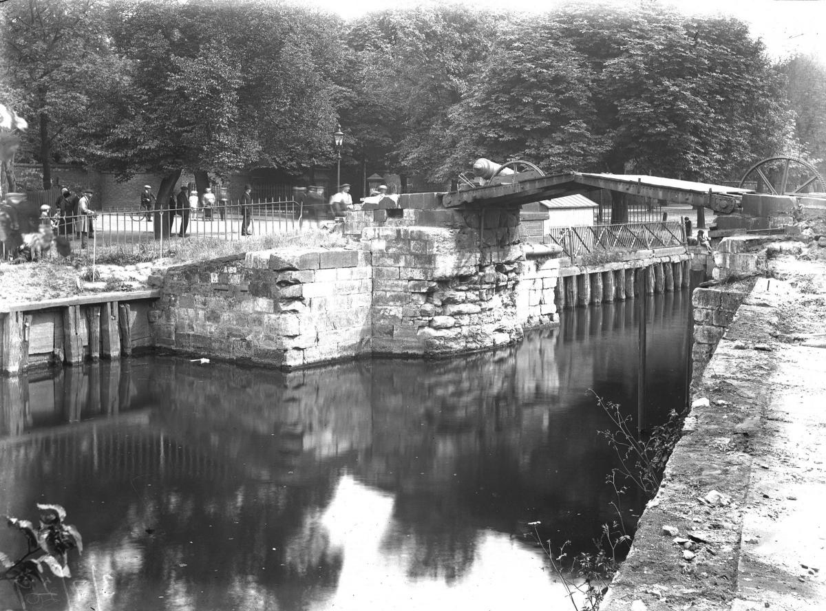
1. We love the detail in this photograph: a busy scene with a number of people who appear to be watching something going on on the Blue Bridge. The confluence of the Foss and the Ouse has been crossed here, at this point, for hundreds of years. This picture is thought to date from July 29, 1929. It clearly shows the cannon from the Crimean War which were placed on the bridge and remained there until being removed in 1941 and melted for scrap as part of the war effort in the Second World War. It is noticeable that in this photograph there are no railings on the bridge.
2. Taken just a few weeks before our first photograph, this image shows a workman standing on one of the cannon mounted on Blue Bridge. The picture is thought to date from July 5, 1929.
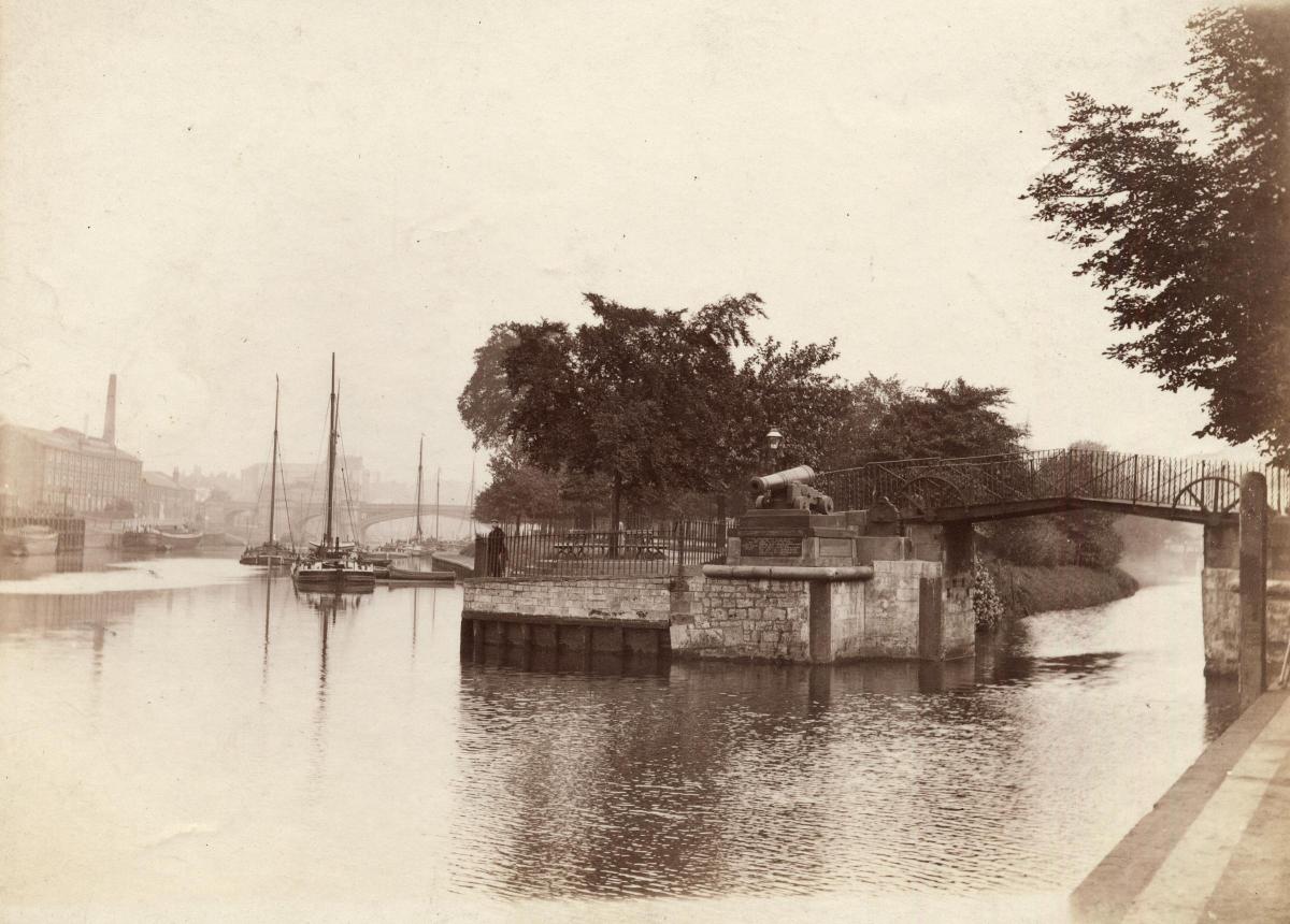
3. This photograph, taken in the 1890s, shows Blue Bridge (complete with both railings and cannon, this time) at the confluence of the Ouse and Foss. Sailing barges can be seen coming down the River Ouse to the right of the photograph.
4. A rare aerial view from the 1890s, this shows the confluence of the rivers Ouse (left) and Foss (right), and the tongue of land sandwiched between them. Clifford's Tower can be made out in the centre of the photograph, with York Minster in the distance behind.
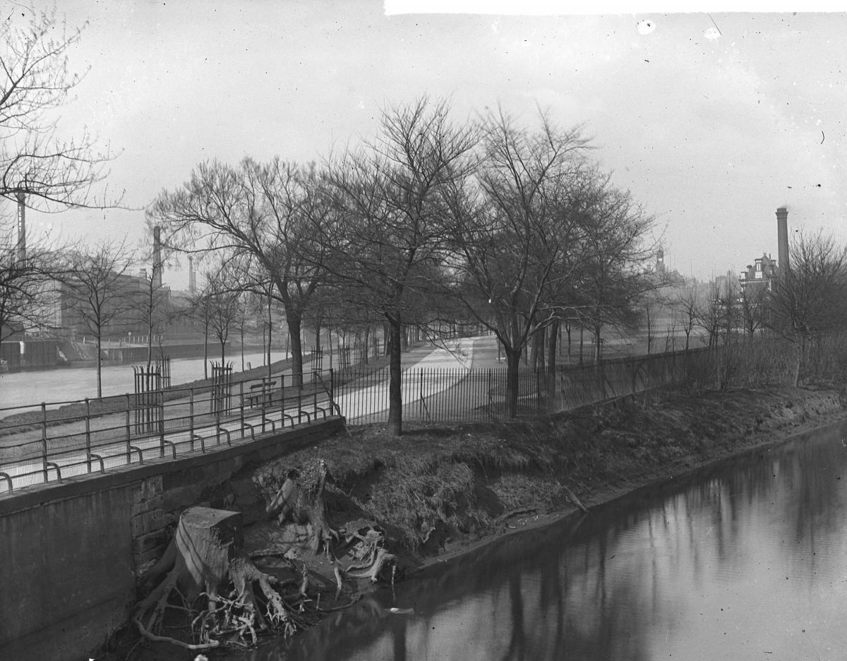
5. This unusual photograph, taken in the 1910s probably before the outbreak of the First World War, shows the section of New Walk leading from the Blue Bridge to Skeldergate Bridge, ie just upriver from the confluence of the Ouse and the Foss. Taken presumably from Blue Bridge itself, the Foss is in the foreground, the Ouse to the left across the tongue of land along which New Walk runs at this point. The Co-operative Coal Wharves can be seen on the extreme left of the photograph.
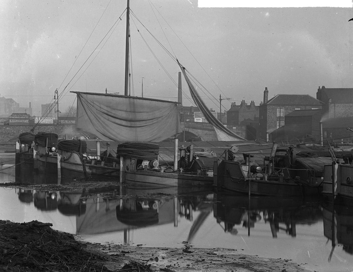
6. This image shows sailing barges moored in Foss Basin near Castle Mills Lock, probably in the 1910s. There has been talk in recent years of making more of the potential of the Foss Basin. This photograph gives an indication of just what a good mooring place it could be...
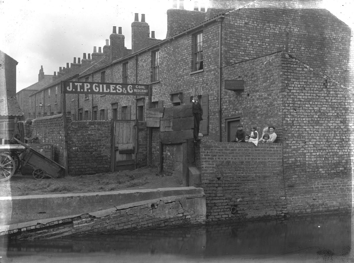
7. Further upstream, the River Foss can be seen in the foreground of this photograph, which was taken on August 15, 1912. The family pictured are standing in Downhill Street (which was off Layerthorpe) near a sign for JTP Giles Coal Merchant. This was at No. 13. Downhill Street, but was demolished between 1961 and 1963.
Stephen Lewis
- All the photos on these pages, and thousands more, are held on Explore York’s Imagine York archive. You can browse it yourself at imagineyork.co.uk


Comments: Our rules
We want our comments to be a lively and valuable part of our community - a place where readers can debate and engage with the most important local issues. The ability to comment on our stories is a privilege, not a right, however, and that privilege may be withdrawn if it is abused or misused.
Please report any comments that break our rules.
Read the rules hereLast Updated:
Report this comment Cancel