


BOB ADAMS takes in the views – and history – of a walk along the River Foss from the Blue Bridge to Haxby
Day One: Blue Bridge to Haxby
Distance: approx. 6 miles
Over the last four years I have walked three of Yorkshire’s rivers from confluence to source.
I started with the Nidd, then the Rye and finally the Ure. Accounts of all these walks have been published in the York Press and are on its website.
It was time to tackle another river. Which one was it to be?
One of the comments on the Press website asked when was I going to tackle the ‘mighty’ Foss. This was a challenge that had to be met.
The River Foss flows into the Ouse in the centre of the City of York, just past its Norman Castle. It fact William the Conqueror damned the Foss in 1068 to provide a moat for his castle. The Foss may only be a small river of 22 miles in length but it is indeed mighty. It even has its own preservation group, the River Foss Society.
Foss means ditch in Latin and waterfall in Norse, so take your pick as to the origin of the name of the river. There would have been a waterfall over the dam in medieval times. There still is, albeit a rather small one, around Castle Mills Lock. I favour the Latin origin because further up river the Foss can easily be mistaken for a ditch.
As is often the case with my river walks very little planning takes place. I happened to find myself in York one weekday afternoon early in October and decided to take a look at the confluence of the Foss. Three hours and over six miles later I arrived in Haxby. As on previous river walks, my aim was to concentrate mainly on the history. As always I am surprised as to how much history there is. What I did not know was that in the late 18th century, the Foss was originally navigable almost as far as Sheriff Hutton. The key to this was a series of six locks and some 13 miles of navigable waterway, all now removed, apart from a short section after Castle Mills Lock.
My walk started at the Blue Bridge. The present incumbent was constructed in 1929. There has been a lifting bridge on this site since the Foss Navigation Company was founded in 1778.
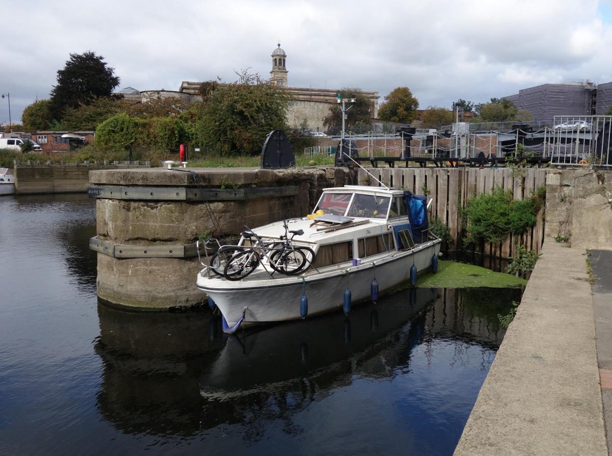
As I passed the Foss Barrier there was evidence of much building activity taking place around the new pumping station. I hope it will fully operational before winter. I then entered Castle Mills Lock Basin, a large expanse of water presumably packed with barges and boats in days past. The lock is little used now and a boat had been moored right in front of it. I passed stockpiles of various detritus fished from the river including supermarket trolleys, several bicycles and a vacuum cleaner.
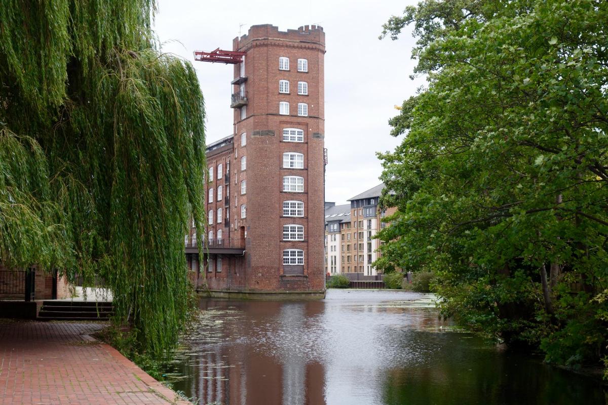
My path then took me on a small detour around York Castle and back to the river below the Coppergate Centre. I crossed the river at Piccadilly and again at Fossgate. A short cut through Straker’s Passage and a right turn took me to a one of the secret places of York, a pleasant canal side area with a great view of Foss Bridge, built in 1812. To the left towered the impressive Navigation Warehouse on a promontory between the Foss navigation and Wormald’s Cut. The Warehouse (now private flats) was at one time used by Rowntree’s chocolate factory to unload and store cocoa beans, gum arabic and sugar.
I then crossed the river again and headed for Foss Islands Road along a metal walkway tacked on to the side of the warehouse. Foss Island gradually emerged from King’s Pool in the 18th century as the area silted up.
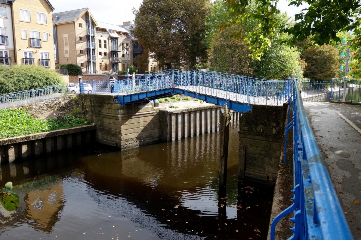
The walk along this part of the river was memorable because of a huge overgrown weeping willow on the opposite bank and an iron pedestrian bridge (also painted blue). The bridge was built by the Monk Bridge Construction Company in 1931 to improve communication between York’s power station and its cooling tower, both now demolished, although the chimney still stands. This area was once a hive of industrial activity and included a massive flour mill (Leetham’s Mill), a glass factory and various coal depots, all using the River Foss for transport.
The river then turned north on its way out of the city, for a while following Huntington Road. I passed Number 59, once Saint Andrews, the psychotherapy centre for York’s mental health services. Next up was the old York workhouse, now converted into student flats, and an old railway bridge. This part of the walk was very pleasant along a wooded path.
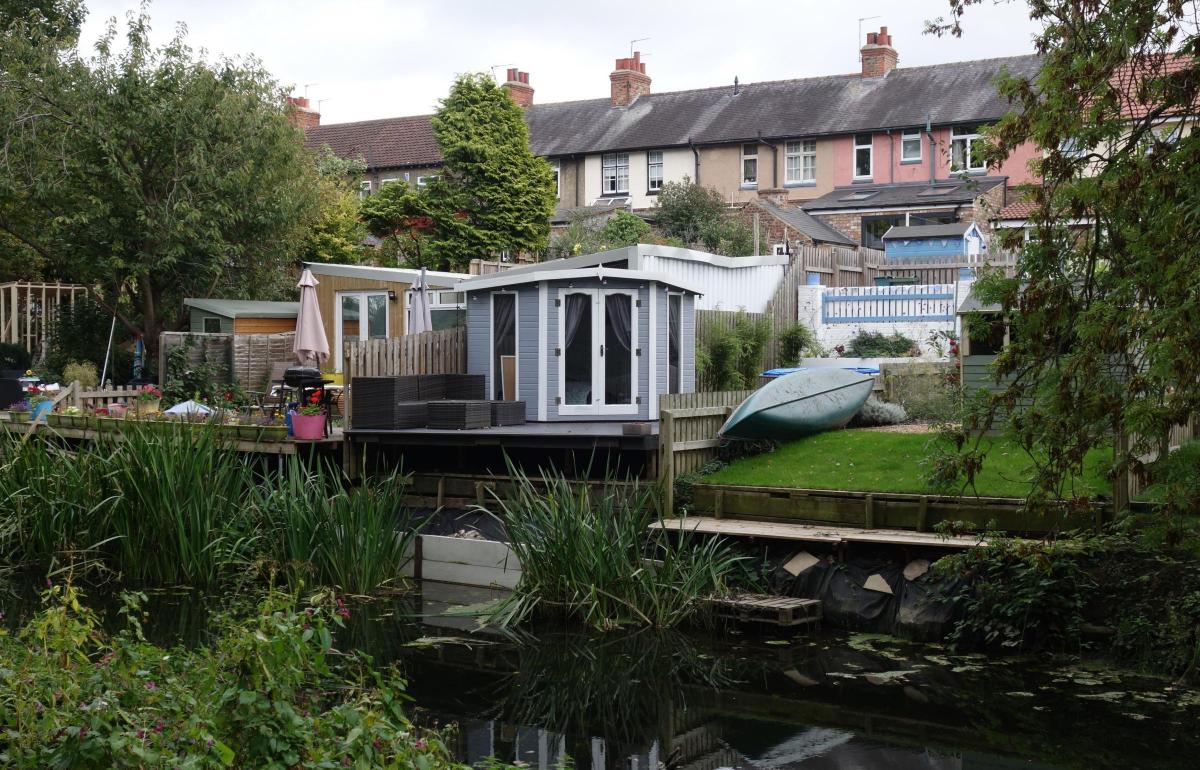
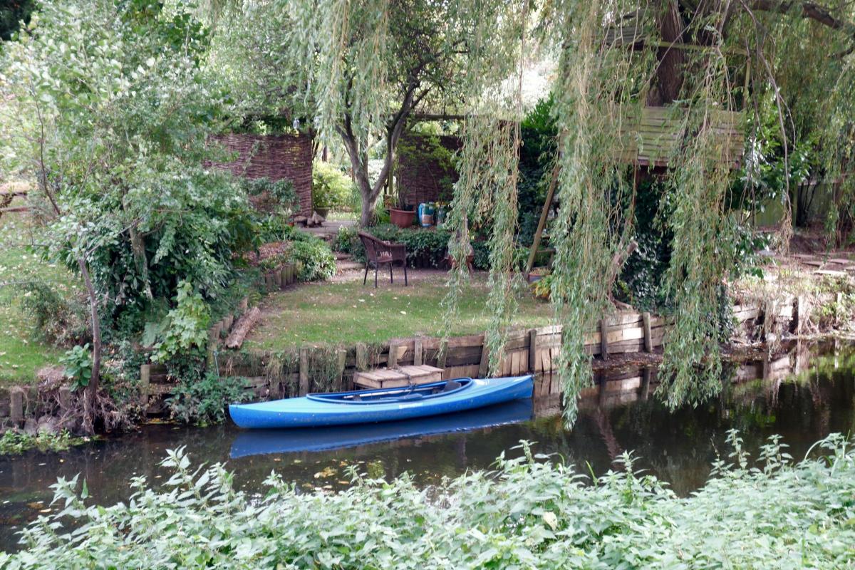
Further on I passed Rowntree’s factory (now Nestlé) and broke out into open fields. There were shouts of sports players and, to my right, in gardens abutting the river, what appeared to be the setting for a battle of the sheds. I couldn’t make up my mind if I preferred the ‘wild garden approach with tethered canoe’, or the ‘wooden balconies, steps and decking approach’. One even had a seated area on a dais, rather like a bandstand.
Just before New Earswick, I passed the dried-up channel of part of the original canal and lock, once known as Steel’s Lock. The white building you see as you enter the village was once the old lock keeper’s cottage. The railway from York to Beverley used to cross the Foss where the Link Road now stands. New Earswick was built by Joseph Rowntree in the early 20th century as a ‘model’ village to house workers and managers at his sweet factory.
It was then time to make a decision. Do I get the bus back from Huntington or do I press on? The sun had come out and it was turning into a pleasant evening so the decision was easy.
I followed a long left hand curve to All Saints Church, attractively situated at the end of a dead-end road from Huntington village. The hum of traffic from the Outer Ring Road was now evident in the distance. I often gaze out at the river from this road when stuck in traffic jams on the way to to Monks Cross or Scarborough. My path now took me under it, passing some stepping-stones and keeping to the west bank, the old tow path.
Haxby was now only a mile or so away. Across the other side of the river I could see the gardens of the new estate of Earswick Chase. I passed many early evening dog walkers, all friendly.
Just before Haxby the path by the river appeared to be closed off and I had to take a small detour to Landing Lane. I plan to return on another occasion to reconnoitre the weir and Lock House from the other bank. It was time to press on to Haxby and my lift home.


Comments: Our rules
We want our comments to be a lively and valuable part of our community - a place where readers can debate and engage with the most important local issues. The ability to comment on our stories is a privilege, not a right, however, and that privilege may be withdrawn if it is abused or misused.
Please report any comments that break our rules.
Read the rules hereLast Updated:
Report this comment Cancel