

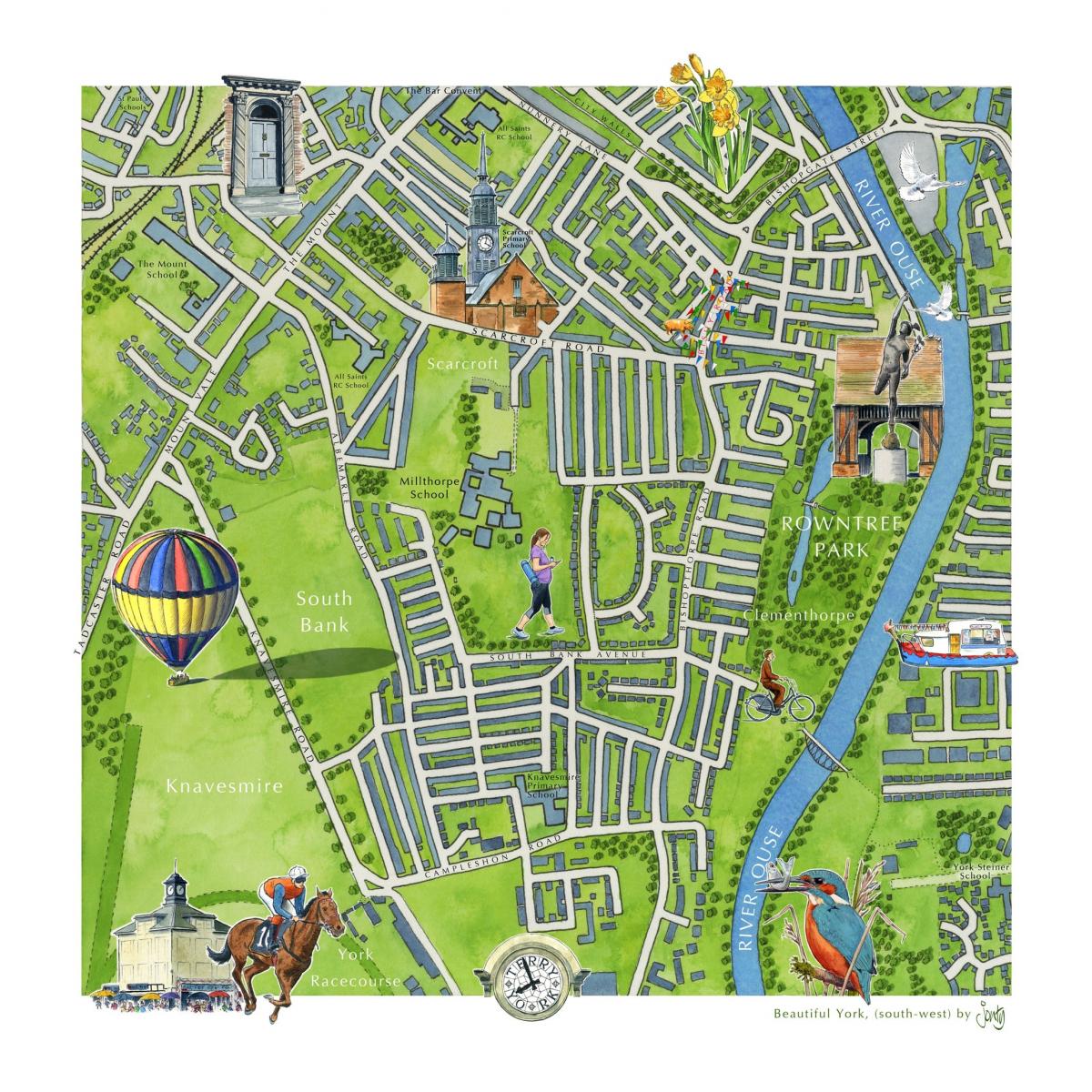

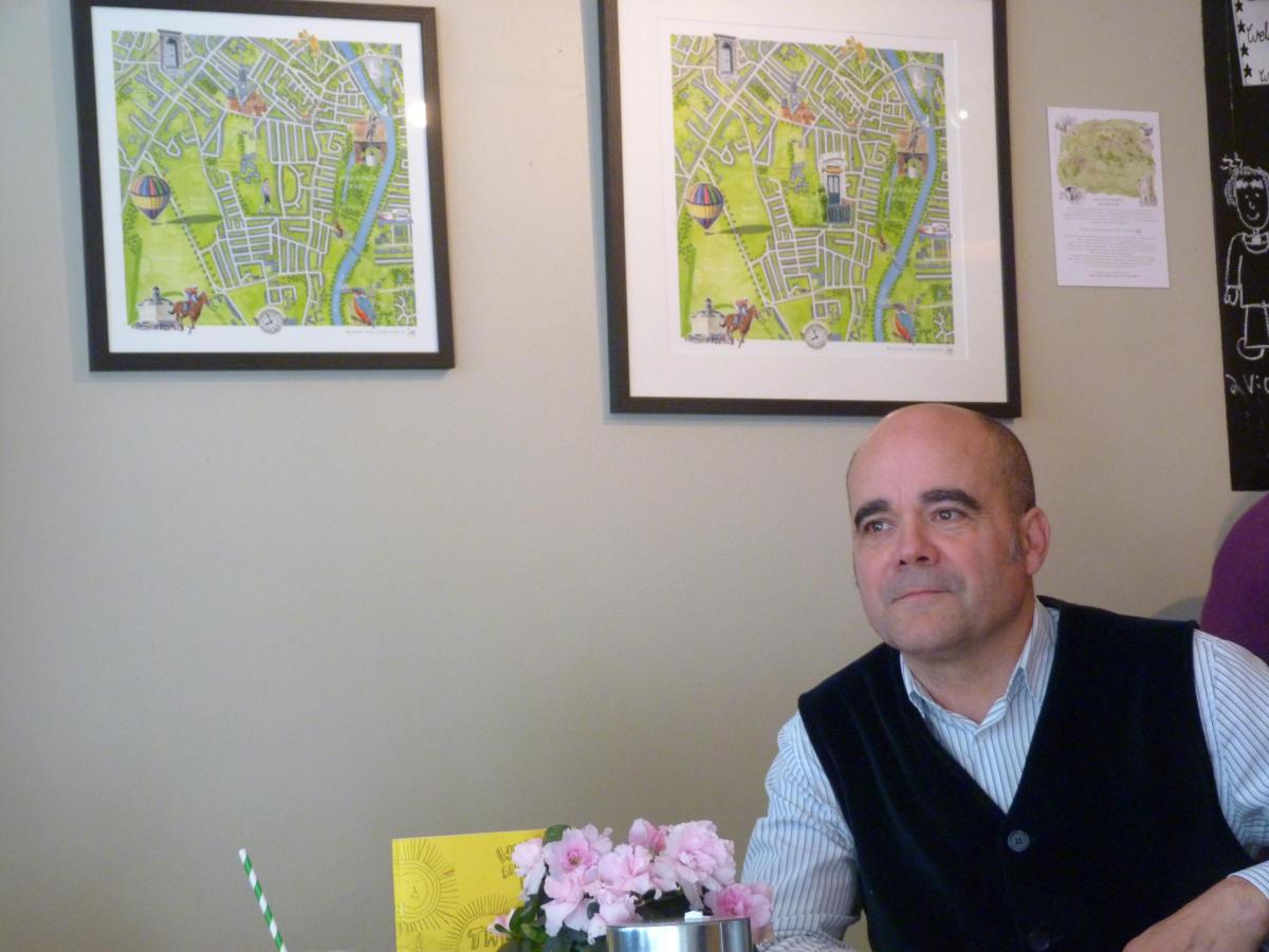
IF you pop into the Pig & Pastry on Bishopthorpe Road for a coffee and a cake any time soon, you might notice hanging on the wall beside the counter a pair of lovely, hand-painted maps of the South Bank area.
The grid of streets is outlined against a lush green background, with the River Ouse snaking down the right hand side.
It is the details which make the maps stand out, however. In the bottom left hand corner, there is a jockey in racing silks riding his horse across Knavesmire. Further up, where the recent balloon fiesta was held, a hot air balloon is inked in, its billowing canopy done out in bright colours.
Bishy Road itself is marked out with bunting; there's a beautifully drawn kingfisher perched on the banks of the Ouse; and a drawing of the Rowntree Park fountain bang in the middle of Rowntree Park.

These maps are the work of local illustrator Jonty Clark. The 58-year-old drew them to celebrate the fact that he has now been living in South Bank for 10 years. But he's more than happy to sell prints of the map to anyone interested - or even draw a bespoke map featuring your own house...
Jonty is an artist with an impressive portfolio.
Brought up in Lincolnshire, he went to the Royal College of Art in London to study architectural glass and ceramic work. He found work in the visual effects department at the BBC, working on Dr Who (in the Sylvester McCoy years) among other programmes, then spent seven years designing museum displays, including an interpretation of the kitchens of Hampton Court Palace.
In 1996 he moved to York and set himself up as a freelance artist. He took a portfolio of his work to London and ‘did the rounds’, which resulted in a job illustrating a weekly column in the Independent on Sunday.
Since then, he’s worked for the Mail on Sunday, The Times (illustrating its weekly ‘popular culture’ section in The Weekend Review from 2005-6) and the BBC History, BBC Music and BBC Countryfile Magazines, among others.
He works from a wonderfully cluttered, bohemian studio at the Danesmead Business Centre on Fulford Cross, which he shares with two other artists and his 12-year-old whippet, Alfie.
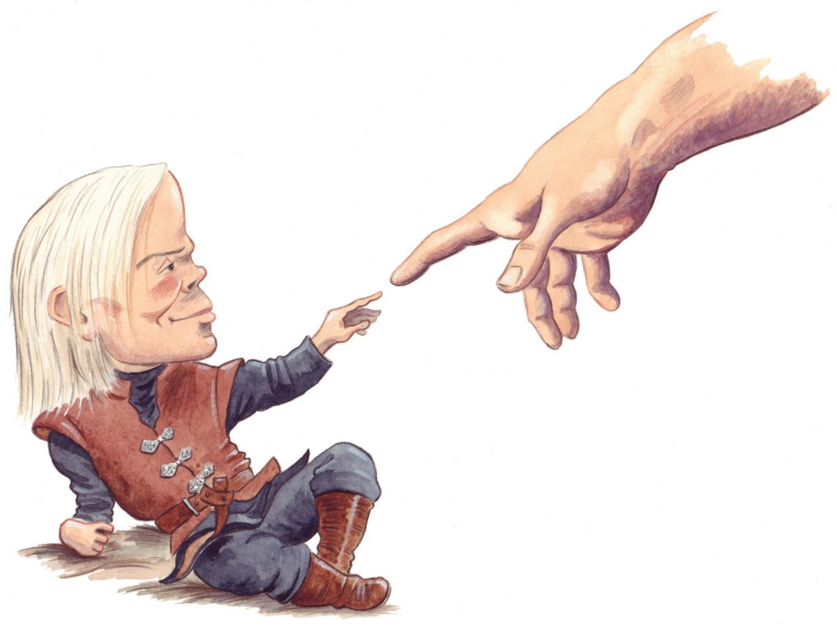
One of his biggest commissions came in 2013, when he illustrated a Game of Thrones spin-off book called The Wit & Wisdom of Tyrion Lannister. His brief was to base his illustrations of Tyrion not on Peter Dinklage, the actor who plays the character with such devastating wit and charisma in the TV series, but on the original George RR Martin descriptions from the novels.
So his Tyrion has a head far too large for his body; long, lank, ash-blond hair; and mismatched green and black eyes.

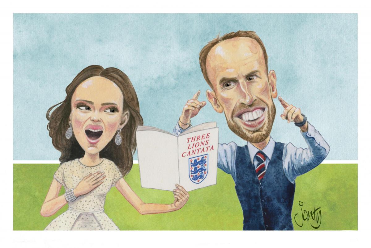
Jonty Clark's drawing of Gareth Southgate
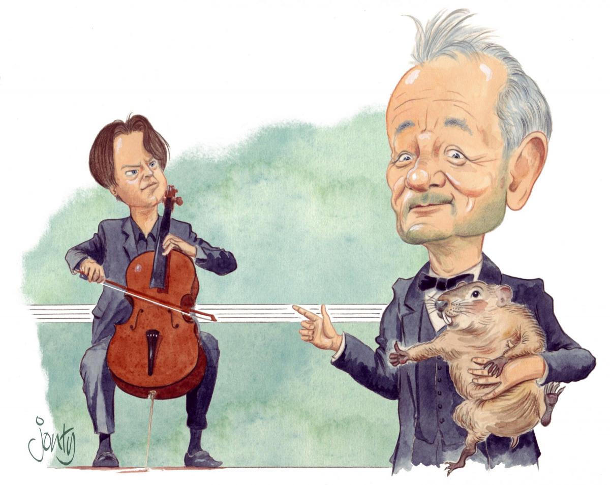
Jonty still does a monthly illustration for BBC Music magazine - recent subjects include Gareth Southgate singing a Three Lions cantata with singer Aida Garifullina at the World Cup opening ceremony in Russia (Southgate's agent like it so much he bought a print) and actor Bill Murray singing to an accompaniment by Cellist Jan Vogler. "Bill Murray is a singer as well an actor," Jonty says. "He actually has a very good voice!"
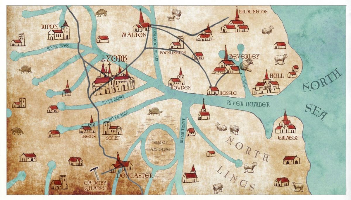
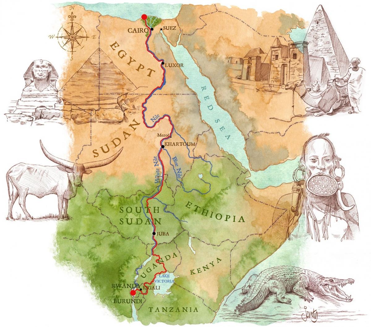
These days, however, he is beginning to specialise more in drawing maps. A few years ago he drew a beautiful map of the Nile for the Telegraph to illustrate TV explorer Levison Wood's journey along the river. More recently, he has done an illustrated historical map of Corfe Castle in Dorset for the National Trust and a beautiful historical map of East Yorkshire centred on St Mary's Church at Beverley. "The idea was to show where the stone to build the church was quarried," he says.
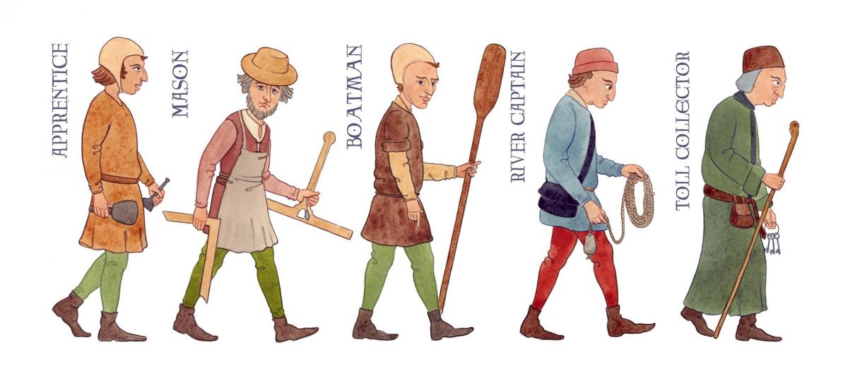
As well as the map itself, he drew a series of typical medieval characters who might have been involved in the transport of stone to Beverley and the building of the church itself. They include a mason, a boatman, a river captain and - of course - a toll collector. "These are all now displayed on a huge screen in the church," he says, clearly delighted.

Jonty Clark's drawing of medieval workmen
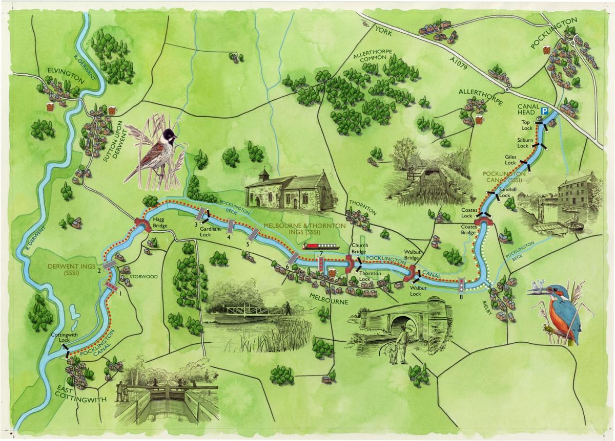
His biggest project so far this year, however, has been for the Pocklington Canal. He was commissioned to do illustrations for 15 interpretative panels that are sited along the length of the canal - and a large map of the whole canal.
It's a thing of beauty, with the quality almost of EH Shepard's map of Winnie-the-Pooh's 100 acre wood.
The canal on Jonty's map winds through green fields and past woods and copses. Water birds perch in the of the canal bank, and there are beautifully detailed ink drawings of lock gates and bridges that you encounter as you walk the length of the canal. "It was a super job to have to do," he says.

Map of the Pocklington Canal by Jonty Clark
- To find out more about Jonty Clark's work, or to order prints of his maps and illustrations, visit jontyclark.com/ or call 07752 154807.


Comments: Our rules
We want our comments to be a lively and valuable part of our community - a place where readers can debate and engage with the most important local issues. The ability to comment on our stories is a privilege, not a right, however, and that privilege may be withdrawn if it is abused or misused.
Please report any comments that break our rules.
Read the rules here