


QUEEN Street has been in the news recently, thanks to proposals to revamp the entrance to York Railway Station and possibly demolish the Queen Street Bridge.
The consultation on those proposals closed just a week ago. We'll wait with interest to see the detailed plans that eventually emerge. But now seems a good time to look back at how the street has changed over the years, with the help of some photographs from Explore York's wonderful Imagine York archive.
Queen Street today is dominated by the bridge which bears its name. Built in 1878 to replace an original level crossing on the approach to the old railway station inside the city walls (now the city council headquarters) the bridge has 'high historical significance as an early example of reinforced concrete construction' and 'some significance as evidence of the approach through an arch in the city walls to the first railway station,' according to Alison Sinclair, a retired English Heritage historic buildings expert who is now a member of York's Conservation Areas Advisory Panel
This hasn't prevented it being declared obsolete and redundant by city planners who are keen to demolish it to create more space in the approach to the railway station.
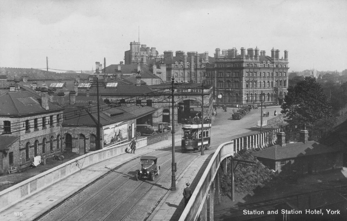
We have three great photos of the bridge. One, taken in about 1920, shows a car and a tram crossing the bridge, with the railway station to the left and the station hotel in the distance. Taxis are queueing near the entrance to the station (so nothing has changed there, then) and, to the right of the photograph, you can just make out the railway track leading to the old station.
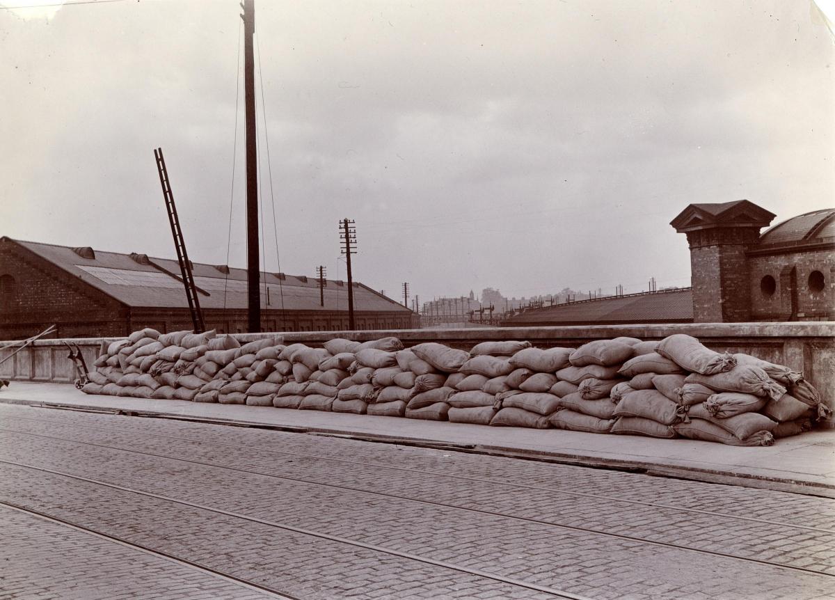
The other two photographs of the bridge date from May 19, 1911, on a day on which the bridge was being given a 'weight test'. One photograph was taken looking underneath the bridge along the railway lines in the direction of the old railway station. The second was taken on top of the bridge. It shows sandbags piled along the bridge's perimeter. These were being used to test the strength of the bridge's footpath. The sandbags represented the weight of people, and the three vertical lines which can just be seen dropping from a pole beside the bridge were measuring the bridge's height. By measuring how much lower the bridge was when under weight, its strength could be calculated. The newly-laid tramlines can also be seen in the bridge's brick surface.
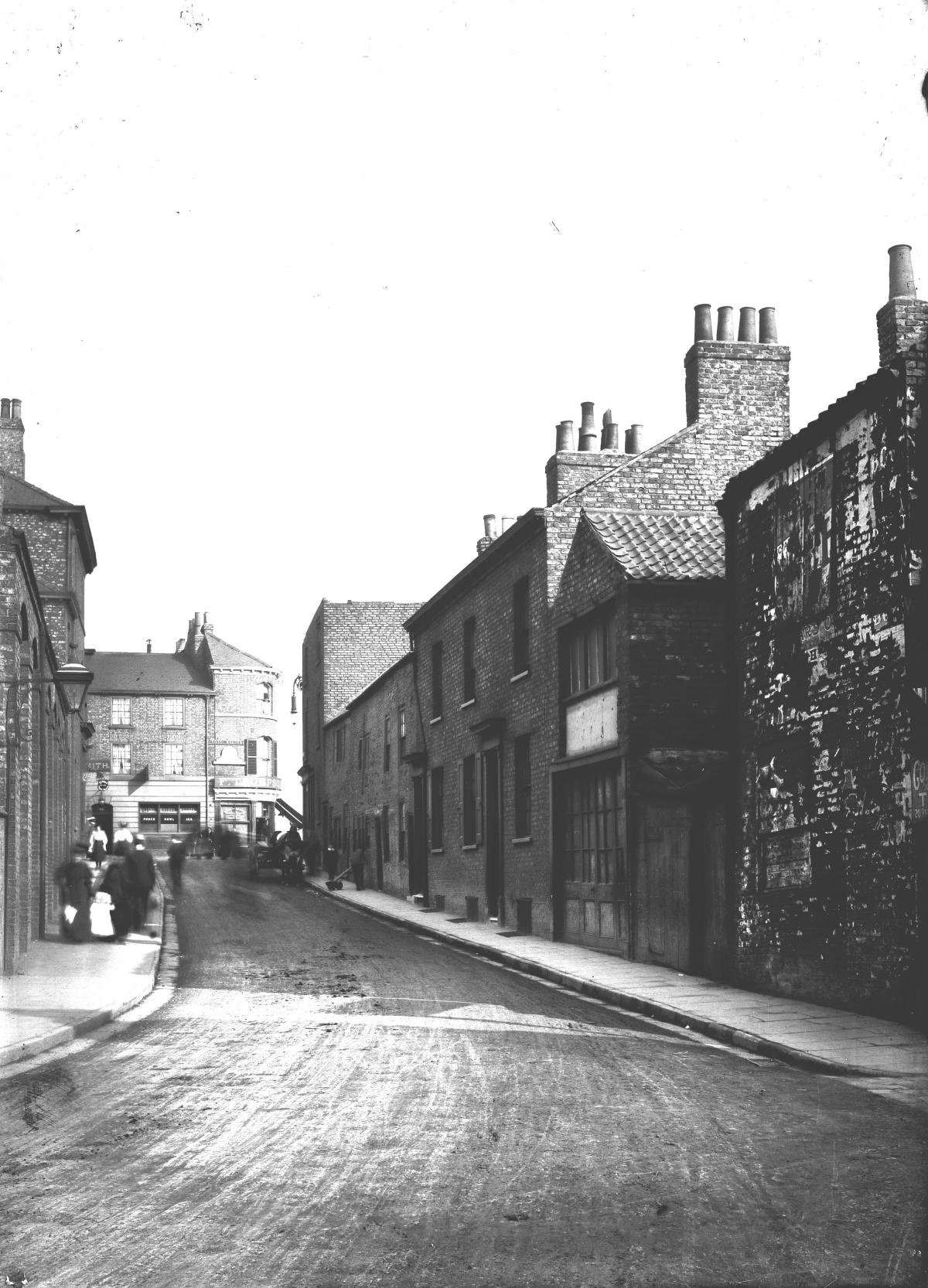
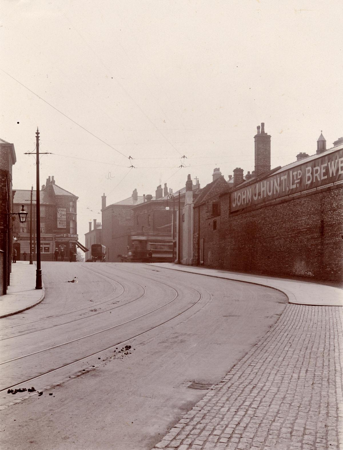
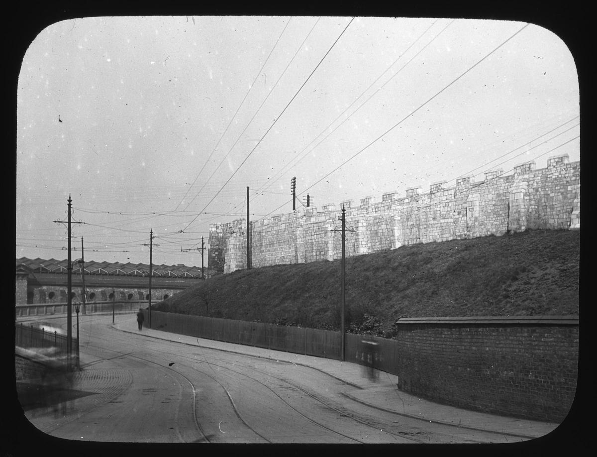
Three photographs taken within a few years of each other between about 1907 and the mid 1910s show clearly how much Queen Street changed at the time the city's electric tramlines were laid.
One, taken some time between 1907 and 1910, shows the street before it was widened to make room for the electric tram routes. Two others, taken just a few years later, show the widened street complete with tramlines in place.
One final stunning image, taken in 1934, shows trams themselves on Queen Street/ Station Road in 1934. The trams didn't have much longer left to run when this photograph was taken, sadly: the last of York's electric tram routes were phased out in November 1935.
Stephen Lewis
All the photos on these pages, and thousands more, are held on Explore York’s Imagine York archive. You can browse it yourself by visiting imagineyork.co.uk/


Comments: Our rules
We want our comments to be a lively and valuable part of our community - a place where readers can debate and engage with the most important local issues. The ability to comment on our stories is a privilege, not a right, however, and that privilege may be withdrawn if it is abused or misused.
Please report any comments that break our rules.
Read the rules hereLast Updated:
Report this comment Cancel