
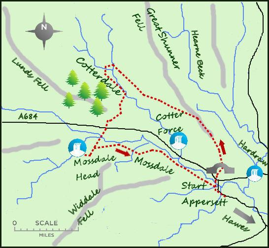
I WOULD imagine that very few people have heard of Cotterdale or Mossdale. These two side dales can be found in Upper Wensleydale, near the market town of Hawes. They offer a quiet and very pleasant alternative to the more popular walks in the main dale.
Mossdale has the distinction of being the smallest side dale of Wensleydale while Cotterdale, among its other delights, has a pretty waterfall slightly off the beaten track.
The walk starts in the little hamlet of Appersett, a mile to the west of Hawes. There is some parking available next to the village green, a pleasant green often full of ducks, geese and goats. Head west along the road over two bridges, the second over the embryonic River Ure. Immediately after the second bridge a path heads north, initially along a stream, and then steeply up the hillside.
After ½ a mile, the path meets a large track, turn left up the track. This is the Pennine Way which heads up Great Shunner Fell, one of the remotest sections of the entire trail and the subject of a quite different walk!
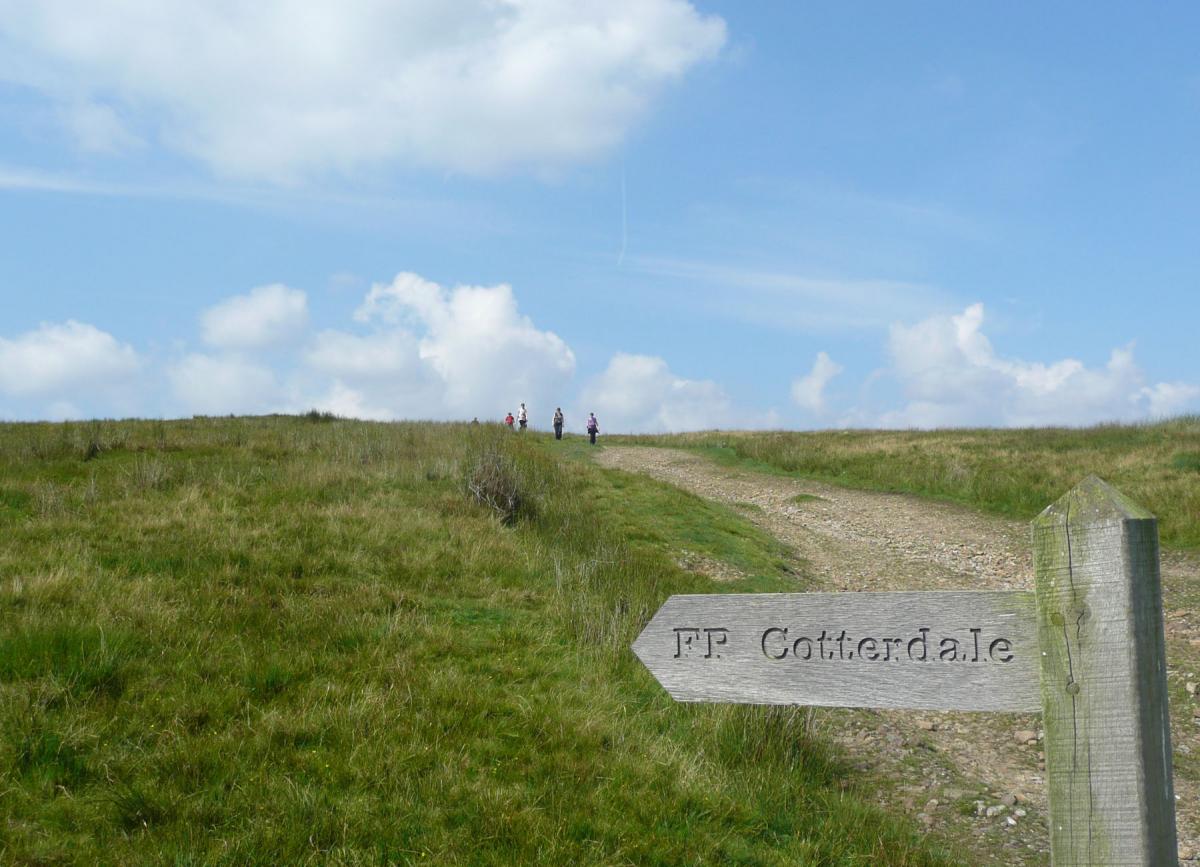
The walk for today only takes in a few hundred metres of the Pennine Way before a prominent finger sign heads off to the left. This is the path to Cotterdale (named after the norse word for huts), the first section offering a wonderful perspective of the dale.
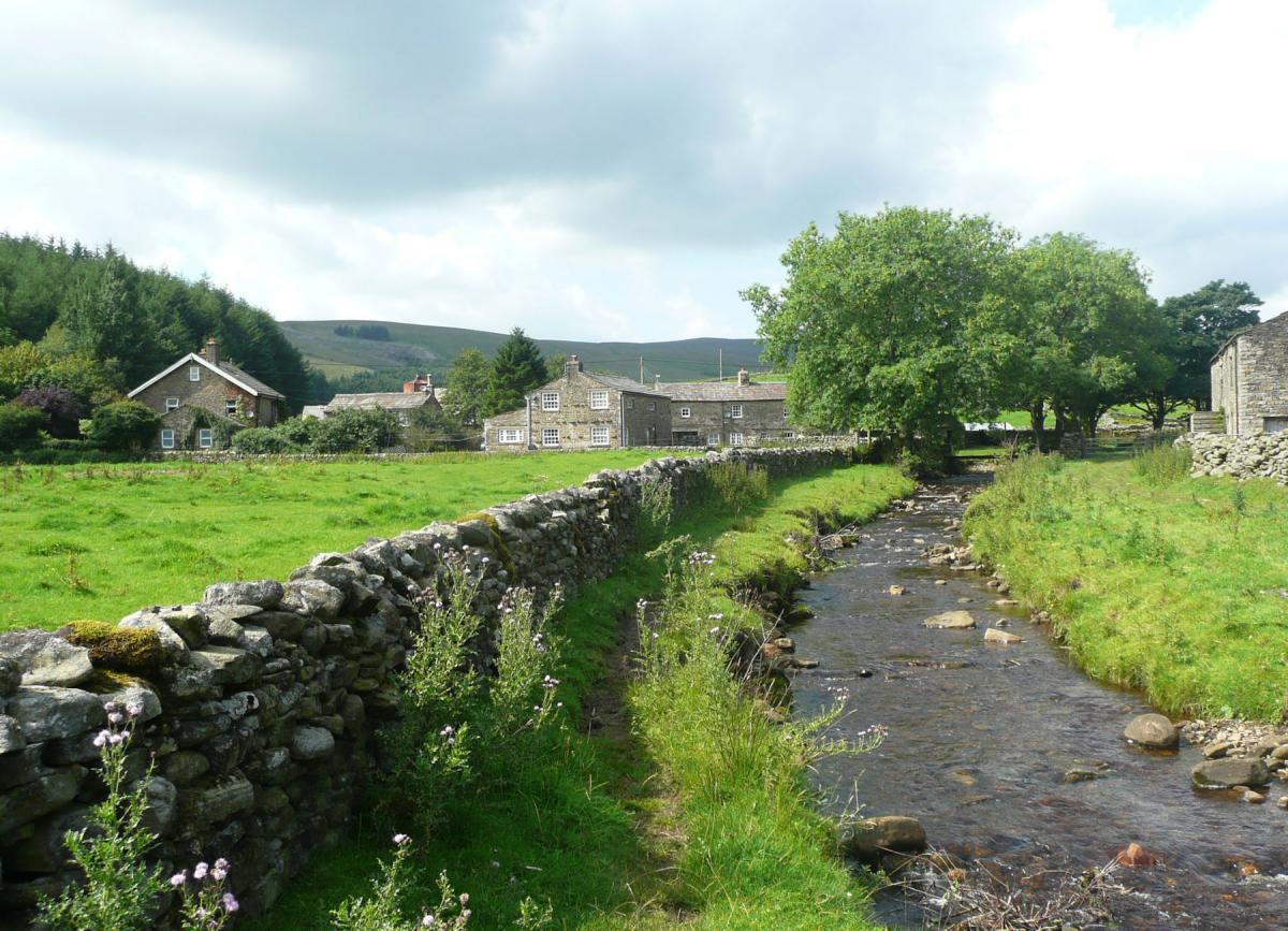
Cotterdale is known as a dead-end dale as the road stops at the hamlet, where there are some holiday cottages and a working farm. It is a lovely, peaceful spot. Those who have sensibly brought some sort of picnic should walk the 200 metres in to the forestry of the High Abbottside Moorland Generation Project where some tables are conveniently situated.
From the hamlet follow the badly eroded footpath alongside Cotter Beck for a few hundred metres. The path then divides, take the right-hand fork, cross the road and start climbing the slopes opposite. The path is intermittent at times as it passes over the high shoulder of Cotter End. It is a delightful bit of walking with great views over Wensleydale and more impressively back down Cotterdale. The track then drops sharply south west past a slither of woodland before entering some woodland next to the main Hawes to Garsdale road.
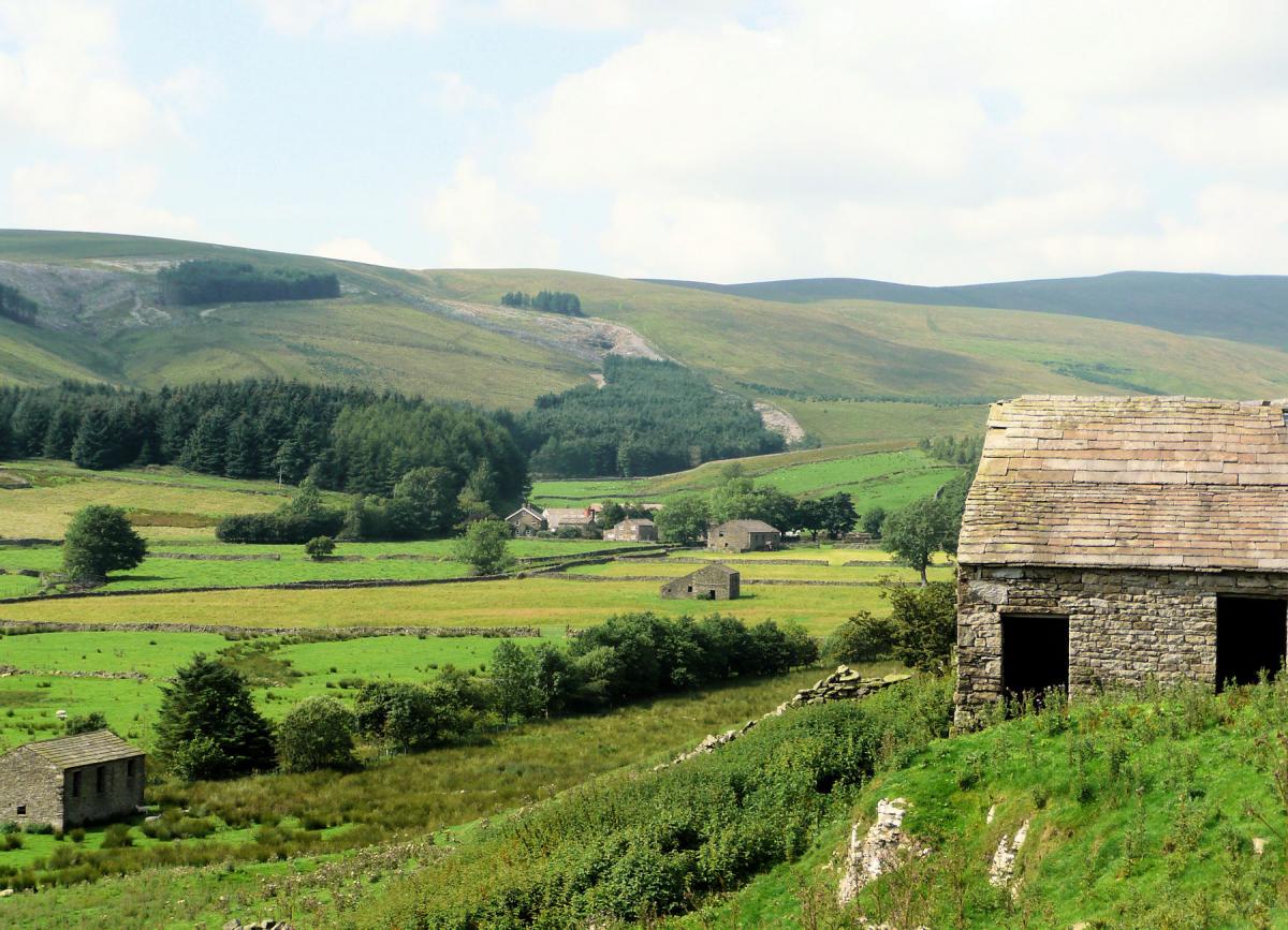
The second half of the walk along Mossdale is very different in character to the first half. Here you will be visiting waterfalls, viaducts and tracking low level along the valley, it is definitely a place to take your time and explore. Initially the route takes in Mossdale Head, the track circles the farm and comes to Mossdale Head viaduct, a four-arched bridge that used to carry the old branch railway from Hawes up to Garsdale. There are noises concerning the re-opening of this line which would be splendid and actively encouraged. At present the line finishes at Redmire.
Aside from the viaduct there are some splendid waterfalls on Mossdale Beck, it is a peaceful spot. Mossdale Beck lies on the lower slopes of Widdale Fell (Great Knoutberry Hill), one of the finest mountains in the Dales and one of the least visited. However the dawdling must end so join the path heading east over open fields. The path soon becomes a farm track (and less muddy as a result) before passing Birk Rigg Farm. Past the farm the track heads north, crosses the river and meets the main road. The path to Cotter Force is 200 metres to the east on the far side of the road. This is a small diversion (15 minutes max each way) that will take you to Cotter Falls, it is well worth the diversion. Return to the track that follows the south bank of the River Ure.
The path back to Appersett passes initially through some woodland and reaches the main road in just over ½ a mile, follow the path as it bends south until a stile takes you back in to Appersett at the first road bridge. There is no refreshment in Appersett so I always drive back in to Hawes for a pint where there is an excellent choice of pubs.
Fact Box:
Distance: Roughly 8.5 miles (including Cotter Force).
Height to climb: 320m (1,050 feet)
Start: SD 859907. Appersett, there is some lay by parking near the large green.
Difficulty: The initial half of the walk is on open countryside with some steep climbs, the second half is flatter but the paths can be quite muddy. There are also a few ladder stiles on this walk although the National Park are gradually replacing them.
Refreshments: Nothing in Appersett but plenty in Hawes, 1 mile distant.
Be Prepared:
The route description and sketch map only provide a guide to the walk. You must take out and be able to read a map and in cloudy/misty conditions a compass. You must also wear the correct clothing and footwear for the outdoors. Whilst every effort is made to provide accurate information, walkers head out at their own risk.
Please observe the Countryside Code and park sensibly.
Jonathan Smith runs Where2walk, a walking company in the Yorkshire Dales. Jonathan has written his own book, the “Dales 30” which describes the highest mountains in the Dales. He also runs 1 Day Navigation Courses for Beginners and Intermediates. Join his Learn a Skill, Climb a Hill Weekend in the Dales. To find out more details on any of the above and details of many more walks in the area visit his website: Where2walk.co.uk


Comments: Our rules
We want our comments to be a lively and valuable part of our community - a place where readers can debate and engage with the most important local issues. The ability to comment on our stories is a privilege, not a right, however, and that privilege may be withdrawn if it is abused or misused.
Please report any comments that break our rules.
Read the rules here