
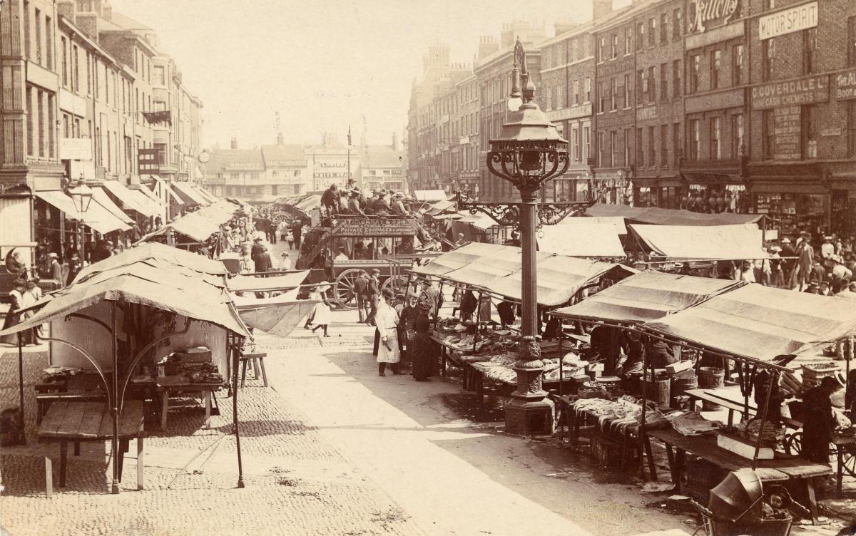


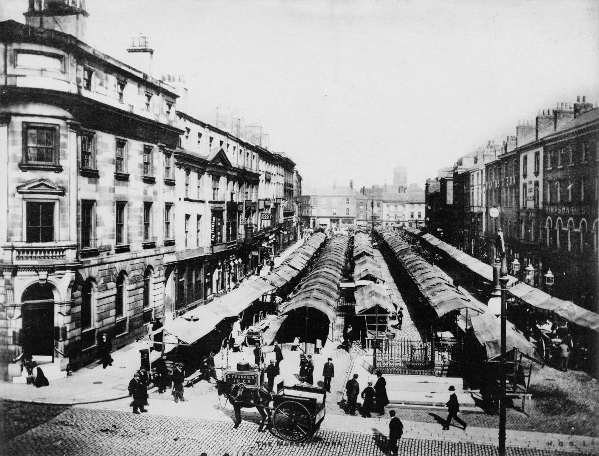


YOU could hardly move in Parliament Street on market days back in late Victorian times. Just look at these photos if you don't believe us...
Parliament Street was actually built - in 1834 - to host York's market. That is why it is so wide.
In the early 1800s, York's two main markets were at Pavement and in the Thursday Market (now St Sampson's Square).
However, according to Hugh Murray, Sarah Riddick and Richard Green in their 1990 publication York Through The Eyes Of The Artist, there wasn't enough space in the two markets to cater for all the traders wanting to bring their goods into the city for sale. The online History Of The County Of York gives a vivid description of the situation.
"The restricted space of Pavement was being increasingly used for stalls of city shopkeepers, and by hawkers and pedlars, to the exclusion of legitimate stall-holders from the country: the corporation had neglected to enforce its regulations, and the offenders were well entrenched," it says.
In 1827, in an attempt to resolve the problem, the York Corporation sought an Act of Parliament to enable "the linking of Pavement and Thursday Market by a broad, new street, and the extensive demolition of old property."
That Act of Parliament was granted in 1833. Old buildings were demolished and the new street opened in 1834. It was known as Parliament Street because of the Act of Parliament that had been required to build it.
A new market was opened in the new street on June 16, 1836, with 185 stalls selling food and general goods. and as our photographs show, it was still going strong by the turn of the century.
Two of the photographs show the view from St Sampson's Square looking down Parliament Street towards Pavement. The photographs were taken before Piccadilly was knocked through into Pavement in 1912. Look carefully, and you can see in one of them the row of shops in Pavement (among them Poads) which once closed off the southern end of Parliament Street. The other two photographs are taken from the south end of Parliament Street, looking northwards towards St Sampson's Square.
The Parliament Street photographs all come from Explore York's wonderful Imagine York website - as do the later photographs on these pages showing the Walmgate area in 1955.
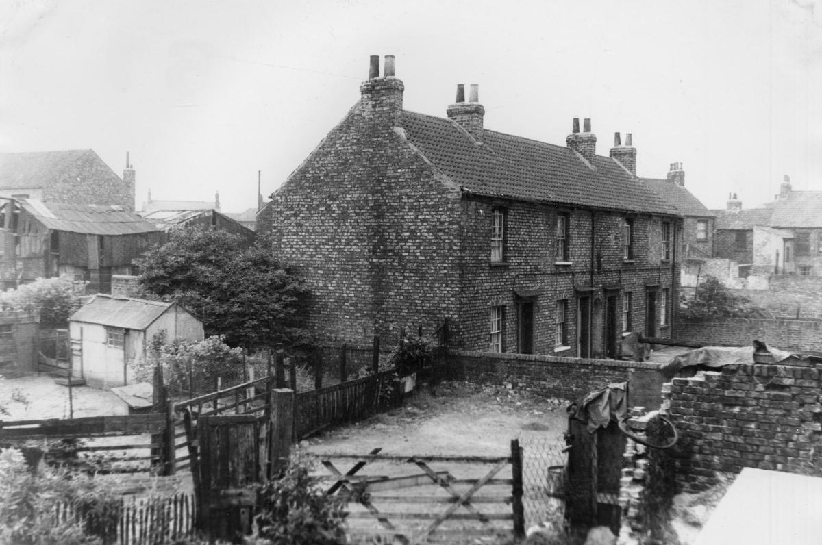
Walmgate is thought to have been part of the main Roman route which approached York from the east, according to a 'character area' appraisal which forms part of the city council's 'Central Historic Core' document. It has been enclosed within the city walls since the 1300s, but by Victorian times much of the area had become a slum.
There was a big programme of slum clearance in the 1930s, and after the Second World War new municipal housing estates were put up. The first of these was on Navigation Road in 1951 - but this was followed by many other phases of development throughout the 1960s, 70s and 80s.
The three photographs on these pages were taken by the York health department in 1955, presumably as part of a photographic survey of housing stock before decisions were made on which streets had to be demolished.
- All the photos on these pages, and thousands more, are held on Explore York’s wonderful Imagine York archive. You can browse it yourself for free just by visiting imagineyork.co.uk/


Comments: Our rules
We want our comments to be a lively and valuable part of our community - a place where readers can debate and engage with the most important local issues. The ability to comment on our stories is a privilege, not a right, however, and that privilege may be withdrawn if it is abused or misused.
Please report any comments that break our rules.
Read the rules hereLast Updated:
Report this comment Cancel