
A pen-and-ink panorama of medieval York was unveiled by architect Edwin Ridsdale Tate 100 years ago. Stephen Lewis tells the story behind the picture.
HERE is York as you will never have seen it before – at least, not unless you're a regular visitor to the Mansion House.
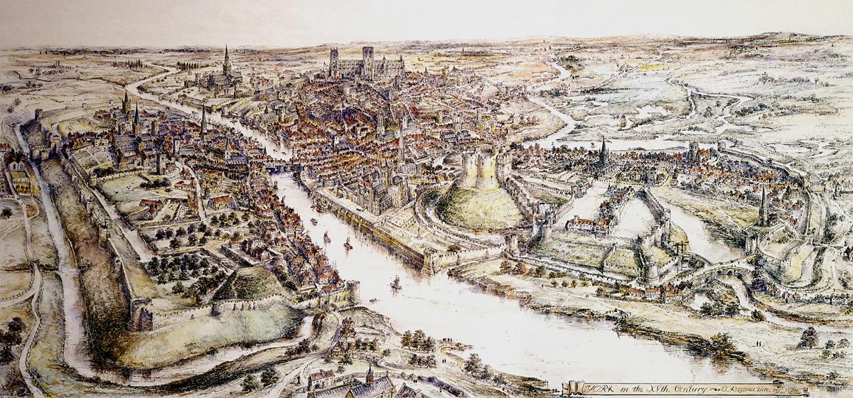
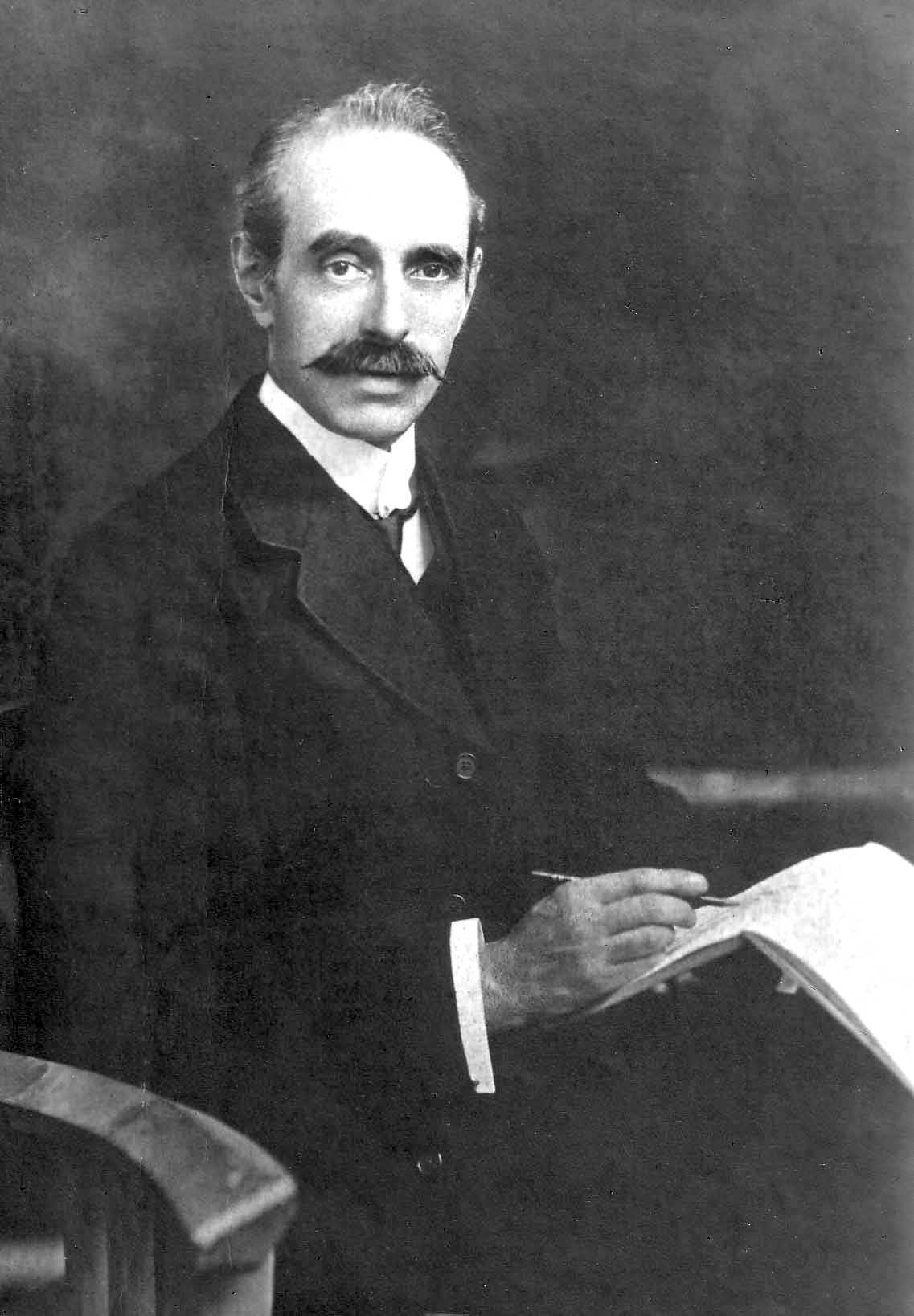
This pen-and-ink panorama of the city was drawn by York architect Edwin Ridsdale Tate 100 years ago – but it depicts a city that is much older than that.
Tate had been commissioned to draw the panorama by his friend David Leith Presley, the editor of the Yorkshire Herald, to mark the newspaper's 20,000th issue.
The panorama was completed 100 years ago tomorrow – on May 15, 1914 – and, after Tate had added a colour wash, was printed across a full page of a special issue of the newspaper a year later, on May 18, 1915.
But it did not depict York in Tate and Presley's day. Instead Tate, a noted antiquarian, used his knowledge of the city's past to recreate a view of the city as it would have been in the fifteenth century.
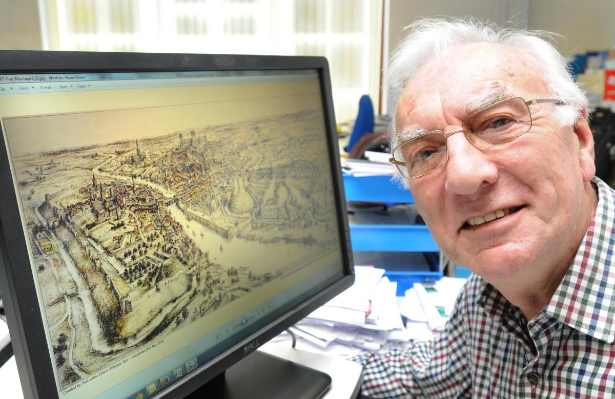
"The 1400s was the period of the greatest prosperity for the City of York in medieval times when York was second only to London as a city in terms of population, commerce, religious, military and political importance," says historian Peter Stanhope, who is writing a book about Ridsdale Tate.
" After this period, with the dissolution of the monasteries by King Henry VIII, the silting-up of the River Ouse preventing further navigation as far as York by sea-going vessels, the destruction of other churches in the siege of 1644, the loss of leading industries and so on, gradually the city of York declined until the arrival of the railway era."
So here, thanks to Tate and Presley, we have a panorama of the city in its medieval prime.
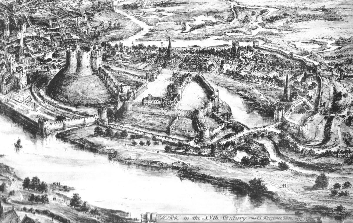
The text accompany the drawing in the Yorkshire Herald on May 18, 1915, talked the readers through what they were looking at .
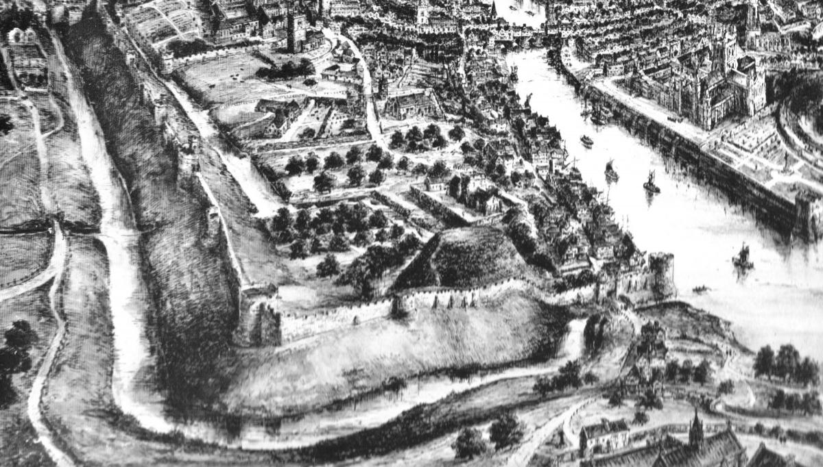
"In the foreground is St. Clement’s Nunnery and the two mounds erected by the order of William the Conqueror," the newspaper explained. "On one of the mounds stands Clifford’s Tower, erected by Henry III, whilst the Castle area is surrounded by the later additions of the Edwardian Kings.
"The Castle, as the guardian of old York, occupies a prominent position, and is shown with the drawbridge leading to the Gatehouse. "Between the Outer and Inner Ward are the Castle buildings including the King’s Great Hall, the Royal Mint, the Chapel and Lodgings. At the city end, gatehouses lead to Castlegate and also to the drawbridge to Clifford’s Tower which is set on a lofty mound surrounded by water.
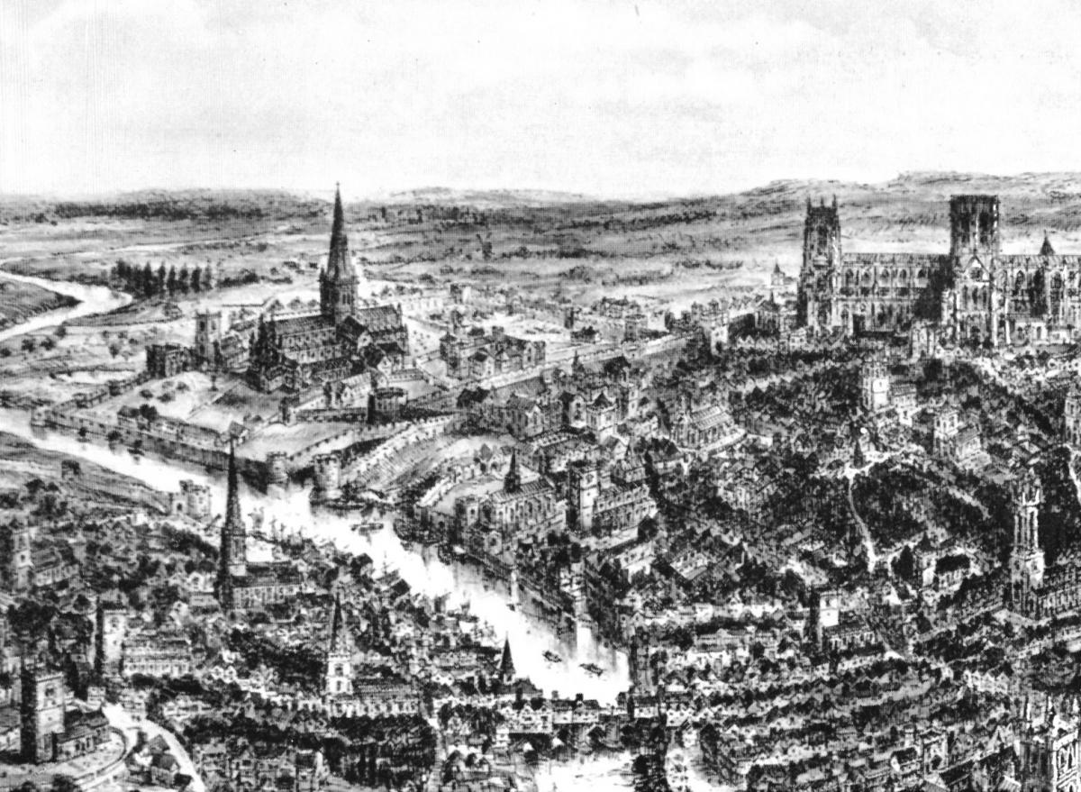
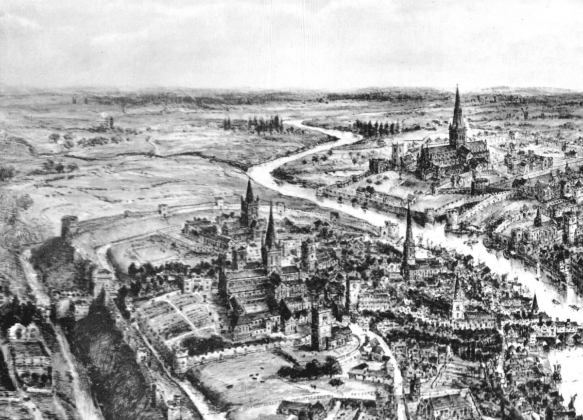
"The city is clearly shown with its two rivers and its walls, and with the moats filled with water. Within the City Walls are the great Minster of St. Peter with it’s walled-in close, the Royal Hospital of St. Leonard, the important Benedictine Abbey of St.Mary (also within its own walled-in close), the ... Benedictine Priory of the Holy Trinity, the houses of the four orders of friars, namely, Dominicans, Augustinians, Franciscans and Carmelties, and the numerous parish churches.
"Ouse Bridge, covered with buildings, the Guildhall, the streets and dwellings are also all well shown. Beyond the city walls there are a number of windmills, and the open country studded with villages and bounded by the Hambleton and Wold hills."
The panorama, almost four feet wide and 20 inches deep, now hangs in the Yellow Room at the Mansion House, where visitors can see it on open days or on guided tours.
So if you want to see the impressive original, you know where to go. Guided tours of the Mansion House are held every Thursday, Friday and Saturday at 11am, 12.30 lunchtime, and 2pm.
Tickets are free to York Card holders, otherwise £5. No need to book - just turn up at the allotted time. The Mansion House shop sells prints of the panorama for £5.


Comments: Our rules
We want our comments to be a lively and valuable part of our community - a place where readers can debate and engage with the most important local issues. The ability to comment on our stories is a privilege, not a right, however, and that privilege may be withdrawn if it is abused or misused.
Please report any comments that break our rules.
Read the rules here