
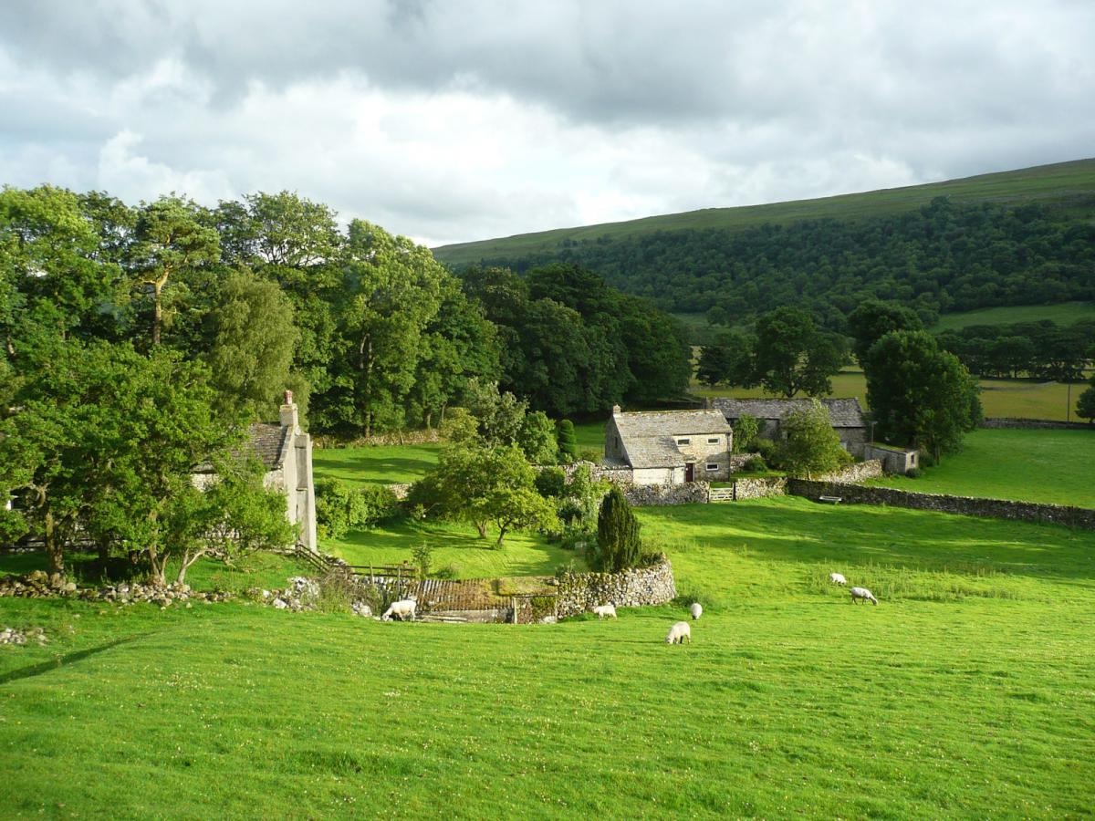
LITTON and Arncliffe are two delightful small villages (each with a pub) tucked away up the best of all Wharfedale side valleys. With the River Skirfare linking the two it is a walk to dawdle, explore and continue to enjoy our fantastic summer.
Start the walk in Arncliffe. Before leaving the village have a little browse around St Oswald’s Church in Arncliffe, inspiration to Charles Kingsley ‘the Water Babies’ and reputed to be the site of a Saxon place of worship. Today it is simply a beautiful browse.
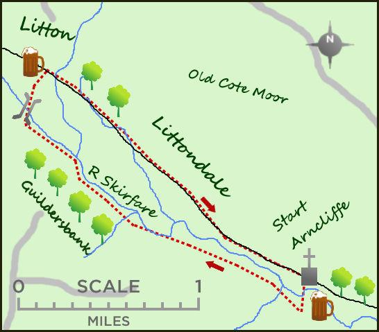
Leave Arncliffe on the road heading north west from the Falcon Inn. Having crossed the river carry straight on (ignoring the road bending to the left) and join a lane which continues parallel to river and soon entering open fields. The views across to the river are excellent.
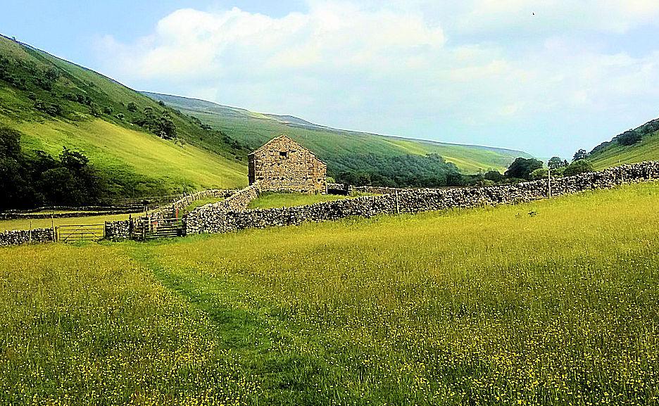
The walk now takes you through a number of fields, beautiful at this time of the year, full of buttercups and wild flowers. The Hay Meadows project, which works with local farmers to create wild flower fields, is one of the most impressive projects in the Yorkshire Dales. To the left is the woodland of Guildersbank, a preserved woodland which harbours one of the largest ash woodland in the area. Above is the steep sides of Scoska Moor, great walking terrain but left for another day.
Littondale is famed for its Bronze and Iron Age settlements and there is an excellent example less than a mile from Arncliffe. The rough mounds can be seen to the left of the path whilst further on it is possible to pick out the field systems of the time. With all that is going on around you it is possible to ignore the numerous stiles on the path. The final half mile of the walk passes close to the River Skirfare and this year you cant help notice how low the water levels are – last year in September most of the walk was under water! The river carries on up the valley, past Halton Gill and on to the slopes of Pen y Ghent, all delightful countryside.
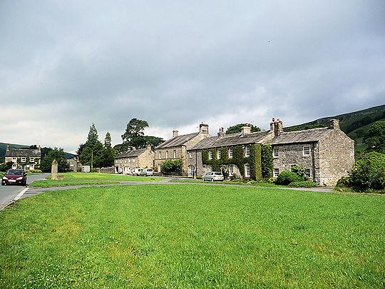
It is only two miles to the village of Litton which becomes clear over the river. A couple of footbridges lead to this pretty small village.
It is worth exploring the hamlet and more importantly stopping for some refreshment at the Queens Arms amidst the beer garden animals! Litton itself was famous in the 18th century as the centre of a ‘cockpit’ where badger baiting and cock fighting took place.
There is now a dilemma for the walker, either reverse the route you have taken or take the quicker route along the road, as empty as it normally is. I usually take the latter option and sink in to my default position, geography student! The dale of Littondale is simply the most perfectly formed U shaped valley in the country, you can almost picture the rivers of ice serenely moving down the valley. Even on tarmac this is a special valley with so much to see… and I was never knocked over. Even the drivers seem polite.
Fact file
Distance: Roughly four miles.
Height to Climb: 30 metres (100 feet).
Start: SD 931719. Parking around the village green of Arncliffe.
Difficulty: Easy.
Refreshments: The Falcon Inn at Arncliffe is open all year and the Queens at Litton gives a half way option.
Be prepared: The route description and sketch map only provide a guide to the walk. You must take out and be able to read a map (O/S Explorer OL30) and in cloudy/misty conditions a compass. You must also wear the correct clothing and footwear for the outdoors. Whilst every effort is made to provide accurate information, walkers head out at their own risk. Please observe the Countryside Code and park sensibly.


Comments: Our rules
We want our comments to be a lively and valuable part of our community - a place where readers can debate and engage with the most important local issues. The ability to comment on our stories is a privilege, not a right, however, and that privilege may be withdrawn if it is abused or misused.
Please report any comments that break our rules.
Read the rules here