
KILDALE village was once renowned for growing turnips.
It was recorded that the soil was of suitable character for this purpose.
That isn’t the only claim to fame that Kildale holds as it once had a castle built by the important Earls of Northumberland.
It has a famous witch, Nanny Howe who gave herself to the devil and still appears at midnight flying around on her broomstick. There was a corn mill, a bleach mill and for a brief time, a settlement of Crutched Friars. What a sight the Friars must have been in their blue habits adorned front and back with a red cross.
Unfortunately they upset the Archdeacon of Cleveland by holding divine services and using unconsecrated offices without his permission and lost recognition and were told to leave.
The village lies in a valley between Kildale Moor and Coate Moor.
The low lying land has been flooded many times in severe weather.
In 1840 water poured down the hillsides into the village, there were two artificial fish ponds which quickly filled up with water and burst their banks causing a massive flood to roar down the valley causing much devastation.
A corn mill was swept away and a bleaching mill seriously damaged with the force of the water which is recorded as being over thirty feet deep.
Kildale has had a church for hundreds of years. It has been rebuilt, renovated and altered many times in its history.
During one of the rebuilding periods many old gravestones were found containing skeletons in good condition, if that is correct way of describing a skeleton.
Many weapons made of iron were found, some were quite rare and included a battleaxe which could have a connection with the Vikings.
A rare find indeed in a simple village church.
Your route Leave Gillamoor towards Fadmoor but before you leave the village, turn right along a narrow lane. In about a mile, bear right at the junction to soon cycle downhill.
At the bottom of the hill keep straight ahead and start a long ascent to a cattle grid in about two miles.
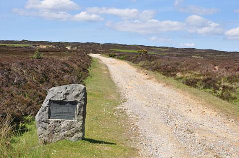
Just after the cattle grid, leave the road to turn right onto a wide old dirt road across Rudland Rigg. Climbing at first, then eventually the road flattens out a little.
Enjoy the views across Bransdale and Farndale as you ride this medieval ridge road. After about six miles, keep straight ahead at the crossroads at Bloworth Crossing, then continue along the Rigg for about three miles to where it meets a narrow road.
Join this road by going left here to cycle along for a while enjoying views across to the Cleveland Hills to a Tjunction.
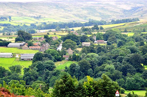
Turn right now into Kildale village.
In the village, turn left at the sign for ‘Station’ and cycle past the entrance to the station to a parking area provided for church visitors near a farm.
Just before the parking area is the entrance to the church across a bridge.
Dismount here to cross the bridge to visit the historic church.
After visiting the church retrace your route to the village, then turn left to join the main road. Continue along for a couple of miles then turn right at the sign for Westerdale. Lots of stiff ascents and descents now as well as a ford to negotiate as you make your way across the moors to Westerdale village.
Cycle through the village built on the hill, then start a long, hard ascent of almost three miles until you reach the main road at Ralph’s Cross. Mainly downhill now for some refreshment at the Lion Inn at Blakey, then continue along for about a mile to the Farndale junction opposite a roadside car park.
Turn right here down a very steep hill, about half way down turn left along a narrow road signed to Farndale East, Hutton-le-Hole and Gillamoor.
At the junction keep straight ahead then at the next junction go right signed to Low Mill and Gillamoor. Not far now and you arrive at Low Mill, turn left at the T-junction and ride towards Gillamoor.
In about three miles, turn right at the T-junction signed to Gillamoor, a steep ascent soon takes you back to the village and perhaps if you are not too late, a cool pint in the Royal Oak Inn.
The facts
Distance – 32miles/51km.
Terrain – Good track but several steep hills.
Best map – OS Landranger 94.
Start/grid ref – Roadside in Gillamoor, grid ref: 683900.
Refreshments – Royal Oak Inn at Gillamoor, Lion Inn Blakey.
Public toilets – Low Mill car park.


Comments: Our rules
We want our comments to be a lively and valuable part of our community - a place where readers can debate and engage with the most important local issues. The ability to comment on our stories is a privilege, not a right, however, and that privilege may be withdrawn if it is abused or misused.
Please report any comments that break our rules.
Read the rules hereComments are closed on this article