
IT is hard to imagine the calm and tranquil Rosedale we know today as a hive of industrial activity.
The picture perfect North York Moors valley is home to a few hundred people, but little over 150 years ago Rosedale's ironstone mines briefly boosted the population into the thousands.
The barren moors in these parts were found to contain magnetic ironstone and, after several difficult years of removing it by horse power, the Rosedale Ironstone Railway was built around the dale.
Huge kilns were installed to carry out the initial calcining process before the iron ore was transported to Teesside via Blakey Junction and Ingleby Incline.
Some 250,000 tonnes were removed at the height of the industry in 1865, but production dwindled towards the turn of the 20th century and the mines closed for good in 1926.
The chimney that gave the famous Rosedale Chimney Bank its name and the railway tracks are long gone, but the crumbling kilns remain - and the trackbed makes for easy route finding.
This spectacular 12-mile walk formed the first stage of a two-day camping trip before the weather turned, with stage two a 12-and-a-half mile trip around neighbouring Farndale.
Having pitched our tents at the perfectly manicured Rosedale Abbey Caravan and Camping Park, a short sharp pull up through Red House Golf Course delivers us onto the cinder trackbed of the railway.
A short detour left from Bank Top cottages gives a first glimpse of Rosedale's industrial past, in the form of surviving kiln arches.
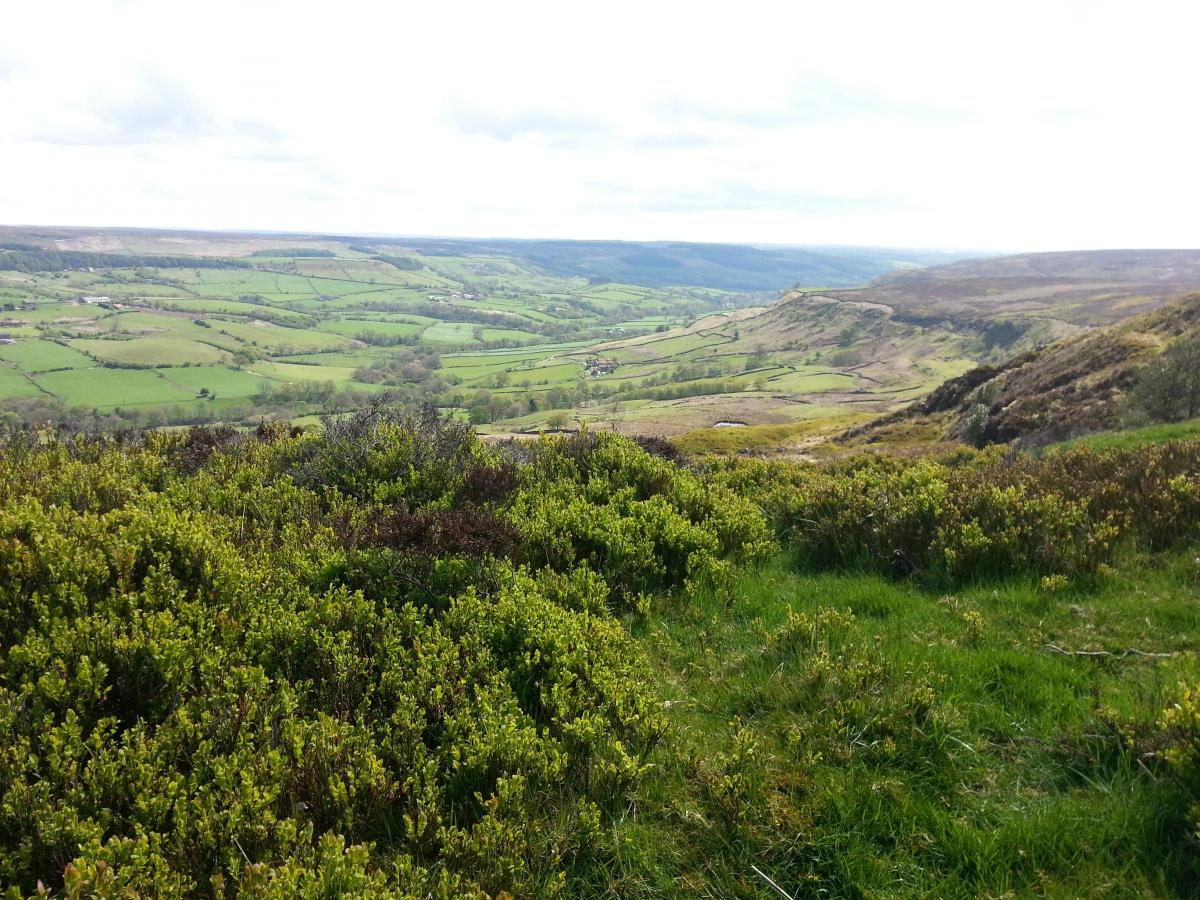
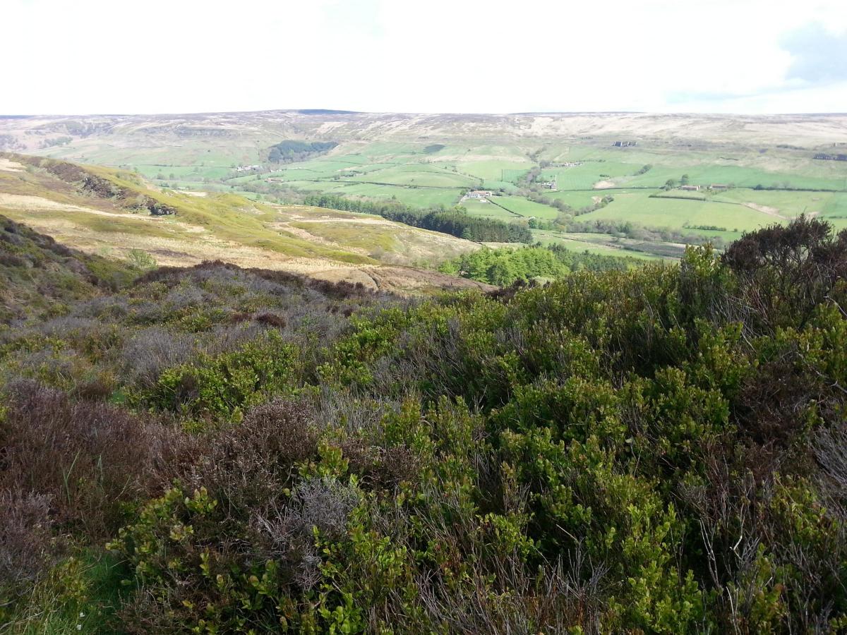
Walking on the bed of the old railway affords incredible views across the verdant valley and onto the bleak, contrasting moors beyond.
After looping around Thorgill Head, the way approaches the old mine shaft of Sheriff's Pit, marked by the lonely remains of the corner of a building.
Our first tea stop is above High House Farm, from where much of the remainder of the walk is laid out before you, right round to the kiln arches of the east mines and back down to Rosedale Abbey.
The only movement 300 feet below is the Royal Mail post van delivering around the peaceful dale, making it even harder to picture the hustle and bustle of the 1860s mining era.
It is possible to cut your walk in half here by descending Round Hill and crossing the dale to Craven Garth Farm and Hill Cottages.
But our thoughts are already turning to a detour to the Lion Inn at Blakey, the remote 16th century pub that occupies the highest point on the North York Moors.
My only previous visit to the Lion Inn was at the tail-end of Wainwright's Coast to Coast walk in 2011, when the high winds lashing the camping field led to 15 walkers pitching their tents in the compact beer garden.
The welcome was just as warm on this occasion, although we only stayed for a cup of tea and a Copper Dragon rather than the night.
Getting back on track, as it were, the spin around Dale Head reveals the scale of embankment work involved in creating the ironstone railway.
This section of the walk is littered with mining landmarks, with the last remaining corner of Black House, complete with fireplace and chimney, giving way to the huge crumbling arches of the East Mines' kilns.
Leaving the railway behind, via one of the last remaining depot buildings, the walk ends with a delightful amble alongside the early meanderings of the River Seven.
The route back into the village takes us past the easy-to-miss remains of the 12th century Cistercian priory that gave Rosedale Abbey its name.
Now, having clocked up a dozen miles, you may be reluctant to tackle another uphill excursion.
However, a few hundred yards up the road towards Chimney Bank is the White Horse Farm Inn and surely one of the best beer garden views in the country.
The Rosedale panorama laid out before you is the perfect end to one of North Yorkshire's finest walks.
FACTFILE
Distance: 12 miles.
Parking: Roadside in Rosedale Abbey.
Refreshments: Rosedale Abbey and (with a detour) the Lion Inn at Blakey.
Maps: Ordnance Survey OL 26 North York Moors Western area.
ROUTE DETAILS
* Leave Rosedale Abbey on Pickering road, turn right opposite Coach House Inn, cross bridge and, as road bends left, take path straight ahead at right-hand side of a house. Go straight ahead across field before crossing a road onto Red House Golf Course. Keep the buildings on the right to follow waymarks through course before turning left and heading uphill through gorse.
* A grooved path climbs to the right of Bank Top cottages, where the drive takes you up to the trackbed of the railway (1). Turn right and follow the railway for about five miles (at point 2, a path on the right drops down across the valley floor to cut short the walk) (at point 3, a short signposted detour takes you to the Lion Inn at Blakey) before the path becomes boggy as it passes around Dale Head. Follow the trackbed for another two miles.
* The path passes the remains of the ironstone kiln arches (4) and swings left then right around one of the last remaining depot buildings to reach a gate. A track takes you downhill to Hill Cottages. Cross the road and follow footpath ahead.
* Go through a gate and walk along the right-hand edge of a field. The path swings left to a gate on the right. Go through and walk straight ahead across fields to meet a stone paved path.
* At the bottom (5), ignore footbridge ahead and turn left to follow River Seven. When track moves away from river, take path on right to stay parallel to river. Walk across fields with river on right until you meet a road through caravan park. Look for path on left to leave caravan park and walk through churchyard to return to Rosedale Abbey.


Comments: Our rules
We want our comments to be a lively and valuable part of our community - a place where readers can debate and engage with the most important local issues. The ability to comment on our stories is a privilege, not a right, however, and that privilege may be withdrawn if it is abused or misused.
Please report any comments that break our rules.
Read the rules hereLast Updated:
Report this comment Cancel