
GEORGE WILKINSON takes a short but picturesque and rewarding walk at Levisham on the North York Moors.
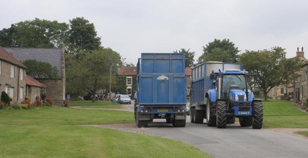
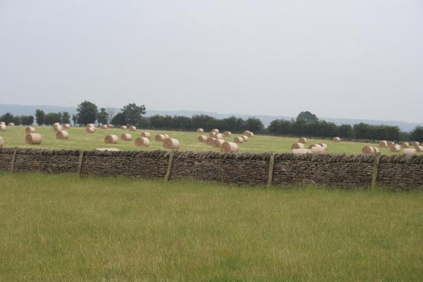
LEVISHAM reminded me of that slogan ‘Eat the View’. Huge shiny tractors rumbled back and forth, pulling big box trailers in blue and red. We had hit a harvest.
And you can certainly eat round here. The delicious Horseshoe Inn sits at the top of the single street, overlooking the church, the old houses and the wide manicured greens. A Ginger Pig lorry rumbled out, maybe to one of their six London butchers. Quite something in a tiny village on the edge of the North York Moors, out of the way and at the end of the road.
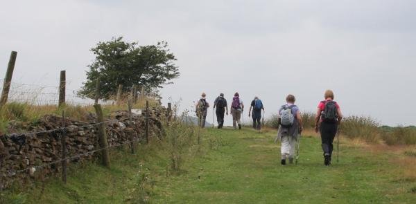
We had Co-op sandwiches, for ‘flexibility’ said my navigator. But really you should indulge, walk the delightful lanes with wild flowers, dry stone walls and a pretty variety of little fields each side.
The further part of this walk is over Levisham Moor, and then a sweep down to the purple heather over Levisham Bottoms.
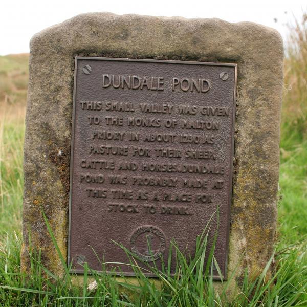
On the bottoms, perched on the edge of the valley, stands Skelton Tower that was built in around 1830 by the Levisham rector as "overnight lodgings after a day’s shooting".
The jagged ruin caught the eye of a family from Kent, out and pedalling their mountain bikes ad lib, free ranging. They sped down to the tower, though mother held back, and then the males bravely scaled the ruins while down in the valley a steam train chugged by. The mother watched, and said ‘adult?’
This is an easygoing moor, owned by the National Park Authority; it’s tended, but the regime is not so harsh as with a commercial grouse moor.
Sheltered by the brow there are three pillow mounds, shapes of grass, that are scheduled ancient monuments, being medieval and made for the breeding of rabbits.
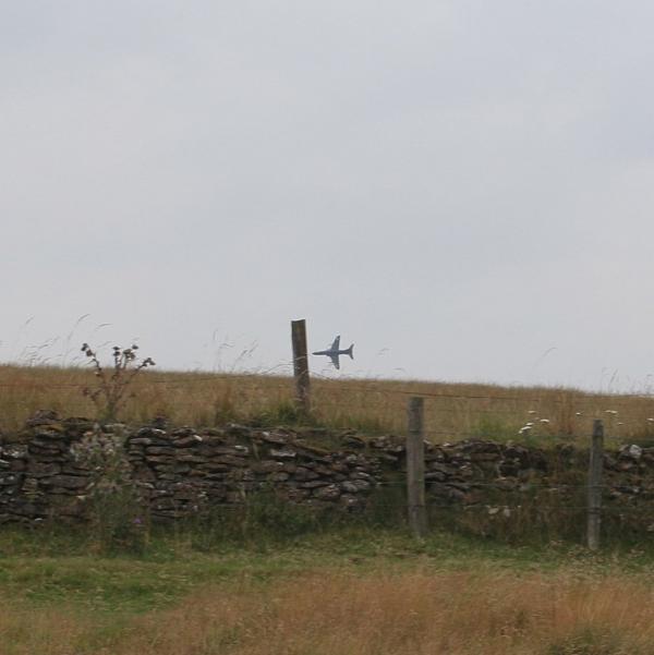
We saw a hare, sheep, a military jet and a crow. That is until my navigator, a childhood rabbit fan, suggested a route around the mounds.
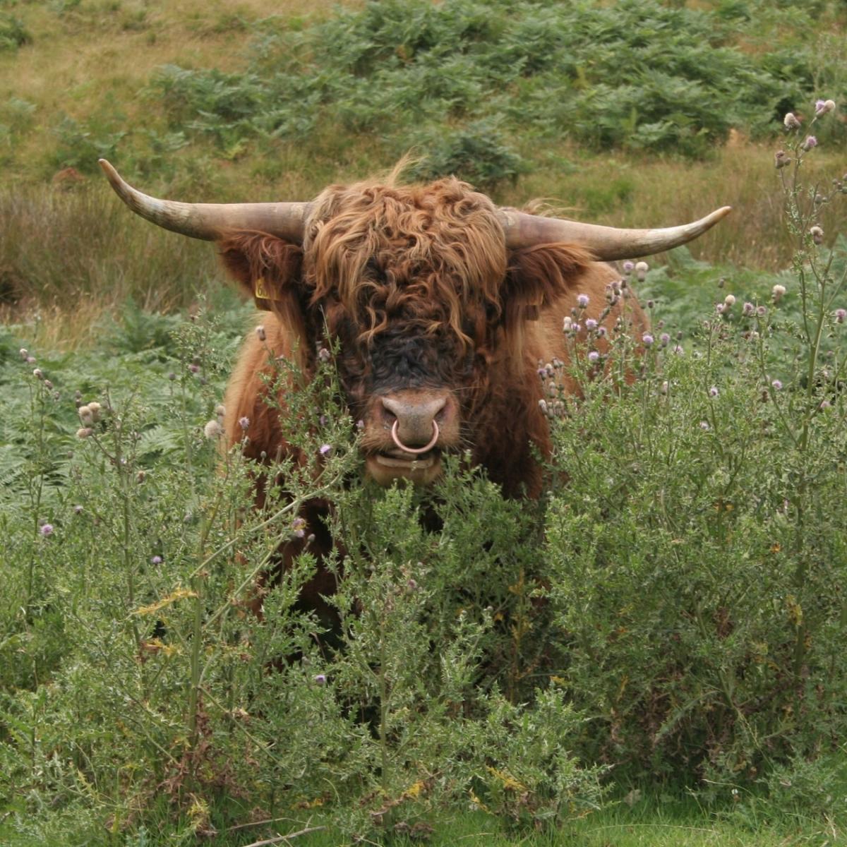
As we investigated we came across a herd of shaggy highland cattle, long, sharp horns, low fat flesh and all. The bull, calf and cows had occupied a car park. Immoveable hulks but seemingly benign, they responded to us with dozy nonchalance.
Directions
When in doubt look at the map. Check your position at each point. Keep straight on unless otherwise directed. (wm=waymark, fp=fingerpost).
1. Up Levisham’s main street. At inn, fork right to road (dead-end sign), becomes track.
2. Fieldgate (infoboard) to moor, sunken path downhill (fp Saltergate 3 miles).
3. Path on left at pond (five-way fp Levisham Station), becomes uphill.
4. At wall corner, EITHER left for grassy track then lane back to Levisham (four-way fp, bridleway, wm), OR right to grass track across moor, crest hill, downhill.
5. Cross grass path/track, path 200 yards to tower, retrace steps 200 yards, right to path/track for half a mile on the flat, fork left (three-way fingerpost bridleway) to path diagonally uphill for 300 yards, straight on at top and pick up field wall to right for 200 yards.
4. Right at wall corner (four-way fp, bridleway, wm) to grassy track, wall to your right. Fieldgate, join track then road to Levisham.
Fact File
Distance: Four or 2½ miles.
Car parking: Roadside in Levisham.
Right of way: Public paths and Open Access.
Date walked: July 2014.
Tourist information: Pickering TIC 01751 473791.
Refreshments: The Horseshoe Inn at Levisham.
Map: OS Explorer OL27 North York Moors eastern area.
Terrain: Moor and lanes.
Difficulty: Easy or moderate.
Please observe the Country Code and park sensibly. While every effort is made to provide accurate information, walkers set out at their own risk.


Comments: Our rules
We want our comments to be a lively and valuable part of our community - a place where readers can debate and engage with the most important local issues. The ability to comment on our stories is a privilege, not a right, however, and that privilege may be withdrawn if it is abused or misused.
Please report any comments that break our rules.
Read the rules here