
GEORGE WILKINSON enjoys a walk with more than one interesting corner.
SQUARE Corner sits nicely on the edge of the moors. Near its car park there is a slope of land that has been named Middlesbrough since the nineteenth century.
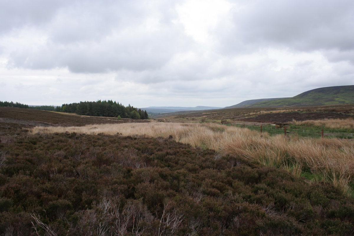
Looking further out, on a clearish day, there’s a wedge of the Vale of York. Closest though is the smooth solid mass of Black Hambleton, rearing out of the moor.
We did not charge up this, in deference to any stomachs just filled at Osmotherley; and actually, the whole walk is a bit of a glide, at an airy thousand foot.
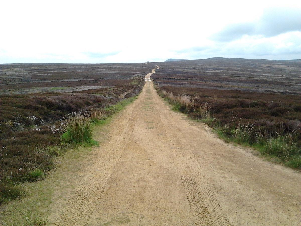
The first mile is on the road and is a pleasure, this being a classic moorland open road with no walls, no hedges, and smooth turf verges. Bill Cowley, in his book Snilesworth, states that it was not surfaced until 1940. There is very little modern traffic because further on it’s a tricky drive, tight and twisty.
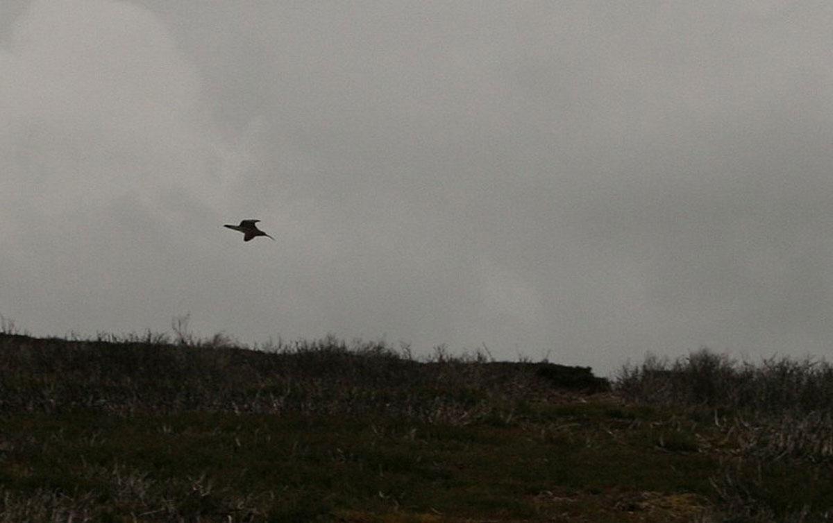
The real treat of the day was the birdsong. We have spent the spring walking in woods with an orchestra or a chaos of songbirds. Here were solo performers, isolated in the empty space.
The stars were the big curlews, the only birds in the sky, coming in on shallow glides, their voices pure and liquid, fluty to fierce.
The golden plovers bleeped plaintive pulses of sound across the moor, but otherwise they didn't put up much of a show, their prettiness blended with the heather.
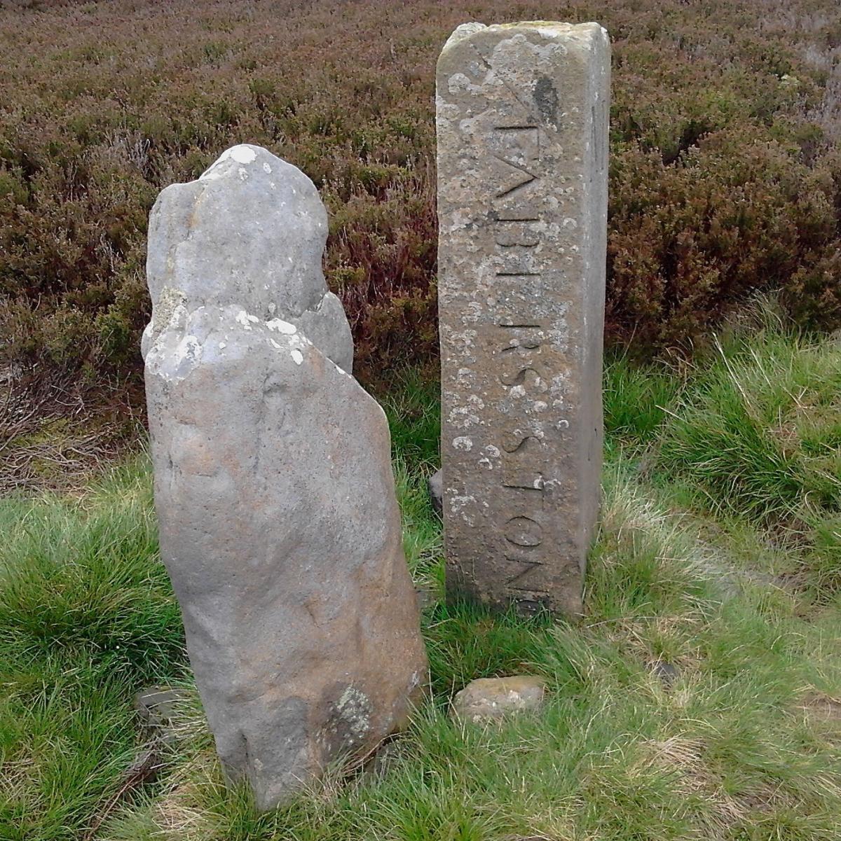
This is a walk with more than one interesting corner. Faber’s Stone stands near the most northern and an intriguing little wood with a Walkers Welcome Sign clusters around another. A redundant ‘No Entry’ sign is at one junction and there is a rush-fringed pond, which had ducks, at the crossover of the walk.
From here you can stroll back down the road, but the route we suggest is hardly more effort because the footpath was a mown strip through the heather. So, it’s a smooth contour under the lower slopes of Black Hambleton with the cachet of a little bit of the Cleveland Way.
Directions
When in doubt look at the map. Check your position at each point. Keep straight on unless otherwise directed.
1. Right from Square Corner car park (info board) to road.
2. Near far end of woods, grass/dirt track on left between trees, uphill, barrier gate. Good stone track.
3. Left at main track junction on moor.
4. Left at main track junction on moor.
5. Right to road, 100 yards, track on left (bridleway sign).
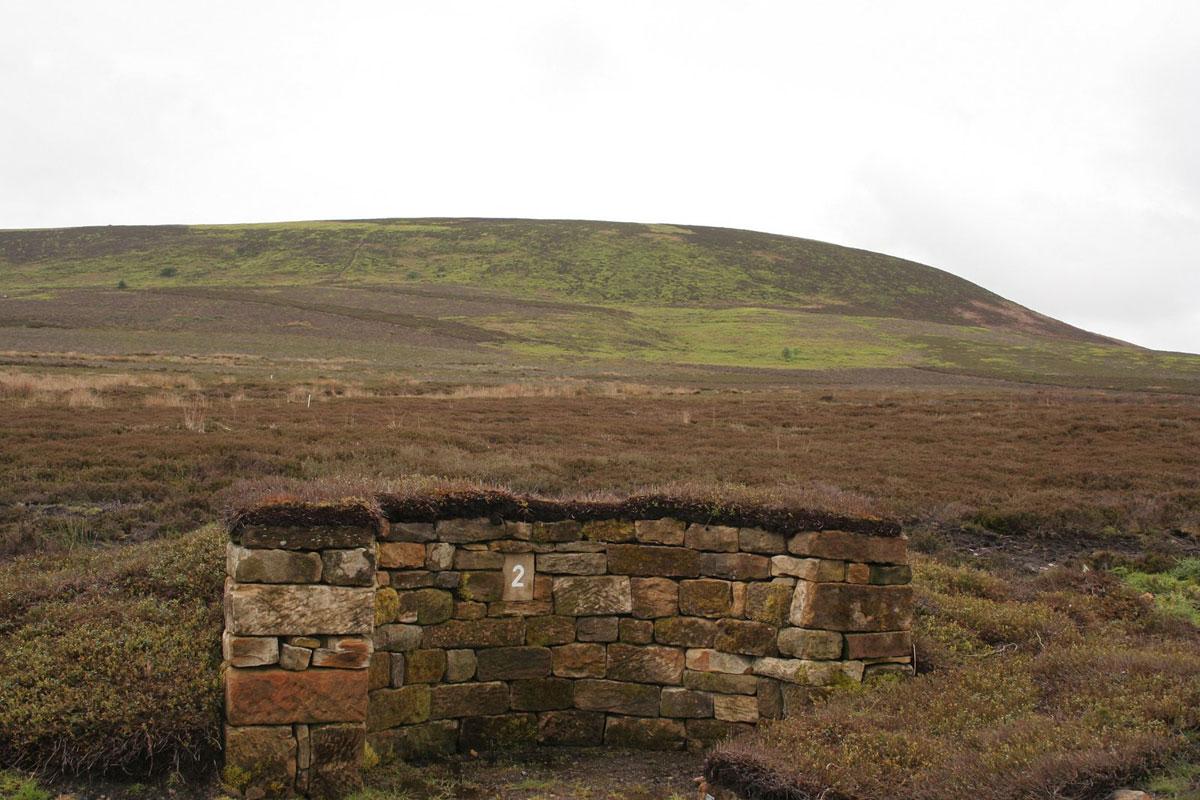
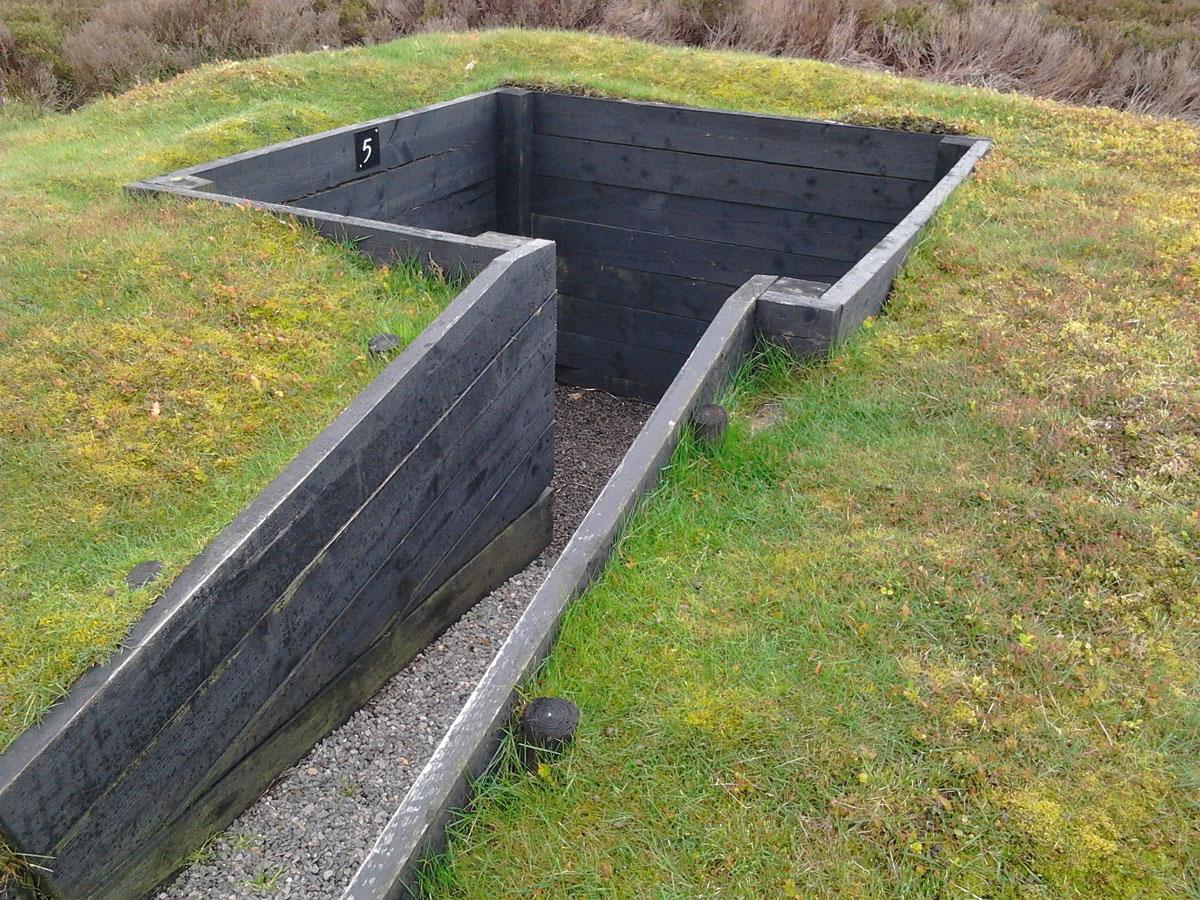
6. Fieldgate, immediately right, by fence to right for 50 yards, from between grouse butts 1 and 2, left to mown strip across heather, aim for the conifers.
7. Right to main track to car park.
Fact File
Distance: Five miles.
Car parking: Free car park.
Right of way: Public and open access.
Date walked: May 2014.
Tourist information: Thirsk TIC 01845 522755.
Refreshments: Osmotherley.
Map: OS Explorer OL 26 North York Moors western.
Terrain: Moor.
Difficulty: Quite easy.
Please observe the Country Code and park sensibly. While every effort is made to provide accurate information, walkers set out at their own risk.


Comments: Our rules
We want our comments to be a lively and valuable part of our community - a place where readers can debate and engage with the most important local issues. The ability to comment on our stories is a privilege, not a right, however, and that privilege may be withdrawn if it is abused or misused.
Please report any comments that break our rules.
Read the rules here