
George Wilkinson enjoys an easy amble around Boroughbridge.
BOROUGHBRIDGE has the most formidable Devil’s Arrows, the prehistoric spears of stone that stand nearly as tall as trees, by the A1(M), by the Great North Road. It also has a free all-day car park.
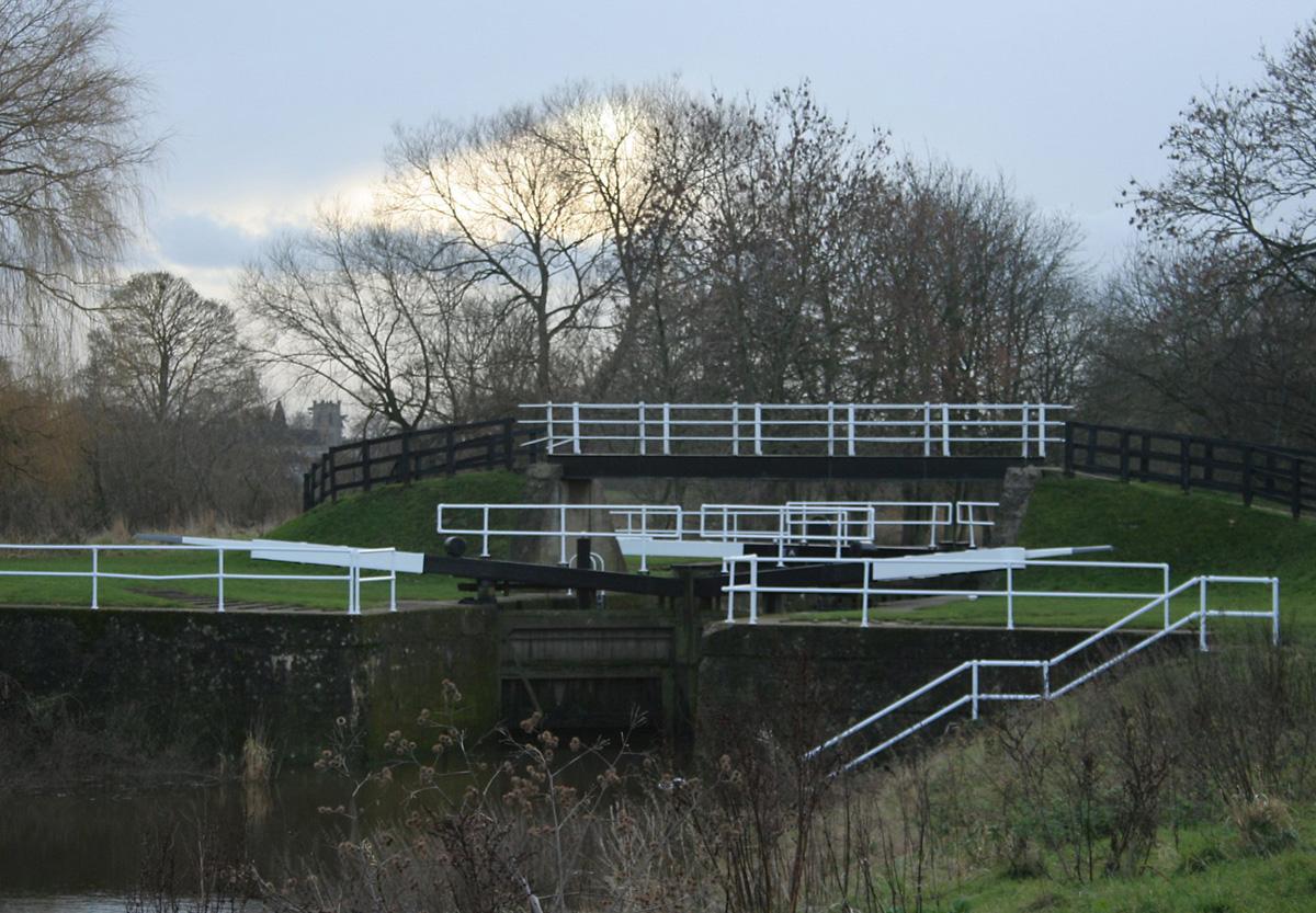
Elevated, we walked out of Boroughbridge by a pretty square, crossed the River Ure, crossed a canal at a black and white painted lock and headed up to Kirby Hill to avoid a busy road; it’s no more than a rise in the flattest of land.
This set us up for Ellenthorpe Lane and the first length of easy ambling. The view was to the north-east, ten miles across the plains to the escarpment of the North York Moors where the White Horse at Kilburn was clear.
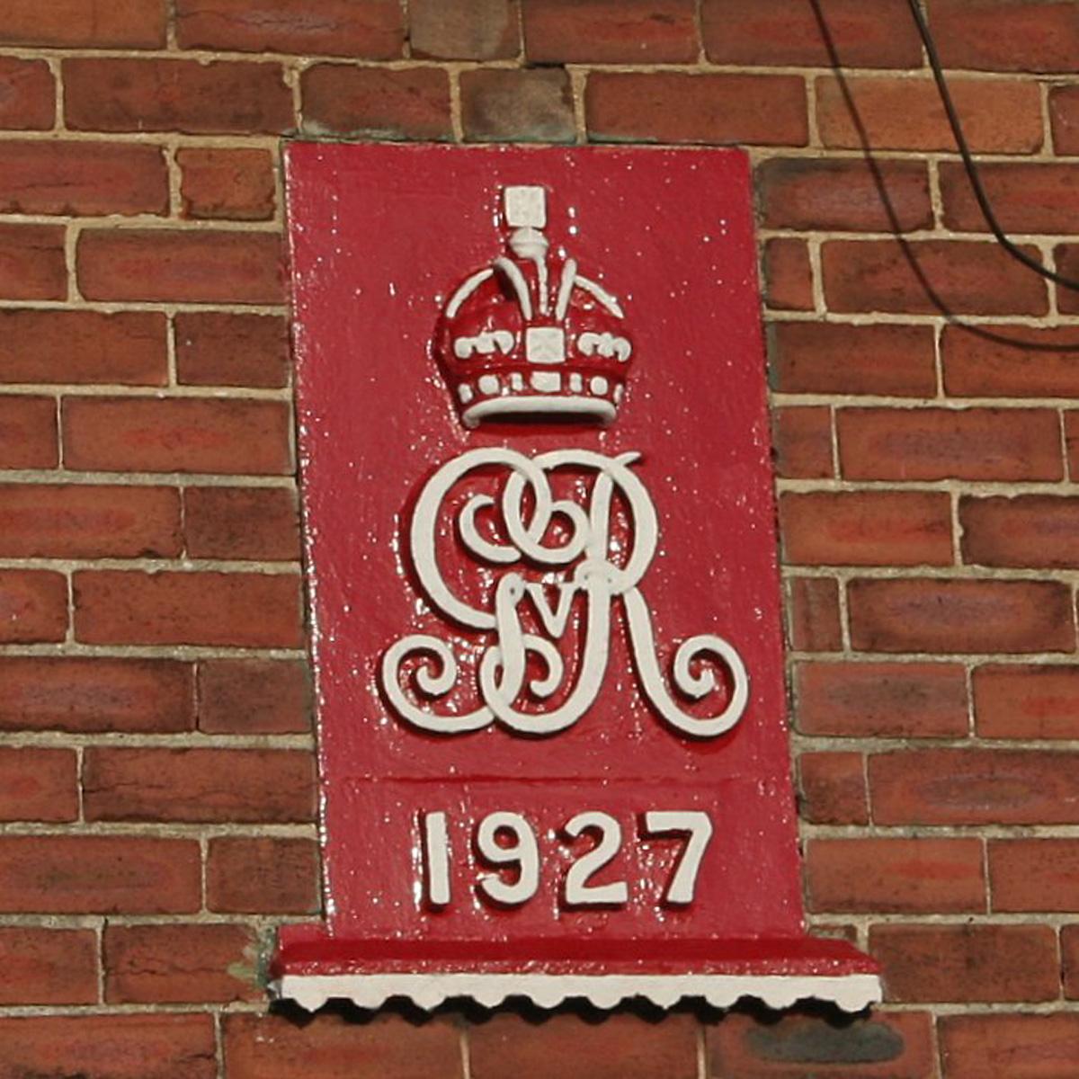
The traffic became agricultural, the lane remained metalled, and we wondered about its green lane status. And then there was a red post box, a sign reading ‘The Crown Estate’ and at Clott House Farm a red crown on a 1927 house.
At a guess, the Queen is probably not best pleased with the next fields where, at the Battle of Myton in 1319, a hardened Scottish Army destroyed the Bishop of York’s ‘curious’ army of 20,000 clerics, townspeople, peasants/farmers, choristers even. There is a bench dedicated to Karl Briggs, the cyclist.
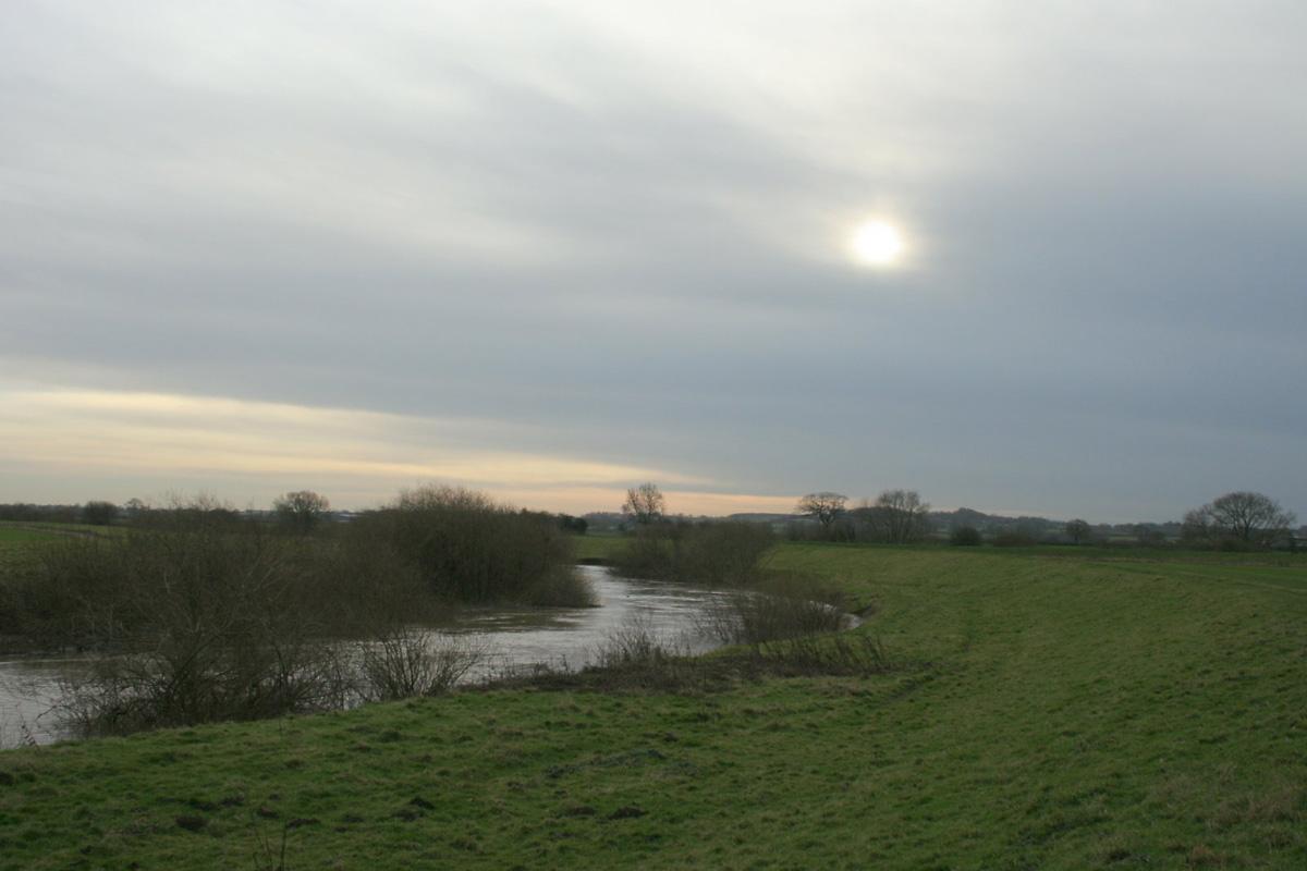
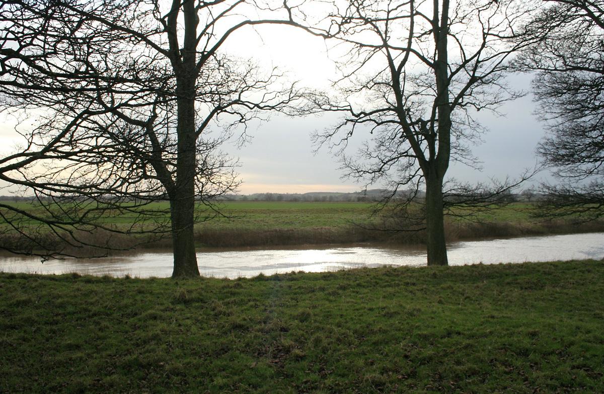
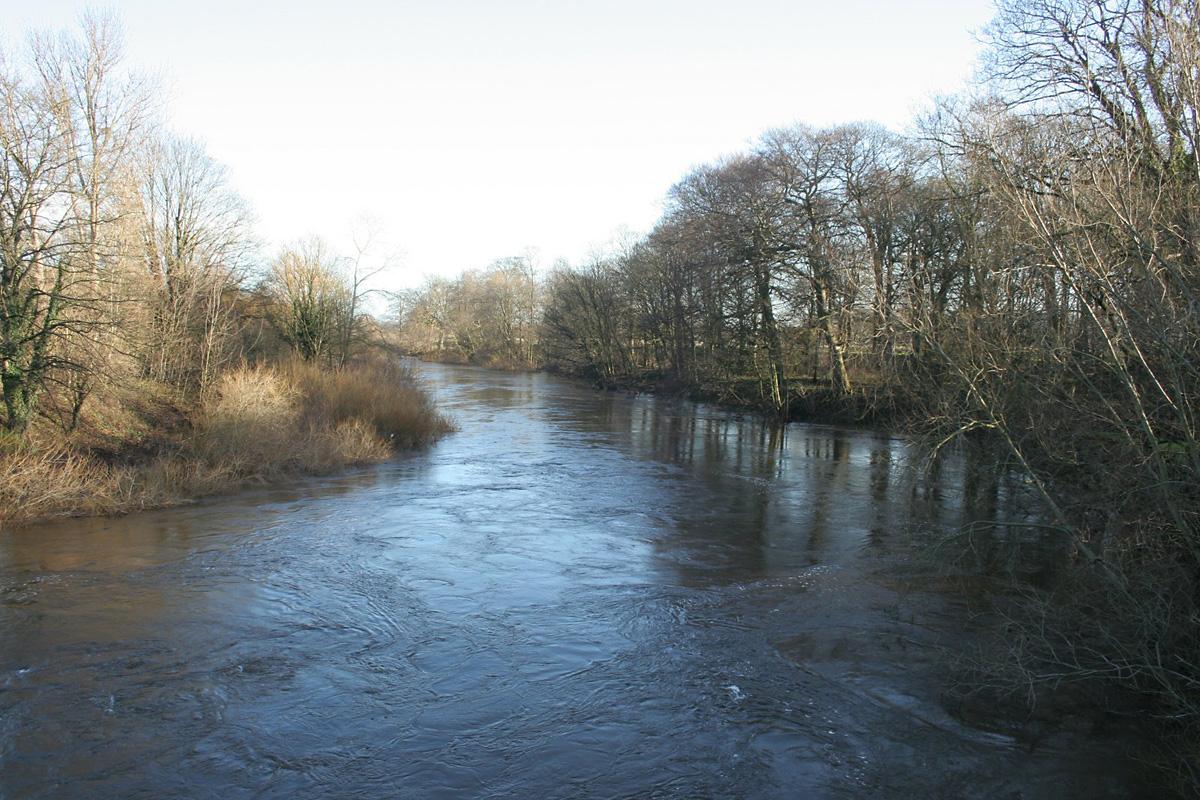
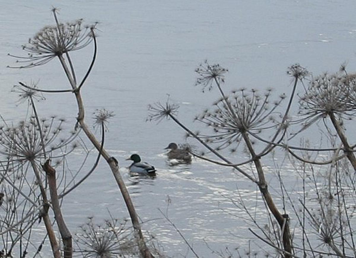
Then it was all riverside, urgent rivers in a peaceful landscape. First the Swale that was powerful and muddy and, after the confluence, the Ure that was similar. We settled into a rhythm, kept moving, kept warm. The grassy flood bank path was quite clean.
Waterfowl shuffled among the submerged willows, a languid grey heron moved away, jackdaws lifted in a swirling, chatty cloud, and the sun hung low. A predator wafted over the fields; we had seen owl boxes.
It’s a long river back, along Long Bank, and especially when you’re swept into reverse by the wide curve of Hall Arm where Ellenthorpe Hall is tight to the river. Over the Ure, hardly visible, is Aldborough, the Roman town and before that an HQ of the Brigantes tribe. It was about here, about a mile out, that we registered again the low hum of the six lanes of the A1(M).
Directions
When in doubt look at the map. Check your position at each point. Keep straight on unless otherwise directed. (wm=waymark, fp=fingerpost).
1. From car park, straight on to Fishergate, right at T-junction to Horsefair, over River Ure and immediately path on right (no sign). Squeezer/gate (signs), fork left to path by canal.
2. Bridge over canal at lock and right, grass track swings left, stile, track, lane.
3. Milby. Turn right to short-cut on busier road. Or, cross road, metalled green lane through Grange Farm, track, muddy for few hundred yards, grass track/path gently uphill.
4. Right to road, 100 yards, right to road downhill (Helperby 4), some verge. Straight on at junction, 100 yards, straight on to dead-end lane (Ellenthorpe 1).
5. Straight on through farm (private road sign), gate to track (wm on wall), 2 waymarked posts, through trees, gate (wm) 20 yards, track by trees (fp). Track swings right at field corner, gap to hedged track.
6. Before bridge, squeezer on right to floodbank path, snickelgate, stile.
7. At bit of fence, just before floodbank ends, left to ‘path’ below farm, 3 stiles. Rejoin outward route.
Fact file
Distance: Eight miles.
Car parking: Free Back Lane Car park.
Right of way: Public paths.
Date walked: December 2013.
Refreshments: Boroughbridge.
Tourist information: Boroughbridge Tourist Information Point.
Map: OS Explorer 299 Ripon and Boroughbridge.
Terrain: Flat.
Difficulty: Moderate.
• Please observe the Country Code and park sensibly. While every effort is made to provide accurate information, walkers set out at their own risk.


Comments: Our rules
We want our comments to be a lively and valuable part of our community - a place where readers can debate and engage with the most important local issues. The ability to comment on our stories is a privilege, not a right, however, and that privilege may be withdrawn if it is abused or misused.
Please report any comments that break our rules.
Read the rules hereComments are closed on this article