

GEORGE WILKINSON reports back on the first of two walks at Grinton in the Dales.
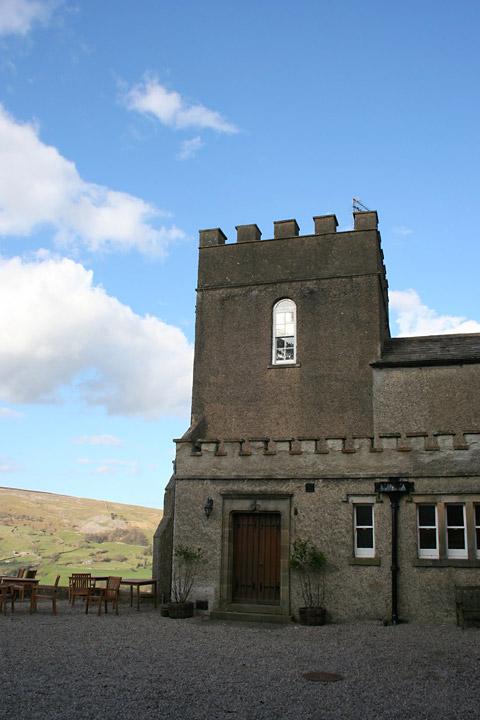
GRINTON is a tiny place with a big church. St Andrew's is called the 'Cathedral of the Dales' and is at the end of Swaledale’s Corpse Way. Otherwise, you will find the Bridge Arms and a WC. Half a mile up the hill stands Grinton Lodge, a youth hostel, more on this later.
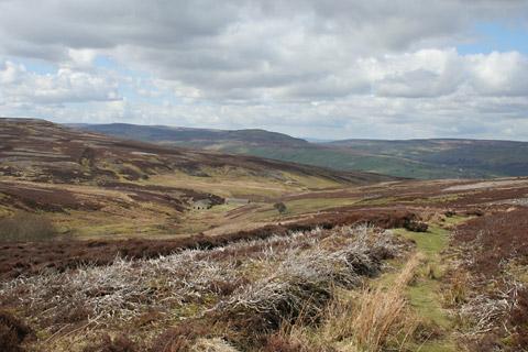
We started at a nearby car park and then shuffled between back lanes and moor for a while, climbing, slower than a smooth road cyclist, slower than a gyrating mountain biker, and the only other traffic was of farmers ferrying sheep, a National Park Ranger’s van and a Yorkshire Water one.
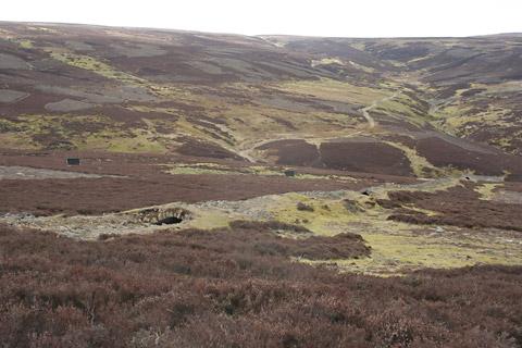
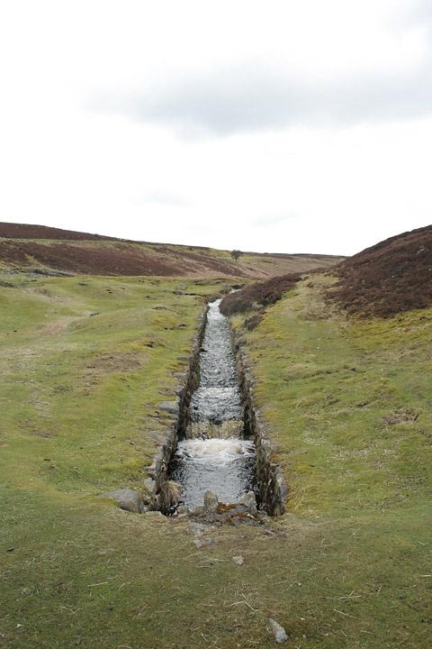
A little higher is the Grinton Lead Smelt Mill which is well preserved and nicely situated. Along with the stone buildings, there’s a water race that powered bellows and a ground level flue 1,000 feet long for the fumes and smoke.
An information board states that collecting lead deposits from the flue was a horrible job, but the whole lead operation was tough and unpleasant and it damaged the environment most obviously in the hushes, where soil and rock was flushed from the lead ore by engineered floods, resulting in the rough gashes in the fellside.
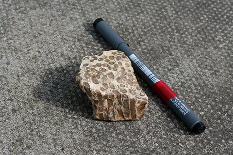
Another little climb, along Lemon Gill, brought our top point at 1,200 feet and at a junction a sandwich stop. Snagged in the heather, tied to a tattered balloon, were the thoughts of a ten-year-old girl from Hastings Academy of Sunderland. She hoped to become a DJ and reminded the finder that “the skys the limit”. Nearby lay a nice fossil of coral, as tubes of shiny olive-green aragonite set in beige limestone, from the days of warm seas of millions of years ago.
These days, the thin, straight, unsigned, bridleway to Sharrow Hill and Cogden Moor has rather vanished in the patchwork heather. A single bearing, off the OS map and to a patch of Fremington Edge, brought us smoothly to the top end of the lead flue.
Mid-afternoon rabbits dived for their holes, lapwings wheeled down to pretend nest sites and we jinked round a limestone scar and lead mine arches. Near here, if you are ‘right to roaming’, there is an immediate view. Reeth was visible. A shepherd on a quad bike and his pillion sheepdog checked the flocks on the valley pastures and we took a turn through Cogden Hall, a garlic wood and a small valley. Then the youth hostel loomed.
We checked in, and were upgraded to the tower owing to the imminent arrival of a school party from Hartlepool, so were well set for the morning and a longer hike.
• George will return to Grinton in two weeks
Directions
When in doubt look at the map. Check your position at each point. Keep straight on unless otherwise directed.
1. From parking area near cattlegrid and bench (junction of Reeth/Leyburn road, signed Redmire 5 (Grid Ref: SE 046977), uphill on Redmire road (verge). Ignore bridleway on left.
2. Track on left (fingerpost bridleway) through shallow valley. Fork right to path for last 200 yards to road. Right to road, over bridge, ignore track after 50 yards, uphill another 50 yards.
3. Track on right (bridleway sign Grinton Moor). Pass mine buildings and continue on track uphill. Ignore a right turn downhill and continue on track through heather.
4. Where track splits there is a lesser grass track cutting back on the left marked by a handful of stones. For 500 yards approximately contour, aiming a little west of north, we used 353 degrees magnetic. Thin path through heather disappears, head for the top of the flue (cairn nearby). Take care, rock face and shafts nearby.
5. From top end of flue, left to path downhill for 50 yards gradually angling away from flue, then swing right to grass path immediately below rock face and also above three arches of mine stonework. Twenty feet diagonally down a bank and right to grass track.
6. Cross road to track (fingerpost), 400 yards, fieldgate, track ahead downhill for 400 yards, track curves right, old fieldgate, fieldgate, track loops left, fieldgate into farmyard.
7. Left at T-junction out of farm to track/ farm drive, bridge over Cogden Beck and immediately gate on left (waymark) to path uphill through woods. Two step-squeezers and keep to left of wall on faint path along top of valley side.
8. Path blocked by thorns so, at a kink in the wall, gated squeezer on right and left by wall for 150 yards, short length of duckboards and immediately gated squeezer, right by wall for 20 yards, over stream and keep by wall and stream for 200 yards, path leaves stream. Left at road, 50 yards uphill to car park.
Fact file
Distance: Four miles.
General location: Yorkshire Dales.
Start: Near Grinton.
Right of way: Public.
Dogs: Legal.
Date walked: April 2013.
Car parking: Free carpark area at road junction.
Lavatories: Grinton.
Refreshments: Bridge Inn at Grinton. Inns and cafés at Reeth.
Tourist information: Reeth TIC 01748 884059.
Map: OS Explorer OL30 Yorkshire Dales northern and central.
Terrain: Moor.
Difficulty: Moderate if fine.
Please observe the Country Code and park sensibly.
• While every effort is made to provide accurate information, walkers set out at their own risk.


Comments: Our rules
We want our comments to be a lively and valuable part of our community - a place where readers can debate and engage with the most important local issues. The ability to comment on our stories is a privilege, not a right, however, and that privilege may be withdrawn if it is abused or misused.
Please report any comments that break our rules.
Read the rules hereComments are closed on this article