
George Wilkinson finds that an easy walk across Strensall Common offers many great pleasures.
STRENSALL Common was bought by the war department in the 1870s and the Army has preserved it. Now it’s a rare thing, very rare in the north, though once widespread over the Vale of York, a good big patch of 1,500 acres of sandy lowland heath and mire.
Locals were out and about, from York, no doubt, and a girl raised pink binoculars. The nonchalant car-park talk was of adders sunning themselves in the spring sunshine.
We seemed the only ignorant strangers with rucksacks. Only we read all the info boards, and then, although we knew where we couldn’t go, for example the grenade range, still we were vague about our route.
A man showed the scar of an adder bite on his whippet’s jaw and all the while, the intermittent and muffled sound of Sunday gunfire came from the centre of the common. We headed for the edge and soon met a photographer looking for a hungry daytime fox.
He told us of a barn owl on a caravan park and he pointed to a good way through the Yorkshire Wildlife Trust woods, avoiding boggy bits or upsetting a great crested newt.
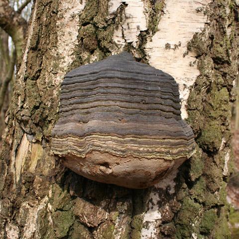
In the woods large tinder fungi grow on the birch trees, and from the woods was the afternoon’s only significant outward view, north across the fields to Sheriff Hutton Castle showing three of its gaunt towers.
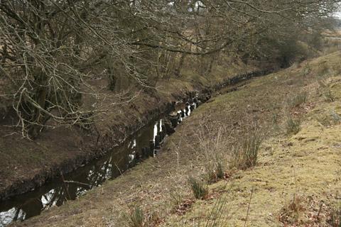
At the far northeast corner of the common we found the perimeter dyke and were forced to double back to Common Road Crossing where the road and railway line touch, and for a minute watched the cyclists swish past.
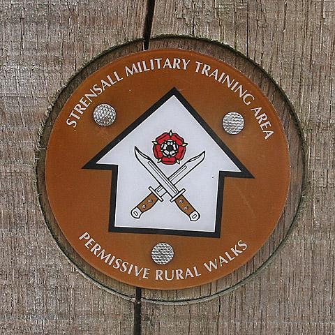
That was the last busy moment, from now on there was one person per mile, and from each we garnered knowledge and part navigated by this and were also sternly reassured by waymark posts that bore the words ‘permissive rural walk’ on a badge of crossed bayonets and a red rose.
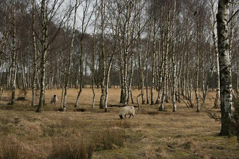
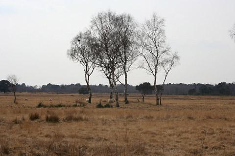
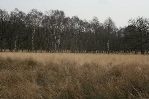
Sanctuary, the MOD conservation magazine, had an article titled “The Uncommonly Dark Beauty of Strensall Common”, this is a moth. Everywhere, as far as we could see, this zone of the common looked beautiful, gorgeous, unfenced, flat and flooded with light, soft gold to the farthest silver edges, the gold in the tall grasses and the silver on the birch.
Some dry areas are darker with heather. Wet areas are seas of reed and rush. Sheep vanished into the tall vegetation, buzzards circled high and a bird of prey drifted out of a tree; it is ever so interesting.
As we cut across the common, and weren’t far from the car park, I remembered about the grenade range and asked my navigator where it was. “Behind the birch,” she said.
Directions
When in doubt look at the map. Check your position at each point. Keep straight on unless otherwise directed.
1. From car park (Public Car Park sign) opposite gated house ‘The Haven’, right to road, 100 yards. Track on left (Nature Reserve sign).
2. Cross gated railway line with care, track 100 yards, snickelgate on right to path through wood.
3. Ignore snickelgate to track and info board, through the next snickelgate and right to path through trees.
4. Right to track, 25 yards, left to short path through trees, right at drainage ditch/stream for 100 yards, right to track.
5. Cross gated railway line with care, immediately left to path by fenced railway line.
6. At dog stile/low fence, right to grassy path by drainage ditch/stream. Gate, 100 yards.
7. Cross road and left to path behind the road barrier. Stile, path through trees (some red waymarks and troops training signs) then by the stream.
8. Right at corner by bridge to path (waymark), stay near woods to your left.
9. At fieldgate on left into Forestry Commission woods, take path on right (waymark), becomes track, ignore left forks.
10. Left to surfaced path.
Fact file
Distance: Four miles.
General location: Near York.
Start: Car park, signs.
Right of way: Permissive paths.
Dogs: Legal.
Date walked: April 2013.
Car parking: Free.
Lavatories: None.
Refreshments: Strensall.
Tourist information: York Visitor Information Centre (Phone: 01904 550099). Map: OS Explorer 300 Howardian Hills and Malton.
Terrain: Flat.
Difficulty: Easy.
• Please observe the Country Code and park sensibly. While every effort is made to provide accurate information, walkers set out at their own risk.


Comments: Our rules
We want our comments to be a lively and valuable part of our community - a place where readers can debate and engage with the most important local issues. The ability to comment on our stories is a privilege, not a right, however, and that privilege may be withdrawn if it is abused or misused.
Please report any comments that break our rules.
Read the rules hereComments are closed on this article