

George Wilkinson leaves the road noise behind on a tranquil stroll beside the gently flowing water.
Roecliffe has an award-winning pub and old brick charm. A driver stopped by the crocus green, jumped out and vigorously kicked his vehicle.
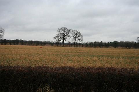
Tranquillity returned, albeit under the soft hum of A1 motorway a mile behind us.
A village sign showed a walk route and we set off past a graveyard for our version of the Roecliffe Ramble.
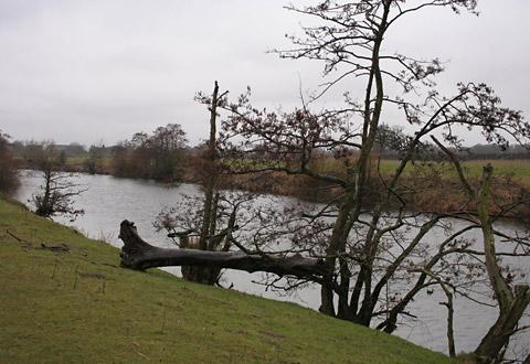
The River Ure curved through the rather flat washlands, running wide, silent and unruffled and to all appearance and to quote the village board, ‘‘a gently flowing river’’.
But clearly not always gentle, as a tidemark of flood branches lay 50 yards distance on the pasture and crack willows lay broken all along the banks, their boughs ready for the next flood to sweep them down until they wedge and root. Some alders and pussy willow flowered.
We made good time, only having to break stride for little bridges over side streams of dirty run-off from field channels. For a mile of the riverbank there was no one about, it rained, but the sound of the motorway was long gone.
Cherry Island Wood sports some unmistakeable very tall stalks of toxic giant hogweed – don’t touch these. Three oystercatchers zoomed downriver, now and then a heron swept across the sky and along chugged a narrow boat.
And in these woods we met a woman who told us there was beagling on the far bank. Her dog control was very neat. So we watched and waited. Soon there was the excited, high-pitched yelping of the beagle pack and a glimpse of the scurrying hounds.
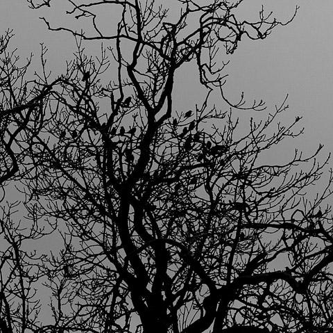
A little further upstream is Westwick Lock which takes boats around a weir via a cut. The official Roecliffe Ramble goes that way as far as a view of Newby Hall. But instead we took a back lane that was very smoothly repaired and saw some crows standing, perhaps for warmth, on a huge steaming pile of dung. Freestanding trees were hubs for lively flocks – one held starlings – and a cyclist swished by.
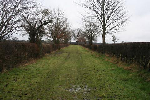
That brought us to Sheaflands Lane track that is grassy, neatly hedged and 40ft wide. It runs past Roecliffe Grange. A smooth farm drive took us on and then, after a little wood, we were back in Roecliffe. There is a festival of walks hereabouts from March 30 to April 6.
Directions
When in doubt look at the map. Check your position at each point. Keep straight on unless otherwise directed.
1. From village green, by info board between benches (fingerpost Westwick Lock), snickelgate to path between graveyard and metalled drive, join track.
2. Into yard and immediately right, 25 yards, fieldgate (waymark), 11 o’clock across field. Left to riverside path, (seven stiles, footbridges, some waymarks), through wood, fields.
3. At Westwick Lock, cross grass to small parking area, cattlegrid, immediately left, track.
4. Left to road, some verge.
5. Fieldgate on left (fingerpost, bridleway) and grassy hedged path. At field corner, metal gate (white arrow) to path along top edge of wood, fieldgate to wide grass track, metalled drive from farm. About 50 yards before road, path on left to paths around pond and through trees back to village.
Fact file
Distance: Four miles.
General location: Vale of York.
Start: Roecliffe.
Right of way: Public paths.
Date walked: March 2013.
Road route: Various.
Car parking: Roadside in Roecliffe.
Lavatories: None.
Refreshments: Crown Inn, Roecliffe.
Tourist & Public Transport Information: Boroughbridge TIC 01423 322956.
Map: Drawn from OS Explorer 299 Ripon and Boroughbridge.
Terrain: Riverside.
Difficulty: Easy.
• Please observe the Country Code and park sensibly. While every effort is made to provide accurate information, walkers set out at their own risk.


Comments: Our rules
We want our comments to be a lively and valuable part of our community - a place where readers can debate and engage with the most important local issues. The ability to comment on our stories is a privilege, not a right, however, and that privilege may be withdrawn if it is abused or misused.
Please report any comments that break our rules.
Read the rules here