

GREAT Whernside is one of a quartet of mountains that circle the northern end of Wharfedale. They are all part of the ‘Dales 30’, mountains of over 2,000 feet in the Yorkshire Dales. Great Whernside is climbed from the attractive village of Kettlewell. The best route up the mountain is direct but the descent should be varied by heading north on to the flanks of Buckden Pike and the delightful descent down the Top Mere ‘Road’.
Kettlewell is nestled under Great Whernside (definitely its mountain) and set on the east side of the River Wharfe. The majority of the attractive stone buildings are clustered around the old coach road linking Wharfedale to Coverdale and further north and has three pubs, two cafes and some quirky shops full of character. There is a large pay and display car park near the road bridge which marks the start of the walk. From here walk up the road with the Blue Bell on your left and Zarinas café on the right and as you approach the sharp bend of the road carry straight on and cross a small bridge over Cam Gill Beck.
Turn left on a farm track having crossed the road and after 200m a right turn heads up the mountainside. This is where the hard graft starts. The path is direct over some fields, through stone walls and on to one of the broad shoulders of Great Whernside. The path flattens after 400 feet and ahead looms an isolated cluster of buildings. This is Hag Dyke Scout Hostel, the neighbouring chapel being the highest in the country at 1,550 feet. The hostel is a fine place to stay (contact the West Rhydding Scout Group for groups of up to 30) not just for its fabulous location but also its character, 1700 is a rough estimate as to when the original building was built but it could be earlier.
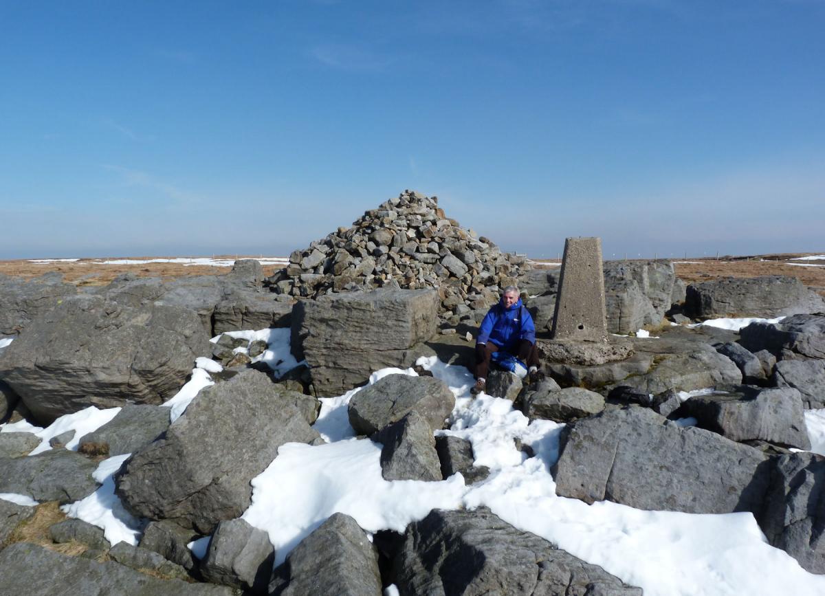
However you are unlikely to be offered a coffee so head on past the hostel and take to the steep slopes above. Having climbed through some rough ground the summit of Great Whernside comes as a bit of a surprise. It is a mass of boulders with a cairn and trig point in its centre. Mind you it would not be a surprise if you had researched the translation of Great Whernside ‘hillside where millstones are got’ and these are boulders of millstone grit! I enjoy this summit as much as any in the Dales.
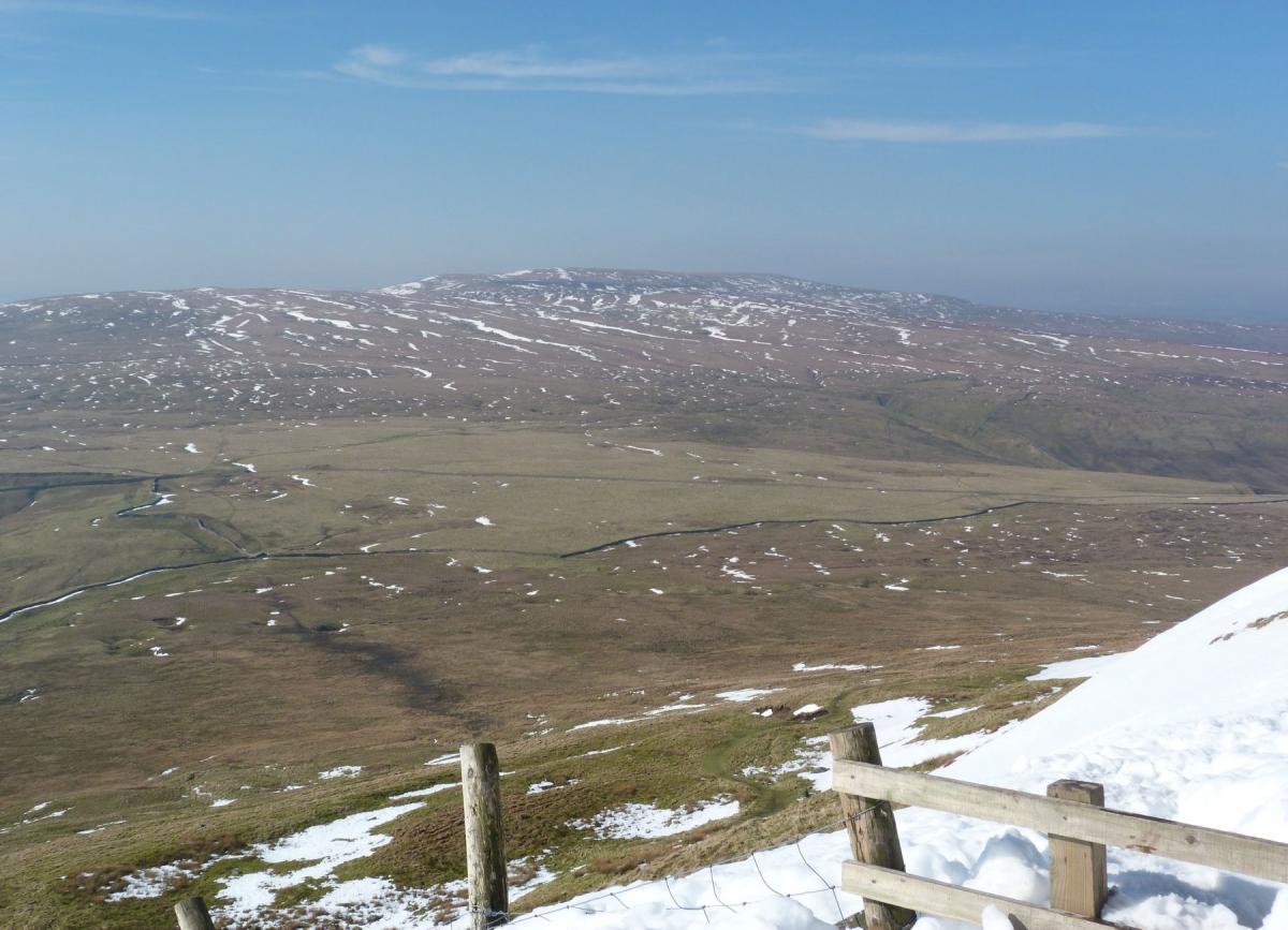
From the summit take the path north. It is a fine plateau with steeper slopes to your left in to Wharfedale while to the right is one of the largest wilderness slopes in the area. It is rough and featureless and a long way to the head of Nidderdale, do not be tempted! After ¾ of a mile walking north, pass a large stone shelter and then take the path which turns sharply left and downhill next to a stone wall. Soon the path passes through the wall (where it has collapsed and been replaced by a fence) and on to open hillside. The path continues just north of west and drops to the road from Kettlewell to Coverdale.
From the road there is a choice of routes, ahead and to the right a track heads towards Buckden Pike, another of the Dales 30 peaks and another of my favourites. Unfortunately this approach to the excellent mountain is wet and at this time of the year best avoided and anyway, by now you may be keener to return to Kettlewell. The easiest descent is via the road but the best route is to cross the road and follow the path to the north of a stone wall that winds its way west on level ground. The views are exceptional, particularly across to Birks and down Wharfedale.
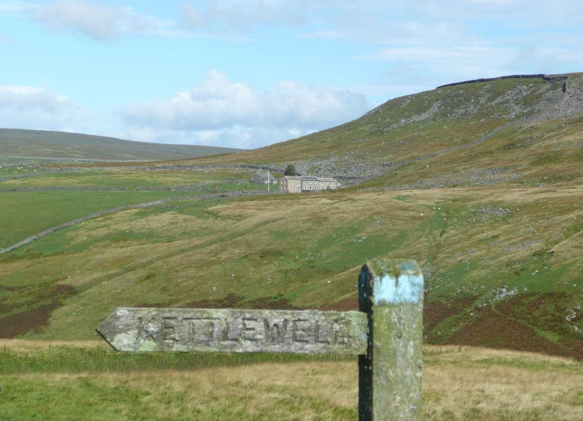
After ¾ of a mile there is a meeting of paths and an immaculate signpost describing routes to Buckden Pike, Starbotton and your choice, Kettlewell. From here the path improves and descends, soon turning in to a wide track, Top Mere Road. Top Mere Road is now an official ‘green lane’ protecting it from the 4 by 4s and trials bikes which have damaged it in the past. The track heads like an arrow for Kettlewell and a well earned pint in one of the three excellent pubs.
Fact Box:
Distance: Roughly 8 miles.
Height to climb: 550m (1,800 feet)
Start: SD 973724. There is a large National Park car park on entering the village from the south.
Difficulty: A tough climb and some rough, often wet, walking in particular on the descent to the Kettlewell/Coverdale road.
Refreshments: 3 pubs and 2 cafes. All are good and I will keep my favourite as a secret.
Be prepared:
The route description and sketch map only provide a guide to the walk. You must take out and be able to read a map and in cloudy/misty conditions a compass (very relevant on this walk). You must also wear the correct clothing and footwear for the outdoors. Whilst every effort is made to provide accurate information, walkers head out at their own risk.
Please observe the Countryside Code and park sensibly.
Jonathan Smith runs Where2walk, a walking company in the Yorkshire Dales.
Jonathan has written his own book, the “Dales 30” which describes the highest mountains in the Dales. He also runs 1 Day Navigation Courses for Beginners and Intermediates. Join his Learn a Skill, Climb a Hill Weekend in the Dales.
To find out more details on any of the above and details of many more walks in the area visit his popular website, Where2walk.co.uk


Comments: Our rules
We want our comments to be a lively and valuable part of our community - a place where readers can debate and engage with the most important local issues. The ability to comment on our stories is a privilege, not a right, however, and that privilege may be withdrawn if it is abused or misused.
Please report any comments that break our rules.
Read the rules here