
YOU have until midnight next Monday (October 30) to have your say on a major planning document that will determine the way York develops over the next 15 years.
The York Local Plan sets out a framework for how the city will grow and develop between now and 2033. It covers everything from identifying land that can be used to build new homes, offices and factories, to transport improvements, the need for new schools and open spaces, and even where to site new travellers' pitches.
The plan will also formally identify a ring of green belt land around the city, and sets out policies on the number of affordable new homes that should be built, as well as on what does and does not constitute acceptable development within York.
It has been years in the making, with successive political administrations having repeatedly ripped up their predecessors' draft plans and started again.
However, the current Conservative/ Liberal Democrat coalition hopes to submit the draft plan to central government for approval by next May.

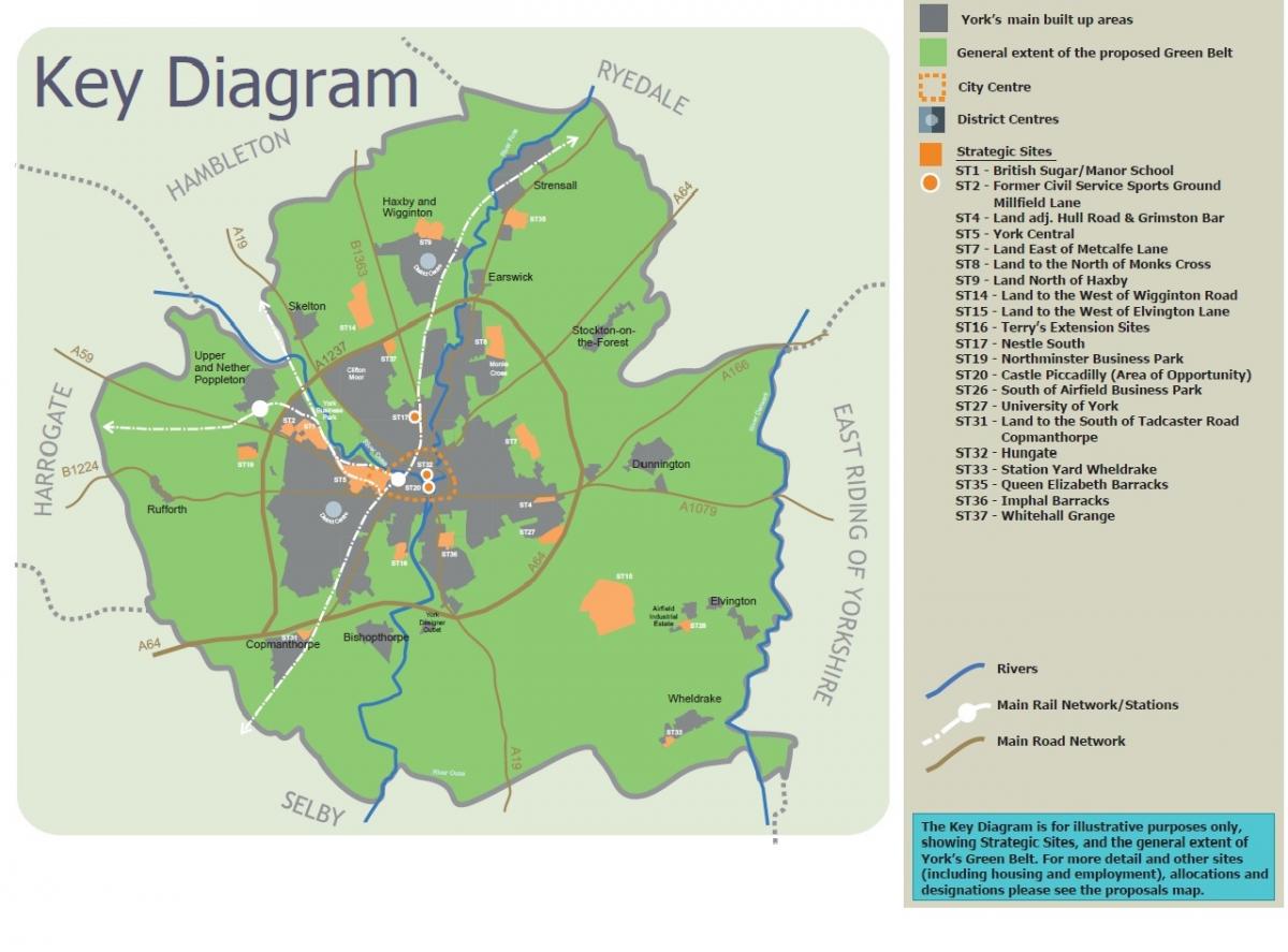
Local plan map showing green belt boundary and development sites (in orange)
There is still time for local people to have their say, however, says Martin Grainger, head of strategic planning at the council.
"We will be collating and considering all feedback received," he said.
The plan is a 300-page document that comes complete with a ream of supporting documents, maps and plans. Here, we outline some of the key proposals. To see the full document, and to submit your comments online, go to www.york.gov.uk/localplan
HOUSING
The plan says that to meet York's housing need, we need to be building 867 new homes every year during the 15-year lifetime of the plan (ie, between now and 2032/33). That is, in itself, controversial. Recent figures from the Department for Communities and local Government suggests York actually needs to be building 1,070 new homes a year.
To enable its target of 867 new homes a year to be met, the draft plan identifies land where three new 'garden villages' could be built, and also identifies a series of other large, medium and small housing sites.
These include:
Garden villages
- Land west of Elvington Lane: The biggest of the three proposed 'garden villages', which would consist of 3,339 new homes, 2,200 of them to be built within the lifetime of the local plan (ie by by 2033). It would be an all-new development to the west of Elvington airfield that should include shops, services and other facilities and 'reflect the existing settlement form of villages', the draft plan says
- Land west of Wigginton Road: 1,348 new homes, 1,200 of them to be completed by 2033. Another all-new 'village' just north of the A1237 outer ring road and west of the B1363 that should 'create a new local centre incorporating ... shops, services and community facilities.'
- Land east of Metcalfe Lane, and west of the northern spur of Outgang Lane, north of Osbaldwick: 845 new homes, again to include shops and other services, on an area of land bounded to the north by Tang Hall Beck
Major housing sites
- York Central, the huge (192 acre) site west of York Railway Station. This could provide space for 1,500 homes (1,250 of them to be built by 2033) and 61,000 square metres of office space, as well as local shops, open spaces and other 'cultural, leisure (and) tourism' services, the draft plan says. "However, the majority of the site remains rail locked...The provision of new road. bridge infrastructure and reconfiguration of the existing road infrastructure will provide the necessary access."

The York Central site. Photo: Frank Dwyer
- British Sugar/ Manor School. This should be able to provide space for up to 1,200 homes, the draft plan says - 1,100 on the former British Sugar part of the site, the remainder on the former manor School site.
- Land north of Monks Cross. The plan allocates space to build almost 1,000 new homes just to the north of the Monks Cross shopping park and west of the Monks Cross Link Road. "There is very limited primary and secondary capacity within existing schools to provide for... this site," the draft plan notes. "It would be necessary therefore to deliver a new primary school on site...as well as proving for nursery and secondary education."
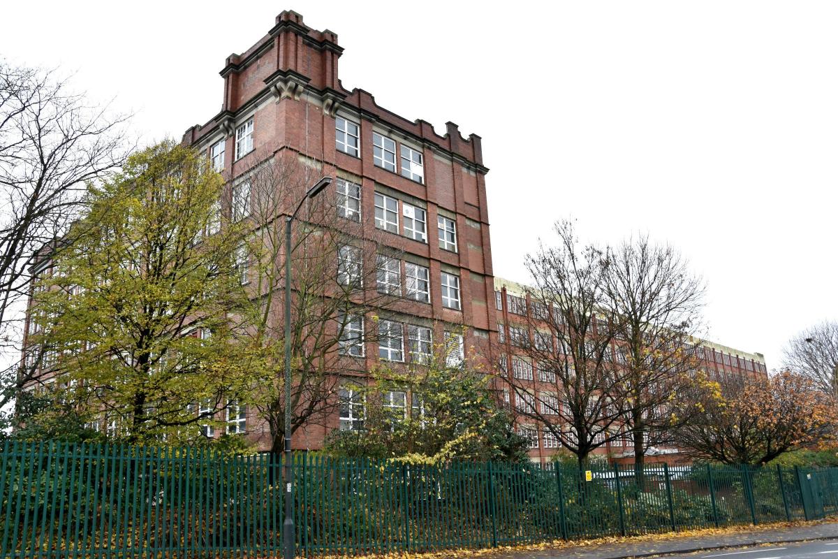
- Nestlé South: A total of 863 new homes on the southern part of the former Joseph Rowntree Cocoa Works. The draft plan envisages the first 263 of these homes being completed within 10 years, the remainder within 15 years

Former Nestlé buildings in Haxby Road
- Land north of Haxby. The plan allows for 735 new homes immediately to the north of Haxby, between Moor Lane and Usher Lane, in what would be an extension of Haxby. The southern part of the site would include open space. This would be essential to 'address the significant shortage of open space in the Haxby and Wigginton Ward', the draft plan says
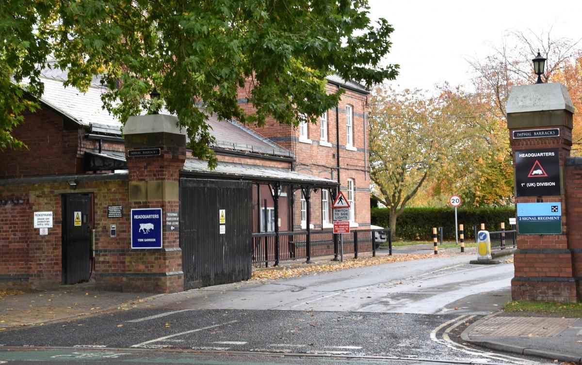
- Imphal Barracks: Imphal barracks is scheduled to close by 2031 under a review of Ministry of Defence sites. The council's draft local plan says it could provide land for up to 769 new homes - though not until near the end of the plan's lifetime (2033). The barracks include two Grade II listed buildings, and other buildings that may need to de designated following a proper assessment, the draft plan says. "The parade ground... is also an important feature...which needs to be retained in any future designs to complement the understanding of the history of the site."

Imphal Barracks: could provide land for up to 769 homes
- Queen Elizabeth Barracks, Strensall: The MoD plans to dispose of this site by 2021. It could provide room for as many as 578 new homes, the draft plan says, with development beginning by 2023. While there are no listed buildings, the barracks has been an important military site. "It is important that the area shouldn't lose the story of its identity," the draft plan says
Affordable Housing
The draft plan sets targets for the level of affordable housing that should be included in new developments in York. These are:
- Brownfield sites of more than 15 homes: 20 per cent to be affordable
- Greenfield sites of more than 15 homes; 30 per cent affordable
There is no requirement for affordable housing on urban developments of fewer than 15 homes, but for smaller rural developments there is a sliding scale of contributions that developers should make towards the cost of affordable housing elsewhere
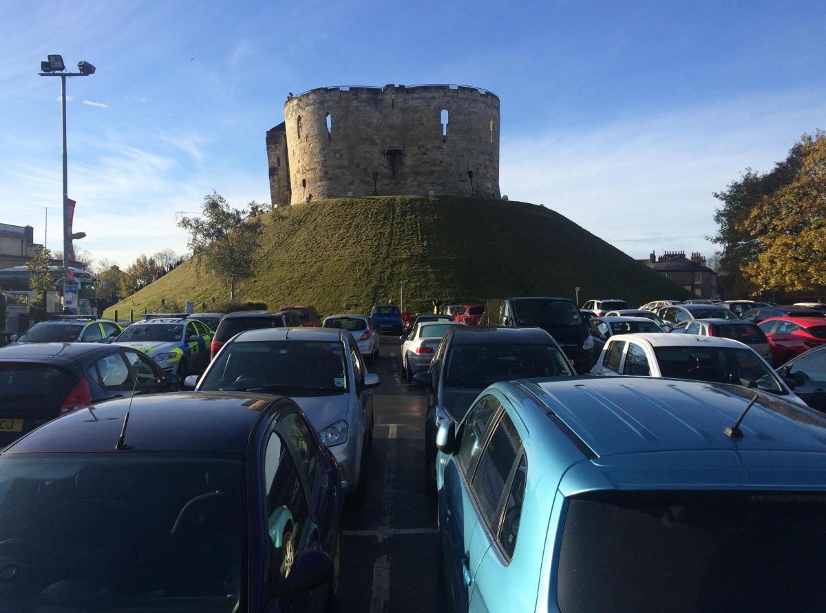
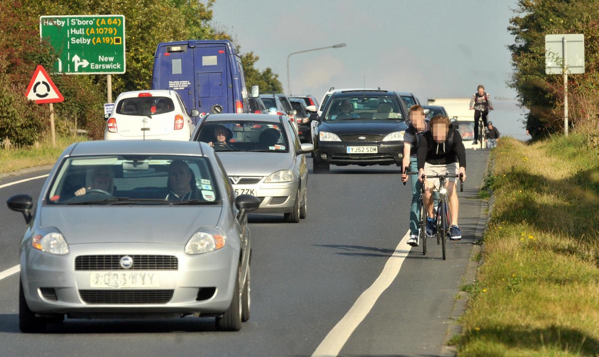
TRANSPORT
The draft plan sets out a number of proposed improvements to roads and public transport. These include:
Public transport
In the short term (ie by 2022)
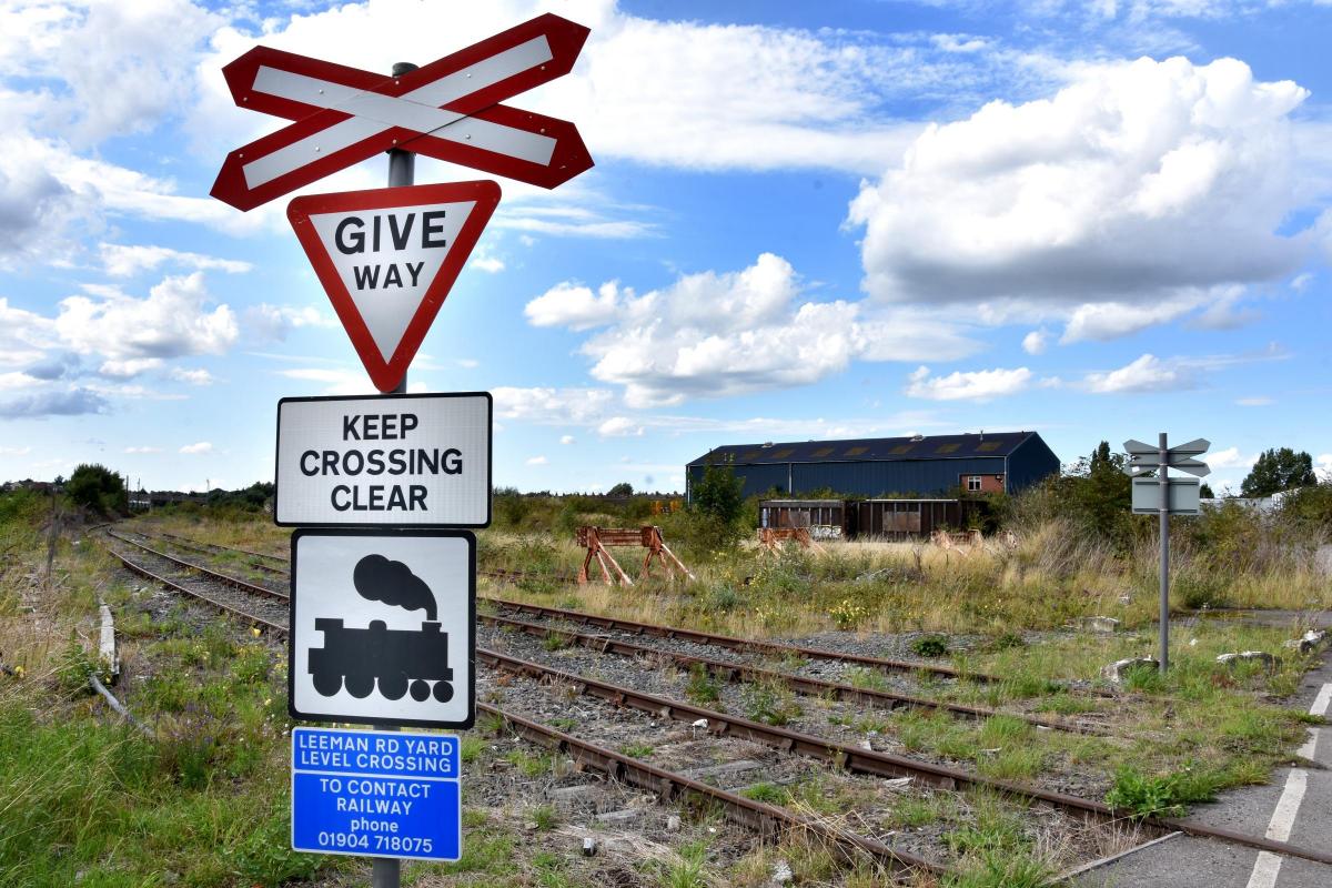
- improvements to bus lanes on Leeman Road and Shipton Road
- improvements to bus waiting areas next to the memorial gardens in Leeman Road
- citywide improvements to traffic lights
In the medium term (by 2027)
- further expansion of Askham Bar and Poppleton Bar Park & Ride
- a bus (and possibly pedestrian/ cycle) bridge across the A1237 to the north west
- a dedicated public transport/ cycle route linking the new 'garden village' near Elvington with the centre of York
In the long term (by 2032)
- a new railway station at Haxby
- 'traffic restraint' measures in the city centre. The plan doesn't specify what these might be.
Roads
By 2023
- improvements to inner ring road (A12370 junctions at Haxby Road, Monks Cross (North Lane), the B1363 (Wigginton Road), Great North Way, Strensall Road, Clifton Moor and the B1224 (Wetherby Road)
By 2028
- improvements to the Grimston Bar junction
- improvements to the A1036/ Stockton Lane/ Heworth Road junction
- junction improvements on Wigginton Road north of the northern ring road
By 2033
- upgrading the A1237 northern ring road to be dual carriageway
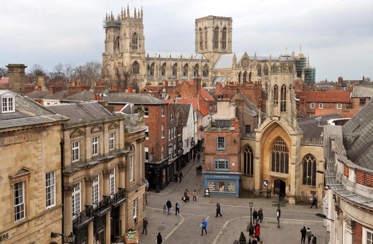
RETAIL/ CITY CENTRE
The draft plan outlines a clear 'hierarchy' for shopping development, with the city centre at the top, followed by district centres (such as at Acomb and Haxby) and then local parades of shops. Out-of-town shopping developments will only be considered in future where the shopping development proposed cannot be accommodated within the city centre or district centres, and where the development 'will not result in a significant adverse impact on existing, committed and planned public and private investment in York City Centre', the draft plan says.
The Castle Gateway area (which includes Coppergate, Fossgate, the Castle/ Piccadilly area and the Foss Basin and Ouse riverside) is seen as crucial to developing the city centre. Major proposals for regeneration are being planned. According to the draft plan, these could include:
- getting rid of the Castle Car Park to allow for a new contemporary building on the west bank of the Foss and new public space
- providing a replacement car park either underground or at Castle Mills
- opening up both banks of the Foss, with riverside walkways on one or both banks
- a pedestrian/ cycle bridge across the Foss linking Piccadilly with the Castle precinct
- 'maximising' the development potential of the Foss Basin and St George's Field
GREEN BELT
The draft plan, once established, will set up a swathe of green belt around the city. Development within the green belt would be 'inappropriate' other than in particular special circumstances. These circumstances might include proposals in which the land would be used for:
- agriculture and forestry
- outdoor sport or recreation
- limited infilling
- limited affordable housing for proven local need
- minerals extraction
- roadworks
- renewable energy schemes
OTHER
Gypsies/ travellers
The local authority has a duty to provide pitches for gypsies and travellers. There are three existing sites in York, at James Street, Water Lane and Outgang Lane. These will be protected.
In addition, the draft plan stipulates that large new developments of 12 acres or more must either provide gypsy/ traveller pitches within them, provide alternative land for such pitches, or pay towards the cost of pitches elsewhere. The draft plan does not specifically identify where new pitches might go.
LOCAL PLAN TIMELINE
Once the local plan consultation deadline passes on Monday, the results will be fed back to the council's Local Plan Working Group and the Executive by January next year. A final, revised version of the plan will then go out to consultation again for six weeks from next March.
The draft plan will then be submitted to the government for examination in May, following which there will be an 'Examination in public' overseen by a Government inspector.


Comments: Our rules
We want our comments to be a lively and valuable part of our community - a place where readers can debate and engage with the most important local issues. The ability to comment on our stories is a privilege, not a right, however, and that privilege may be withdrawn if it is abused or misused.
Please report any comments that break our rules.
Read the rules hereLast Updated:
Report this comment Cancel