

There is a new man in charge of protecting York against floods. STEPHEN LEWIS spoke to Steve Wragg
IN November 2000, as the flood waters rose higher and higher in York, a young Environment Agency engineer named Steve Wragg was among those working round the clock in the city's flood incident room.
Their job: operating the city's network of flood gates, penstocks and pumping stations to try to cope with the rising waters.
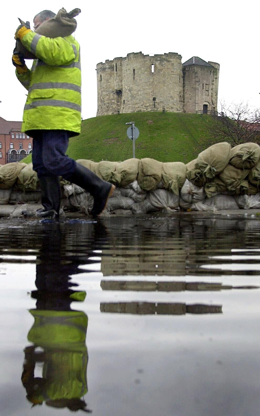
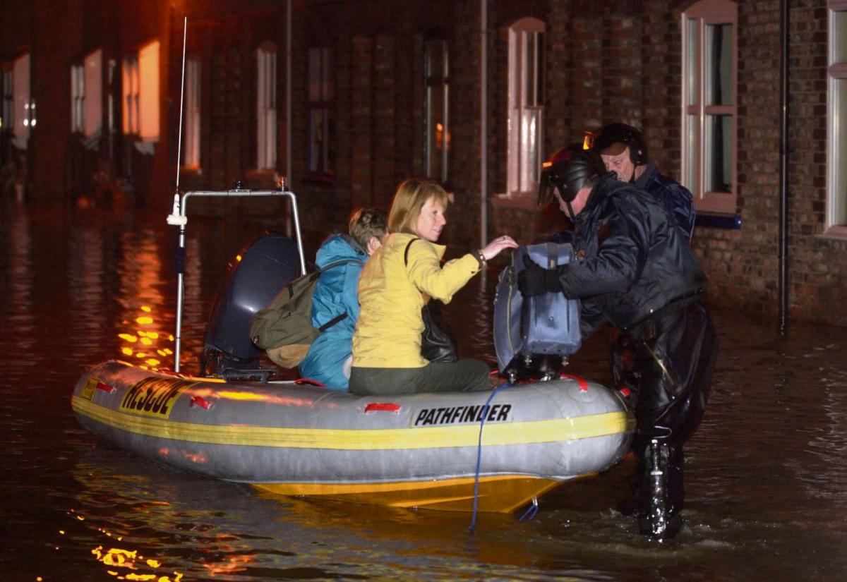
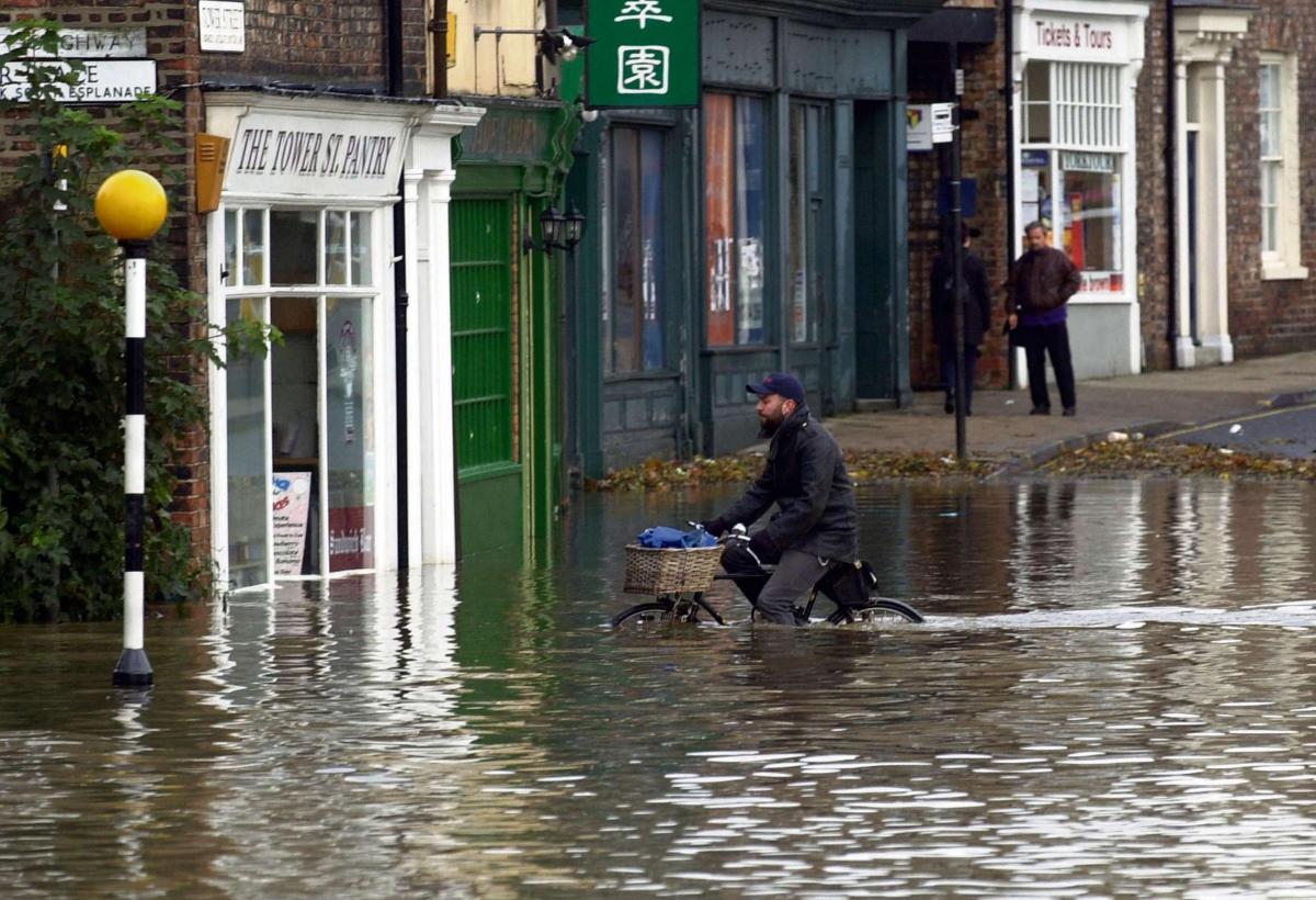
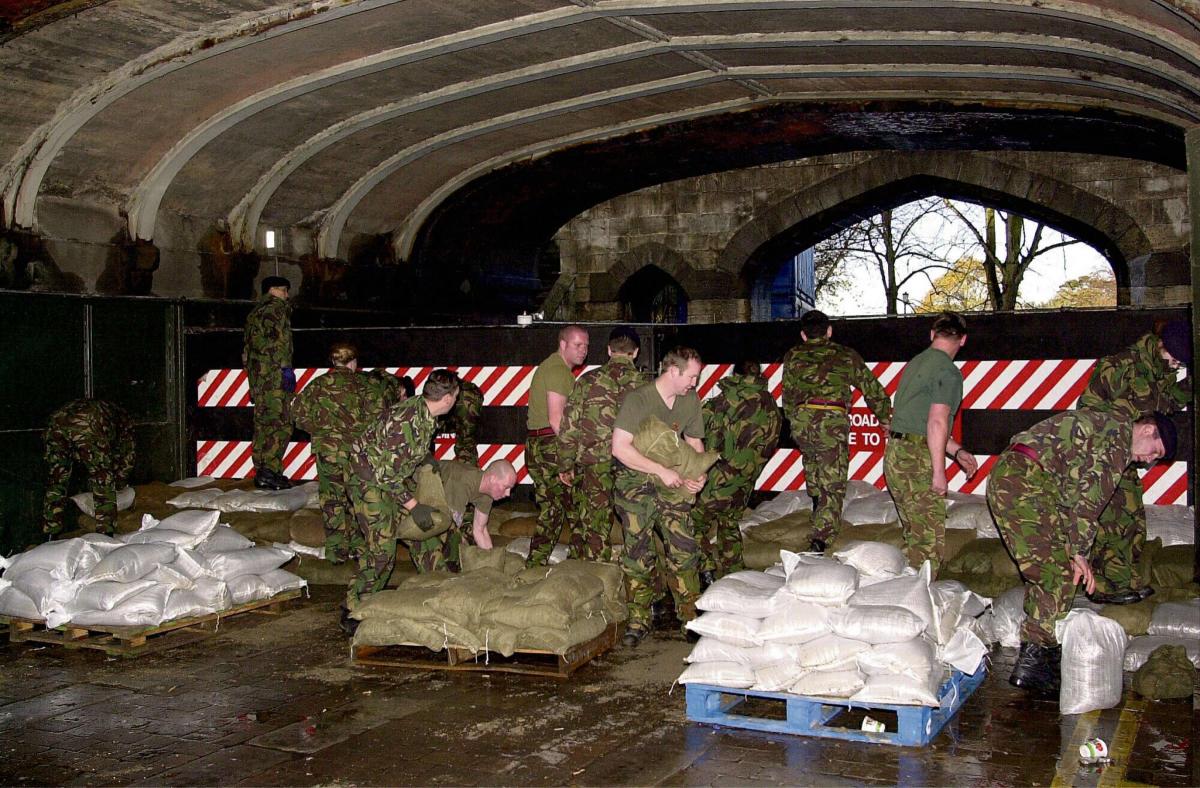
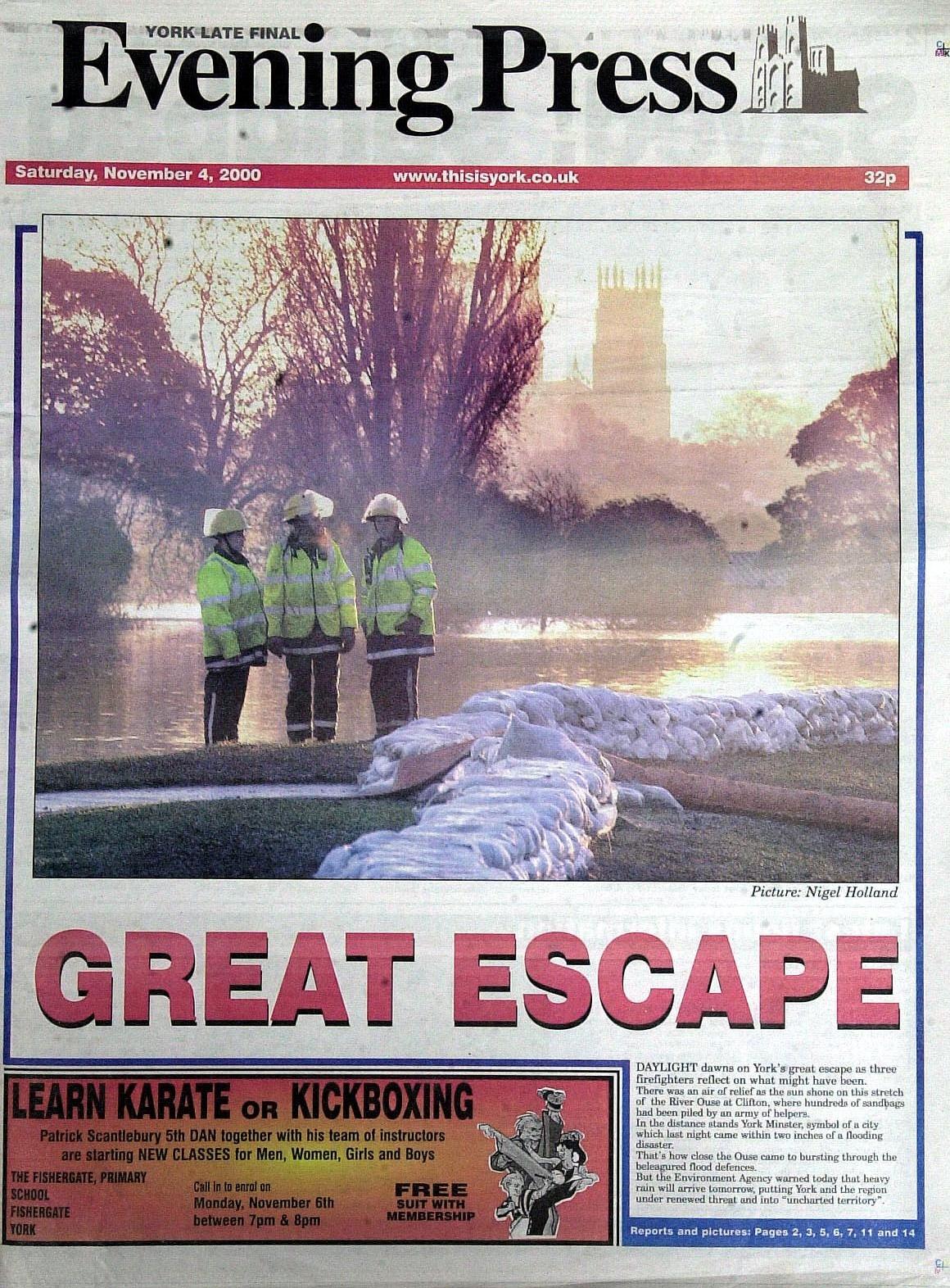
Over the night of November 3 and 4, with an army of soldiers, council workers and ordinary citizens desperately piling sandbags against flood walls and banks to shore them up, it was touch and go. The city held its breath as water levels in the Ouse rose to a frightening 17 feet 10 inches above normal - the highest ever recorded, and just two inches short of overwhelming the flood defences. More than 500 homes were flooded nonetheless: but thousands more were saved.
It was an unforgettable time, Mr Wragg admits. Huge volumes of water were predicted to be coming down into the Ouse from higher ground: but nobody really knew just how bad things would get. As the floodwaters rose higher, tough decisions were having to be made about whether to evacuate areas of the city. "It was an extremely difficult situation," he says, with heroic understatement. "With new forecasts coming in throughout the event it was often difficult to fully grasp the situation."
Were there any times when he and his agency colleagues feared the worst?
There were, he admits. "Sometimes the forecasts were really showing that the defences could be inundated."
In the event, the city's flood defences held - just. But for the young engineer, it was a steep learning curve. "I was a relatively junior engineer at the time, and learnt an amazing amount," he says.
Fourteen years later, that young engineer - now a married, 40-year-old father of two - is back in York: not with the Environment Agency, but as the city council's new flood risk manager. He took over the job in May, and is the man now charged with coordinating a flood risk strategy for the city that will hopefully ensure York can withstand the worst any future floods will throw at it.
That won't be easy. The Environment Agency itself, in its own guide to York's flood defences, admits that "while we do everything we can to reduce the chance of flooding, it is a natural process and can never be completely eliminated."
If anything, we will be more at risk from flooding than ever before in the years ahead: partly because we insist on building near rivers and watercourses, but mainly because of climate change.
Mr Wragg won't be drawn into the debate about whether the changing climate we are witnessing is the result of some natural long-term cycle, or whether we are contributing to it by burning fossil fuels. "But we will see more severe floods in the future," he says. "Today's rare flood events may well be tomorrow's frequent events."
So how can York protect itself?
The city's flood defences, which held up so well 14 years ago, were mainly put in between the late 1970s and the 1990s, in response to earlier floods (see panel). They have done a good job over the years, he says - not only in 2000, but in 2012 too - but they do need upgrading. They were built before we fully understood the risks posed by climate change. "And they need to be renewed to ensure they provide more protection against serious flooding."
As well as protecting against rising river levels, future flood defences will also need to protect against flash-flooding caused by sudden heavy rainstorms - a lesson from what happened in Sheffield in 2007.
A £4million scheme to improve York's Leeman Road flood defences and to install a flood wall at Water End - funded mainly by the Environment Agency but with a £1 million city council contribution - is due for completion this month.
Mr Wragg's next priority is to develop a Flood Risk Management Strategy for York, which will be consulted on later this year. Then, over the next two years, he will carry out a comprehensive assessment of the flood risk York will face in future - the Environment Agency is working on an updated computer model of the city's rivers which will feed into this - and identify which parts of the city's defences most need upgrading.
A bid has already gone in to DEFRA (the Department of the Environment, Food and Rural Affairs) to cover the cost of this assessment work, and also potentially to cover the cost of future flood defence improvements.
However, there is a limited pot of Whitehall cash for flood defences, Mr Wragg says. You might think York, with its history of flooding, would naturally be a priority. But Sheffield, too, suffered devastating floods in 2007, as did Hull last year: and that's just in Yorkshire and the Humber. "Demand for flood risk funding outstrips supply in England and we will have to build a very strong case to attract monies," Mr Wragg says.
It seems we'll have to fight our corner just like the rest...
York's flood defences
York has been prone to flooding for centuries. As long ago as 1263, according to the Environment Agency, flood water rampaged down North Street as far as the junction of Bridge Street and Ouse Bridge.
In 1316, York Castle was surrounded by flood waters and essential earthworks were washed away. And in 1516, huge chucks of melting ice carried on floodwaters smashed away parts of Ouse Bridge.
In 1625 and 1638, meanwhile, water levels in the Ouse reached 17ft 7 inches above normal - the highest recorded until 2000.
More recently there was serious flooding in 1947, 1978, 1982, 1991, 1995, 2000 and 2012.
Most of the city's flood defences today were introduced following the floods of 1978, 1982 and 1991. They include:
• The Foss Barrier, installed in 1986/7: a 'turn and lift gate' which, when in place, effectively cuts the Foss off from the Ouse, stopping water from surging back upstream. It is supported by a pumping station and flood wall.
• North Street: a series of flood gates and walls installed in 1992/3, together with a main trunk sewer which can be pumped.
• Lower Ebor Street: a combination of concrete flood walls and steel trench sheeting, with valves to isolate sewage. Installed after the 1978 and 1982 floods
• Holgate Beck: Upstream tributaries of the beck were diverted to empty directly into the Ouse, and a pumping station was installed where the beck joins the Ouse
• Lower Bootham: a 650 metre earth floodbank combined with a 280 metre reinforced concrete wall, installed following the 1982 floods which caused £1.2 million of damage affecting 134 properties
• Acomb Landing: York's fresh drinking water comes from here, so it must be kept free of flood contamination. A reinforced retaining wall was added to existing embankments after the 1982 floods.
• Clifton Ings: a natural flood-plain which can hold 2.3 million cubic metres of water - lowering the peak flood level in the rest of the city by almost six inches. In 1982, the flood banks were raised and new embankments built to increase the amount of water the Ings can store
• Leeman Road: A flood bank was built in 1980, following the 1978 floods, and raised in 1982, following further floods. The defences have now been upgraded again in a £4 million project that has included raising the banks further and adding a flood wall at Water End.
Housing danger
THERE is a danger that our desperate need for more housing and other infrastructure will lead to increased pressure to build near rivers and watercourses, admits Steve Wragg.
Germany Beck is a development which has "exercised quite a few people ... regarding flood risk," he says.
The Environment Agency uses computer modelling to identify areas at risk of flooding. "Parts of Germany Beck are identified as being flooded in one in 100-year events," he says. "But that does not mean it is a designated flood risk."
Nevertheless, the developers of the 650 home site will be expected to come up with very strong flood alleviation measures, he says. "Our Strategic Flood Risk assessment identifies what we need to see as a local authority to ensure that development does not increase the flood risk to the occupiers that use it ... or to others in the surrounding neighbourhood, and also that it does not increase the run-off downstream." The flood alleviation measures proposed will be scrutinised very closely through the planning process, and if necessary the council has enforcement powers, he says.
There are already good examples in York of schemes which have introduced 'sustainable drainage systems' designed to reduce and contain flood risk, for example at Derwenthorpe and the Vangarde site at Monks Cross. These use networks of ditches, becks, rain gardens and ponds to "slow, attenuate and reduce the amount of surface water flow from developments." In effect, the ditches and ponds at the Vangarde site are an 'urban version of Clifton Ings', Mr Wragg says.
In addition, individual properties in flood risk areas may also in future need to be better insulated against the risk of flooding, by fitting hard floors impervious to flood damage, installing doors and windows that can be sealed water-tight, and removing electricals to higher floors.
Steve Wragg factfile
Age 40. Married with two children. Lives in York.
Born and grew up in Sheffield, where his father was a steel worker.
A keen boy scout, he always liked the outdoors, and became interested in geology, natural processes and "understanding how the land was formed."
Studied engineering geology at the University of Manchester, then did an MSc (Eng) in hydrology and water management.
Worked for the Environment Agency from 1999 to 2010, then as flood risk planning manager for Hull City Council from 2010 until May this year, before becoming York's flood risk manager.


Comments: Our rules
We want our comments to be a lively and valuable part of our community - a place where readers can debate and engage with the most important local issues. The ability to comment on our stories is a privilege, not a right, however, and that privilege may be withdrawn if it is abused or misused.
Please report any comments that break our rules.
Read the rules hereLast Updated:
Report this comment Cancel